Coastal wetland high-definition remote sensing image ground object identification method based on double-flow coding and decoding
A technology for remote sensing image and object recognition, which is applied in scene recognition, neural learning methods, character and pattern recognition, etc. It can solve the problem of low precision and achieve the effect of strong representation ability, wide application prospect and robust classification
- Summary
- Abstract
- Description
- Claims
- Application Information
AI Technical Summary
Problems solved by technology
Method used
Image
Examples
Embodiment 1
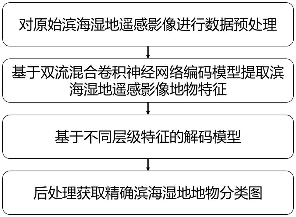
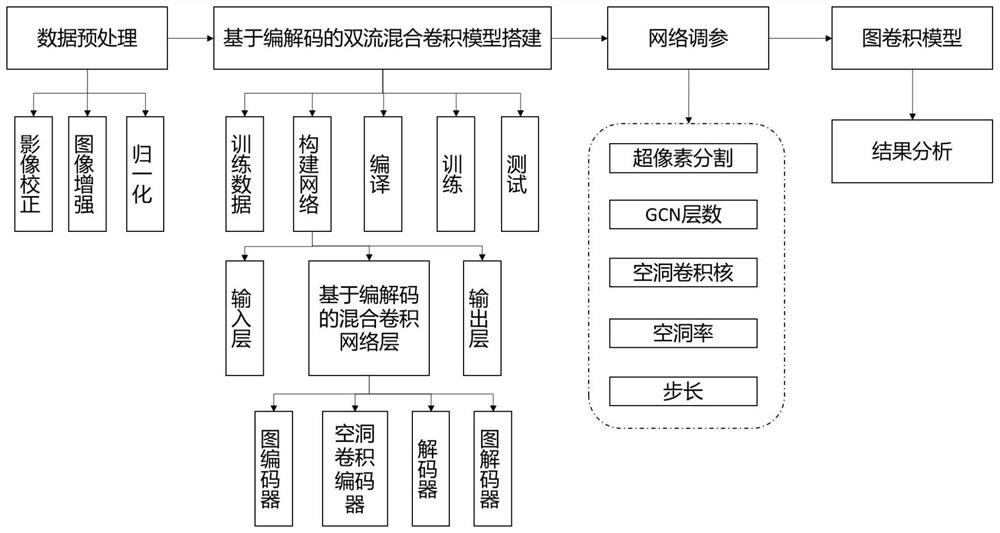
[0030] Example 1, a dual-stream codec of coastal wetland high-definition remote sensing image feature identification method, the method comprises the following steps:
[0031] Step 1: Perform relevant pre-processing operations on the given remote sensing images, including geometric correction, atmospheric correction, image enhancement, data normalization, etc.;
[0032] Step 2: First, the preprocessed remote sensing image is superpixel segmented, and the k-neighbor algorithm is used to construct the graph G=(V,E), where V={m 1 ,m 2 ,...,m n } represents a different node, Represents the edge of Figure G, followed by (I is the identity matrix, A is the adjacency matrix, D=∑ A.) ii to compute the normalized Laplace matrix, further calculate the node features and update the features of the figure information;
[0033] Step 3: Perform feature extraction based on densely connected convolutional neural networks for the preprocessed remote sensing images in step 1, and obtain a low-leve...
Embodiment 2
[0037] Example 2, a dual-stream codec of coastal wetland high-definition remote sensing image feature identification method, the method comprising the following steps:
[0038] Step 1: Take the remote sensing images for preprocessing operations, including geometric correction, atmospheric correction, image enhancement, data normalization, etc.;
[0039] Step 2: Superpixel segmentation of remote sensing images, use Graph Encoding to construct nodes and edges, use Graph Convolutional Neural Network as the convolutional coding part of graphs, and extract irregular correlation information and spectral information of features in non-Euclidean spaces from remote sensing images; Specifically:
[0040] Step 2.1: Superpixel segmentation of the preprocessed remote sensing image, using the k-neighbor algorithm to construct the graph G= (V, E), where V= {m 1 ,m 2 ,...,m n } represents a different node, Represents the edge of the constructed graph, and then bases it on to calculate the norma...
PUM
 Abstract
Description
Claims
Application Information
 - R&D Engineer
- R&D Manager
- IP Professional
- Industry Leading Data Capabilities
- Powerful AI technology
- Patent DNA Extraction
Browse by: Latest US Patents, China's latest patents, Technical Efficacy Thesaurus, Application Domain, Technology Topic, Popular Technical Reports.
© 2024 PatSnap. All rights reserved.Legal|Privacy policy|Modern Slavery Act Transparency Statement|Sitemap|About US| Contact US: help@patsnap.com


