
Farmland soil moisture simulation method based on Sentinel data and deep learning model

A soil moisture and deep learning technology, applied in the field of microwave remote sensing, can solve the problems of high cost, time-consuming, labor-intensive, and time-consuming, and achieve the effect of low cost, guaranteed calculation accuracy, and high efficiency

Pending Publication Date: 2021-11-30
崔宁博
View PDF1 Cites 1 Cited by
  • Summary
  • Abstract
  • Description
  • Claims
  • Application Information

AI Technical Summary

Problems solved by technology

[0002] After retrieval, Chinese Patent No. CN105510173B discloses a method for on-site determination of soil moisture content. The inventive method measures soil moisture content by weighing method. Although it can effectively avoid soil moisture loss during the measurement process, this type of method can only Obtaining soil moisture content information at limited points is time-consuming, labor-intensive, and costly, and the monitoring accuracy is affected by the density and spatial distribution of samples; soil moisture is an important part of the surface ecosystem, and it is an important part of science such as agriculture, hydrology, and meteorology. An important research parameter in the field, which determines the growth status of crops; Sentinel series satellites are an important part of the global environment and safety monitoring system jointly initiated by the European Commission and the European Space Agency, which are mainly used for global environmental monitoring. The two satellites launched, Sentinel-1A and Sentinel-1B, were launched on April 3, 2014 and April 25, 2016, respectively. They were equipped with C-band synthetic aperture radar and mainly completed radar imaging tasks; among them, Sentinel-1A launched in 2014 In October 2019, it began to provide free data to users around the world. It can provide repeated observations of C-band synthetic aperture radar images. The revisit period of the binary constellation is 6 days, and the optimal spatial resolution is 5m. Such high spatial resolution and high temporal resolution The data provided a good data source for the real-time monitoring of soil moisture at the regional scale; at present, the traditional soil moisture monitoring methods mainly use the drying weighing method, neutron moisture meter method, time domain reflectometer, etc. to conduct field measurements , but this type of method can only obtain soil moisture information at limited points, which is time-consuming, laborious, and costly, and the monitoring accuracy is affected by the density and spatial distribution of sample points, while the Sentinel series satellites have large-area real-time observations, high efficiency, and Low cost and other advantages; therefore, it is particularly important to invent a farmland soil moisture simulation method based on Sentinel data and deep learning model;
[0003] Most of the existing farmland soil moisture simulation methods are realized through traditional soil moisture monitoring methods. This type of method can only obtain soil moisture content information at limited points, which is time-consuming, laborious, and costly, and the monitoring accuracy is limited by the density of sample points and space. Due to the influence of distribution, it is impossible to simulate farmland soil moisture all-day and all-weather, which is not conducive to real-time protection of agricultural production; therefore, we propose a farmland soil moisture simulation method based on Sentinel data and deep learning model

Method used


Image

  • Farmland soil moisture simulation method based on Sentinel data and deep learning model
  • Farmland soil moisture simulation method based on Sentinel data and deep learning model
  • Farmland soil moisture simulation method based on Sentinel data and deep learning model

Examples


Embodiment Construction

[0041] The following will clearly and completely describe the technical solutions in the embodiments of the present invention with reference to the accompanying drawings in the embodiments of the present invention. Obviously, the described embodiments are only some, not all, embodiments of the present invention.

[0042] In describing the present invention, it should be understood that the terms "upper", "lower", "front", "rear", "left", "right", "top", "bottom", "inner", " The orientation or positional relationship indicated by "outside", etc. is based on the orientation or positional relationship shown in the drawings, and is only for the convenience of describing the present invention and simplifying the description, rather than indicating or implying that the referred device or element must have a specific orientation, so as to Specific orientation configurations and operations, therefore, are not to be construed as limitations on the invention.

[0043] refer to figure 1...


PUM


Abstract

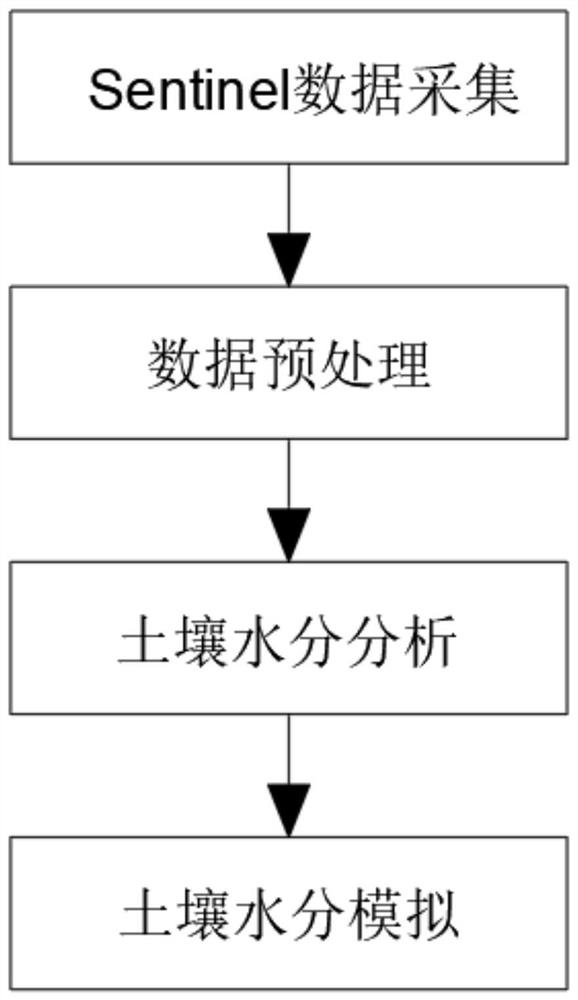
The invention discloses a farmland soil moisture simulation method based on Sentinel data and a deep learning model, and belongs to the technical field of microwave remote sensing, the simulation method comprises the following specific steps: (1) Sentinel data acquisition; (2) data preprocessing; (3) analysis of soil moisture; simulation of soil moisture. According to the method, the Sentinel-1 satellite is used for obtaining synthetic aperture radar data, regression learning is carried out based on the deep learning model, and simulation of farmland soil moisture is realized by researching the relationship between the radar backscattering coefficient and the soil volumetric water content. The influence of factors such as a soil dielectric constant, surface roughness and vegetation coverage in a radar backscattering coefficient is considered, elimination is carried out through an Alpha model, the farmland soil moisture calculation precision is guaranteed, and the method has the advantages of large-area real-time observation, high efficiency, low cost and the like, the farmland soil moisture can be simulated all day long in an all-weather manner, so that the real-time protection aiming at agricultural production is facilitated.

Description

technical field [0001] The invention relates to the field of microwave remote sensing technology, in particular to a farmland soil moisture simulation method based on Sentinel data and a deep learning model. Background technique [0002] After retrieval, Chinese Patent No. CN105510173B discloses a method for on-site determination of soil moisture content. The inventive method measures soil moisture content by weighing method. Although it can effectively avoid soil moisture loss during the measurement process, this type of method can only Obtaining soil moisture content information at limited points is time-consuming, labor-intensive, and costly, and the monitoring accuracy is affected by the density and spatial distribution of samples; soil moisture is an important part of the surface ecosystem, and it is an important part of science such as agriculture, hydrology, and meteorology. An important research parameter in the field, which determines the growth status of crops; Sen...

Claims


Application Information

Patent Timeline
IPC IPC(8): G06F30/27G06F17/11G06F111/10
Inventor 崔宁博吴宗俊赵龙邢立文朱彬郑顺生邹清垚
Owner 崔宁博
Learn More