Underground water level missing data restoration method based on geostatistics and neural network
A groundwater level and repair method technology, applied in the direction of biological neural network model, redundancy in operation, data error detection, neural architecture, etc., to achieve the effect of improving accuracy and reliability, and improving accuracy and reliability
- Summary
- Abstract
- Description
- Claims
- Application Information
AI Technical Summary
Problems solved by technology
Method used
Image
Examples
Embodiment
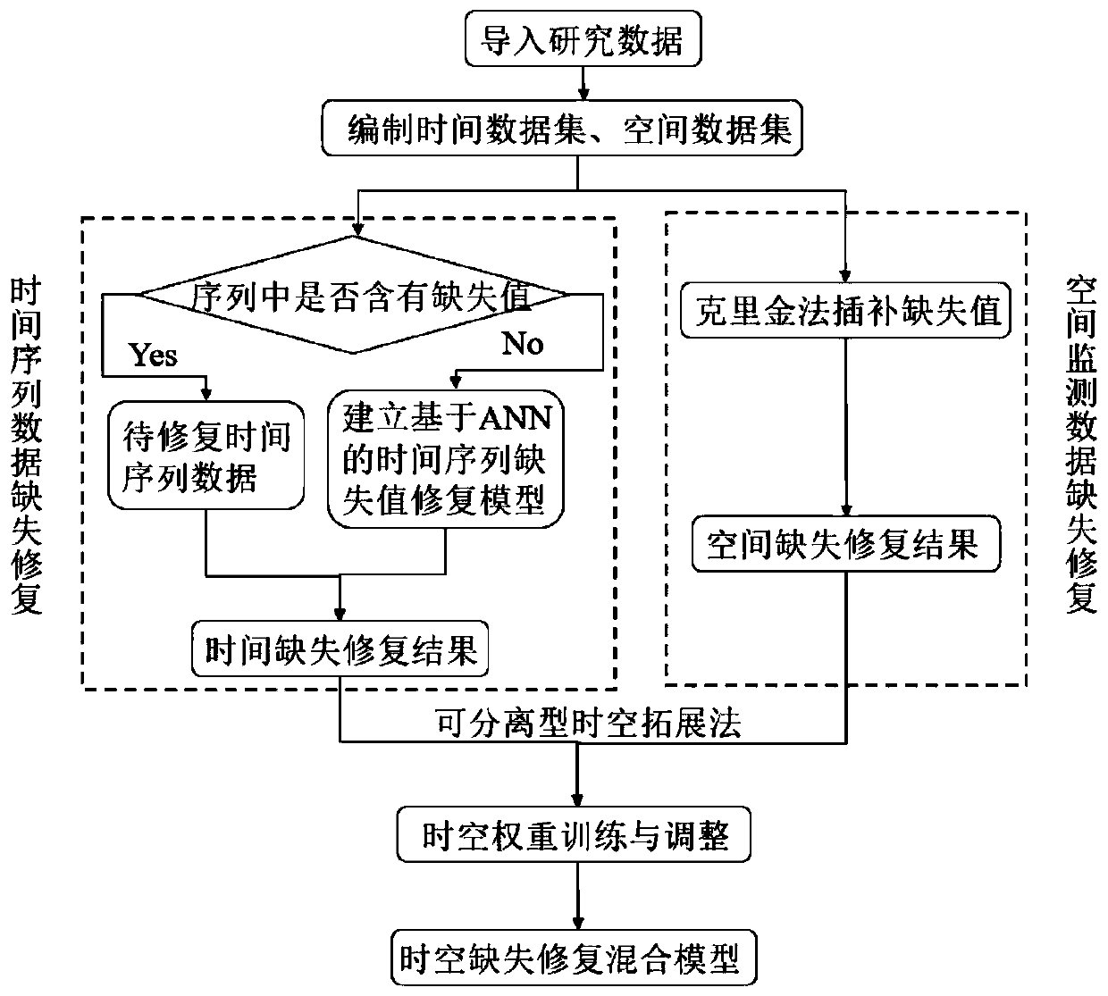
[0022] Such as figure 1 As shown, the repair method of the present invention is based on the universal Kriging method (Kriging) for spatial interpolation and the BP artificial neural network (BP ANN) for repairing missing values in time series, and the specific steps include:
[0023] (1) Obtain the spatio-temporal data set of the groundwater level, edit the spatio-temporal data set, and divide the spatio-temporal data set into a time-series data set with latitude and longitude information and a time series data set without latitude and longitude information. The spatio-temporal dataset includes a temporal dataset and a spatial dataset.
[0024] (2) According to the space-time sequence data set, kriging method is used to interpolate missing values, and spatial interpolation based on geostatistics is carried out to obtain the repaired spatial data set.
[0025] Specifically, the spatio-temporal sequence data set is used as the basic data, and the sequence containing missing ...
PUM
 Abstract
Description
Claims
Application Information
 - R&D
- Intellectual Property
- Life Sciences
- Materials
- Tech Scout
- Unparalleled Data Quality
- Higher Quality Content
- 60% Fewer Hallucinations
Browse by: Latest US Patents, China's latest patents, Technical Efficacy Thesaurus, Application Domain, Technology Topic, Popular Technical Reports.
© 2025 PatSnap. All rights reserved.Legal|Privacy policy|Modern Slavery Act Transparency Statement|Sitemap|About US| Contact US: help@patsnap.com

