A user privacy protection method and system for geospatial data
A geospatial data and user privacy technology, applied in digital data protection, geographic information database, special data processing applications, etc., can solve the problem of not giving tree depth or division granularity, not considering cell area factors, and not conforming to data query actual situation
- Summary
- Abstract
- Description
- Claims
- Application Information
AI Technical Summary
Problems solved by technology
Method used
Image
Examples
Embodiment Construction
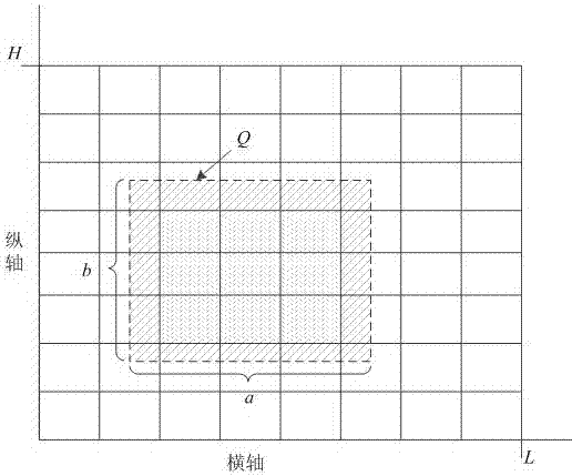
[0075] The present invention proposes a user privacy protection method for geospatial data, which proposes a data domain granularity division model that is more in line with the actual situation of data query based on noise error and uniform assumption error. Through this model, more accurate The data space is divided to improve data query accuracy and data availability; the invention also designs the merging of similar cells in the data space, further improving data availability. In order to make the object, technical solution and advantages of the present invention clearer, the present invention will be further described in detail below in combination with specific implementation cases and with reference to the accompanying drawings.
[0076] figure 1 Shown is the query schematic diagram of the data query Q of the present invention. As shown in the figure, the query Q is a dotted box, and Q intersects with the cells in the data space. The shaded part in the figure is the are...
PUM
 Abstract
Description
Claims
Application Information
 - R&D Engineer
- R&D Manager
- IP Professional
- Industry Leading Data Capabilities
- Powerful AI technology
- Patent DNA Extraction
Browse by: Latest US Patents, China's latest patents, Technical Efficacy Thesaurus, Application Domain, Technology Topic, Popular Technical Reports.
© 2024 PatSnap. All rights reserved.Legal|Privacy policy|Modern Slavery Act Transparency Statement|Sitemap|About US| Contact US: help@patsnap.com


