
Building outer boundary line extraction method based on onboard LiDAR (Light Detection and Ranging) data

An extraction method and building technology, applied in the field of building outer boundary line extraction based on airborne LiDAR data, can solve the problems of large space occupation, slow triangulation network construction speed, inability to distinguish between outer boundary and inner cavity, etc.

Inactive Publication Date: 2014-12-10
AERIAL PHOTOGRAMMETRY & REMOTE SENSING CO LTD
View PDF5 Cites 32 Cited by
  • Summary
  • Abstract
  • Description
  • Claims
  • Application Information

AI Technical Summary

Problems solved by technology

These methods all analyze the spatial structure of the building point cloud and establish a triangular network to obtain a more accurate building boundary outline, but there are still the following disadvantages: First, the structure of the triangular network is more complicated, and the number of the triangular network is mostly the number of point clouds. About 2 times; when the amount of point cloud data is large, the speed of triangulation network construction is slow and takes up a lot of space
Second, using the method of long side limitation, only the boundary of the triangulation network longer than the threshold length can be extracted (when the threshold is infinitely large, the circumscribed convex hull is extracted); details will be lost at the corners or concave edges of buildings
The Alpha Shape algorithm can detect the triangular network that fits the outer boundary of the building very well, but when there is a hole inside the building, it is impossible to distinguish whether it is an outer boundary or an inner hole, and the extracted outer boundary is a discrete line segment without a continuous structure

Method used

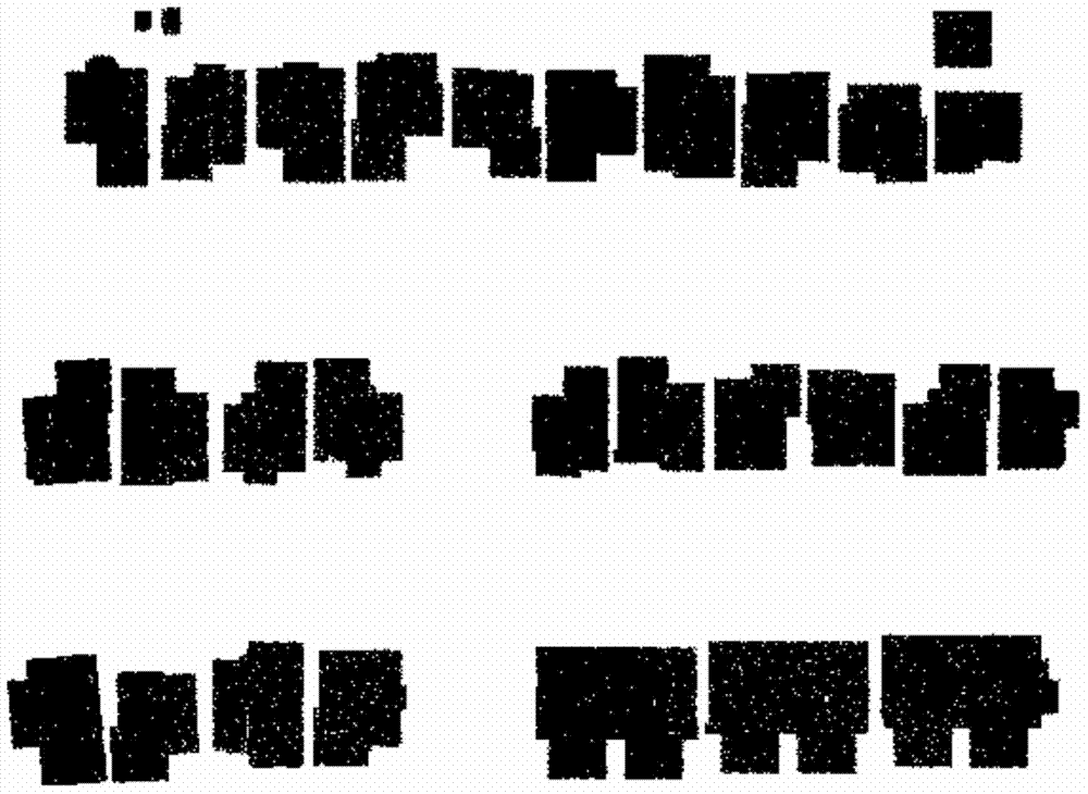
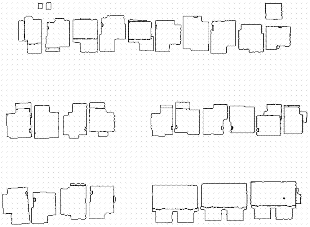

Image

  • Building outer boundary line extraction method based on onboard LiDAR (Light Detection and Ranging) data
  • Building outer boundary line extraction method based on onboard LiDAR (Light Detection and Ranging) data
  • Building outer boundary line extraction method based on onboard LiDAR (Light Detection and Ranging) data

Examples


Embodiment Construction

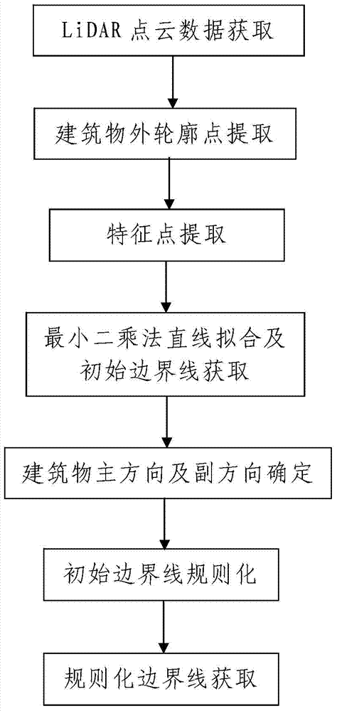
[0094] Such as figure 1 Shown is a method for extracting the outer boundary line of buildings based on airborne LiDAR data, comprising the following steps:

[0095] Step 1. Acquisition of LiDAR point cloud data: The airborne LiDAR measurement system is used to obtain the point cloud data of the area to be measured, and the obtained point cloud data is transmitted to the data processing device. The point cloud data includes point cloud data of multiple buildings in the area to be measured, and the point cloud data of each building includes multiple measuring points on the top of the building and the three-dimensional coordinates of each measuring point.

[0096] Step 2, LiDAR point cloud data processing: use the data processing device to process the point cloud data of multiple buildings respectively, and extract the outer boundary line of each building; the point cloud data processing process of multiple buildings is the same .

[0097] In this embodiment, before the actual ...


PUM


Abstract

The invention discloses a building outer boundary line extraction method based on onboard LiDAR (Light Detection and Ranging) data. The method comprises the following steps: I, acquiring LiDAR point cloud data; II, processing the LiDAR point cloud data: processing point cloud data of a building, and extracting an outer boundary line of the building, wherein the point cloud data of the building is processed through the following steps: 201, extracting the outer boundary points of the building; 202, extracting feature points; 203, performing linear fitting through a least square method, and acquiring an initial boundary line; 204, determining the main direction and the secondary direction of the building; 205, regularizing the initial boundary line: performing regularization processing on a plurality of linear segments in the initial boundary line respectively according to the determined main direction and secondary direction; 206, acquiring the regularized boundary line. The method is simple in steps, is reasonable in design, is convenient to implement and has a good use effect; the extraction process of the outer boundary line of the building can be finished easily, conveniently and rapidly, and the regularization degree of an obtained outer boundary vector is high.

Description

technical field [0001] The invention relates to a method for extracting outer boundary lines, in particular to a method for extracting outer boundary lines of buildings based on airborne LiDAR data. Background technique [0002] 3D city modeling is widely used in GIS fields such as digital city planning. The extraction of the outer boundary line of the building is a key step in the reconstruction of the building model. In traditional photogrammetry, it is necessary to manually draw the outline of the outer boundary of the building in the stereogram, which is time-consuming and laborious, and the efficiency is low. [0003] With the wide application of airborne laser scanning technology, the technology of using airborne lidar data to extract the outer boundary line (ie contour line) of buildings has developed to a certain extent. At present, the methods for extracting building outlines from airborne laser scanning data are mainly divided into rasterization-based extraction ...

Claims


Application Information

Patent Timeline
IPC IPC(8): G06K9/46
Inventor 彭桂辉段梦琦杨培义宋袁龙
Owner AERIAL PHOTOGRAMMETRY & REMOTE SENSING CO LTD
Learn More