Method for on-orbit evaluation of remote sensing image change detection performance
A remote sensing image and change detection technology, applied in image enhancement, image analysis, image data processing and other directions, can solve the problems of automatic and accurate evaluation difficulties, and achieve the effect of reliable evaluation, reduction of calculation time, and strong robustness.
- Summary
- Abstract
- Description
- Claims
- Application Information
AI Technical Summary
Problems solved by technology
Method used
Image
Examples
Embodiment Construction
[0017] The technical problems involved in the technical solution of the present invention will be described below in conjunction with the accompanying drawings. It should be pointed out that the described embodiments are only intended to facilitate the understanding of the present invention, rather than limiting it in any way.
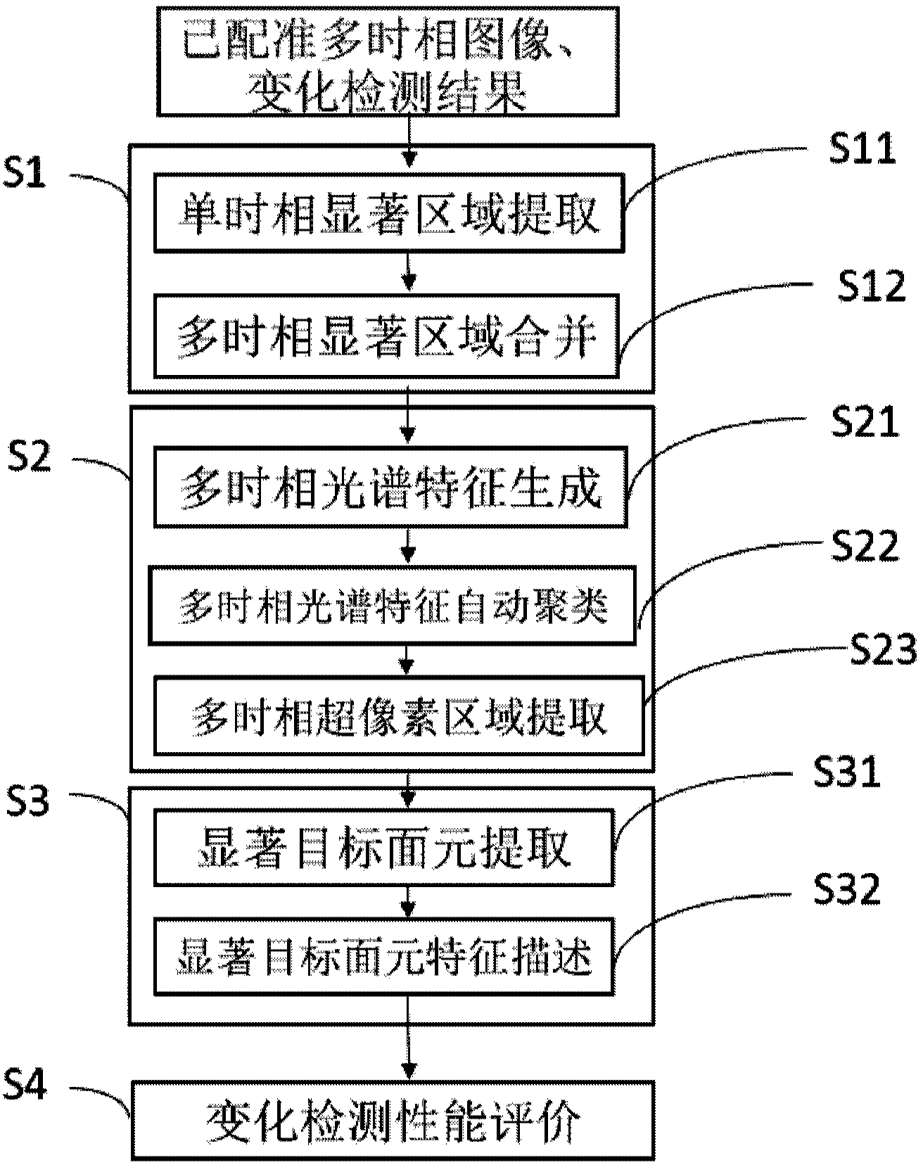
[0018] Such as figure 1 It shows that the present invention proposes a method for on-orbit evaluation of remote sensing image change detection performance, which method includes the following steps:
[0019] Step S1: Multi-temporal salient region extraction uses the sign function of the discrete cosine transform of image grayscale as the saliency metric, first extracts salient regions on the current remote sensing image and historical remote sensing images, and then takes the union of salient regions as a multi-temporal Salient regions of the phase image. The specific process of extracting the multi-temporal salient region is as follows:
[0020] St...
PUM
 Abstract
Description
Claims
Application Information
 - R&D
- Intellectual Property
- Life Sciences
- Materials
- Tech Scout
- Unparalleled Data Quality
- Higher Quality Content
- 60% Fewer Hallucinations
Browse by: Latest US Patents, China's latest patents, Technical Efficacy Thesaurus, Application Domain, Technology Topic, Popular Technical Reports.
© 2025 PatSnap. All rights reserved.Legal|Privacy policy|Modern Slavery Act Transparency Statement|Sitemap|About US| Contact US: help@patsnap.com


