
Calibration of cameras and scanners on UAV and mobile platforms

a technology of mobile platforms and cameras, applied in the direction of image enhancement, instruments, and using reradiation, can solve the problems of not having a digital elevation model, unable to address or propose an optimal/minimal flight and control point/tie point configuration for reliable estimation of boresight angles, etc., to achieve minimizing discrepancies, minimizing discrepancies, and minimizing discrepancies

Active Publication Date: 2020-10-15
PURDUE RES FOUND INC
View PDF36 Cites 23 Cited by
  • Summary
  • Abstract
  • Description
  • Claims
  • Application Information

AI Technical Summary

Benefits of technology

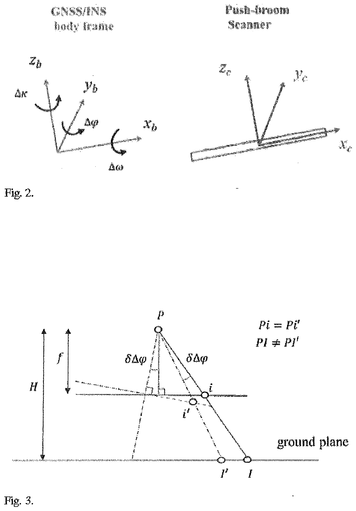
The patent text describes two calibration methods for a LiDAR imaging device mounted on a vehicle. The first method uses a tie feature approach, while the second method uses a rigorous approach based on GCPs (ground control points) and the collinearity principle. These methods aim to improve the accuracy of the imaging device by estimating the boresight angles and mounting parameters. The patent also describes a method for calibrating the imaging device using a travel path with multiple travel paths over a scene, extracting data from the LiDAR scans and image data, identifying conjugate features, and comparing them to the pre-determined mounting parameters to modify the mounting parameters and improve the accuracy of the imaging device.

Problems solved by technology

The key limitation of the above approaches is the need for having a digital elevation model (DEM) of the covered area as well as some GCPs.
Moreover, none of these prior approaches address or propose an optimal / minimal flight and control point / tie point configuration for reliable estimation of the boresight angles.

Method used


Image

  • Calibration of cameras and scanners on UAV and mobile platforms
  • Calibration of cameras and scanners on UAV and mobile platforms
  • Calibration of cameras and scanners on UAV and mobile platforms

Examples


Embodiment Construction

[0055]For the purposes of promoting an understanding of the principles of the disclosure, reference will now be made to the embodiments illustrated in the drawings and described in the following written specification. It is understood that no limitation to the scope of the disclosure is thereby intended. It is further understood that the present disclosure includes any alterations and modifications to the illustrated embodiments and includes further applications of the principles disclosed herein as would normally occur to one skilled in the art to which this disclosure pertains

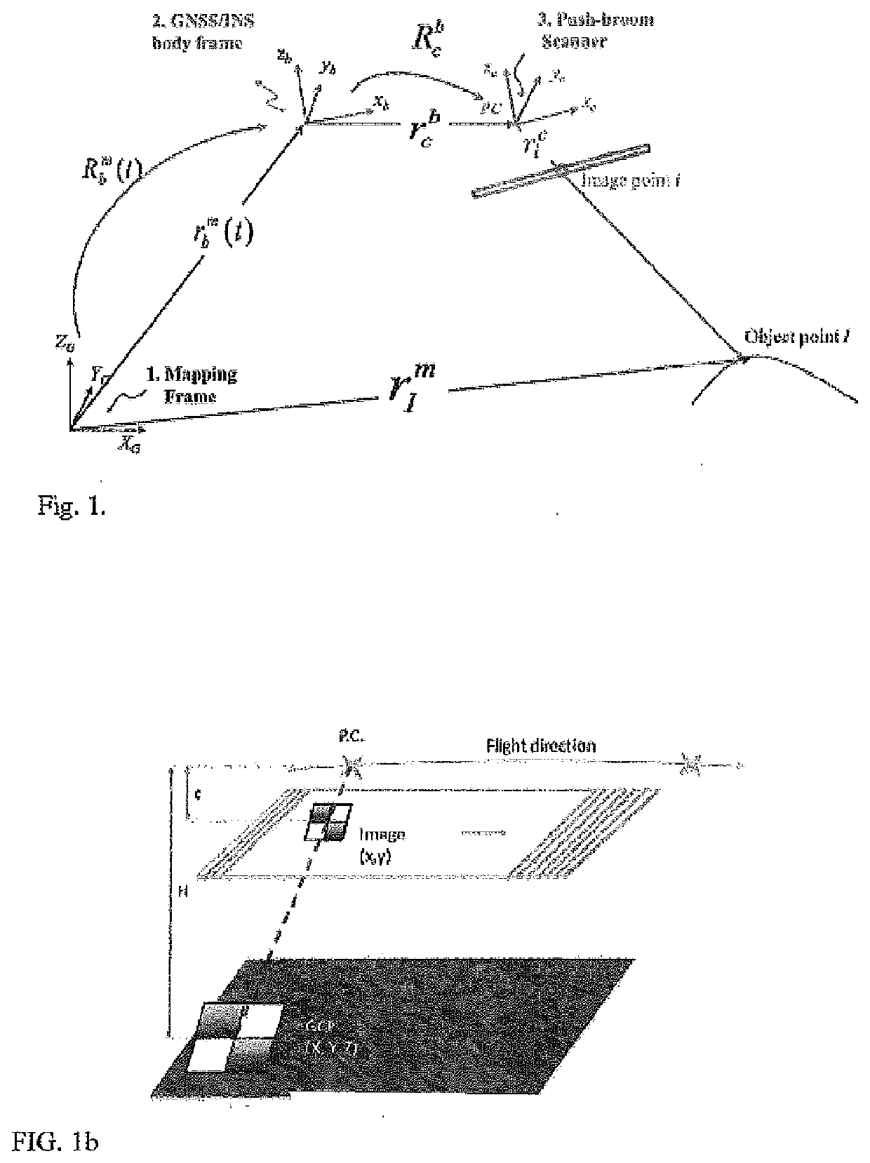
[0056]In accordance with one aspect of the present disclosure, the bias impact analysis and boresight calibration are based on the collinearity equations, which describe the conceptual basis of point positioning using GNSS / INS-assisted push-broom scanners. A push-broom scanner system involves three coordinate systems—a mapping frame, an IMU body frame, and a scanner frame. The mathematical model of the collin...


PUM


Abstract

Boresight and lever arm calibration of cameras and scanners on UAVs or mobile platforms is performed by optimizing the flight / travel path of the UAV / platform relative to control points or tie points. The flight / travel paths account for the potential bias of boresight angles, lever arm and times delays to produce an accurate estimation of the orientation of these cameras / scanners relative to the GNSS / INS coordinate system o the UAV / platform.

Description

PRIORITY CLAIM[0001]This application claims priority to co-pending U.S. Provisional No. 62 / 806,853, filed on Feb. 17, 2019, the entire disclosure and appendices of which are incorporated herein by reference.STATEMENT OF GOVERNMENT INTEREST[0002]This invention was made with government support under DE-AR0000593 awarded by the US Department of Energy. The government has certain rights in the invention.BACKGROUND[0003]Remote sensing is a rapidly growing technological and industrial field. Cameras and / or LiDAR scanners mounted to a mobile platform are used to extract a wide range of information. One increasingly important application is the use of cameras and / or LiDAR scanners to image and gather data concerning land and terrain.[0004]In particular, hyperspectral imaging is quickly emerging as an irreplaceable mechanism for collecting high-quality scientific data. By measuring the spectral radiance in narrow bands across large swaths of the electromagnetic spectrum, hyperspectral sensor...

Claims


Application Information

Patent Timeline
IPC IPC(8): G06T7/80G06T7/73G01S17/89G08G5/00B64C39/02
CPCG06T7/74B64C2201/127G01S17/89G08G5/003B64C39/024G06T7/80G06T2207/10028G06T2207/30252G06T2207/30244G01S17/88G01S17/86G01S7/4972B64U2201/00B64U2101/30B64U10/13B64U20/80
Inventor HABIB, AYMAN F.
Owner PURDUE RES FOUND INC
Learn More