Building extraction method based on lifting track radar data

A technology of radar data and lifting orbit, which is applied in the field of spaceborne synthetic aperture radar data processing, can solve problems such as image radiation level and incident angle difference, and achieve the effects of reducing computing load, reducing image classification noise, and high algorithm efficiency

Pending Publication Date: 2022-03-22
YANGTZE DELTA REGION INST OF UNIV OF ELECTRONICS SCI & TECH OF CHINE HUZHOU
View PDF0 Cites 0 Cited by
  • Summary
  • Abstract
  • Description
  • Claims
  • Application Information

AI Technical Summary

Problems solved by technology

In addition, the imaging principle of radar images leads to the existence of inherent coherent speckle noise, and the observation of ascending and descending orbits will also cause differences in the radiation level and incident angle of the image. Correction and Relative Radiance Normalization

Method used


Image

  • Building extraction method based on lifting track radar data
  • Building extraction method based on lifting track radar data
  • Building extraction method based on lifting track radar data

Examples


Embodiment Construction

[0037] Below with sample area example and in conjunction with accompanying drawing, the present invention is further described, and development environment is GEE (Googleearth engine), and programming language is JavaScript

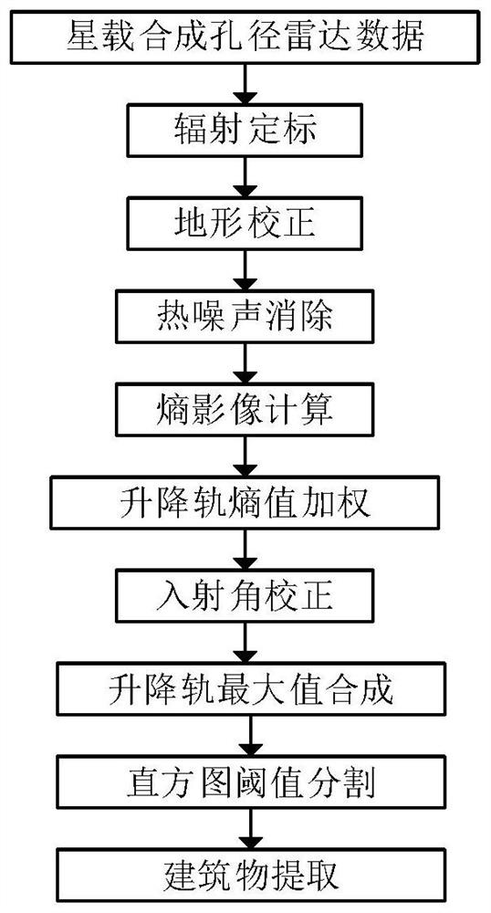
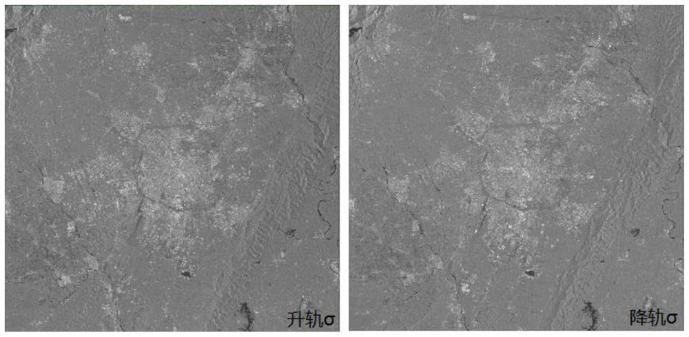
[0038] Step 1. Taking Chengdu City, Sichuan Province, China as the research area, retrieve the radar data of Sentinel-1 on April 3, 2019 (up track) and April 10, 2019 (down track), select the VV band of the two scene data and cut out In the urban area of ​​Chengdu, use the imageCollection function to obtain two backscatter coefficient σ images processed by radiometric calibration, terrain correction and thermal noise removal.

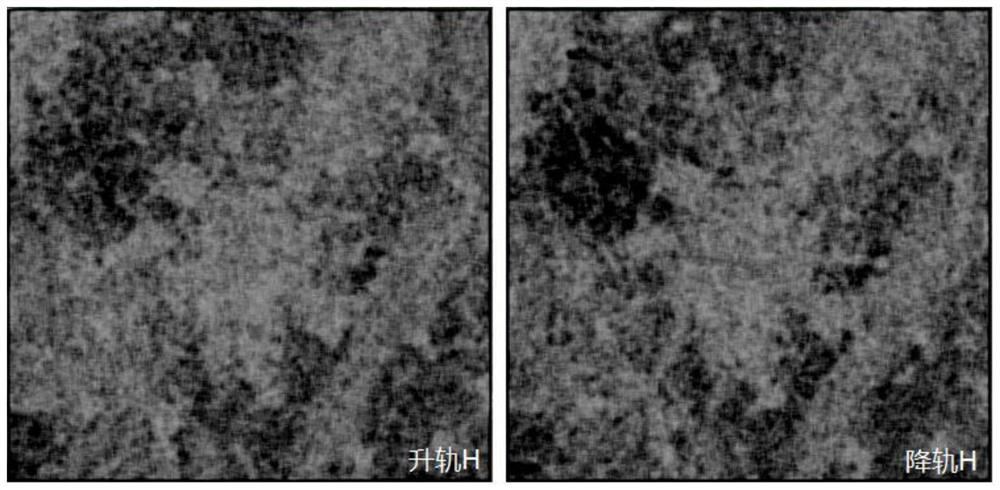
[0039] Step 2. According to the step 2 of the technical solution, use the entropy function to calculate the entropy image of the radar data of the two scenes. Before the calculation, increase the value of each pixel by 100 times and convert it into integer data. The pixel neighborhood is defined as the pixel In a square area with a...


PUM


Abstract

The invention belongs to the technical field of satellite-borne synthetic aperture radar data processing, and particularly relates to a building extraction method based on lifting track radar data. According to the method, a satellite-borne synthetic aperture radar is used for obtaining an orbit ascending radar image and an orbit descending radar image at the time interval of 6 days, and the method for extracting the building based on the satellite-borne radar data is established through radiometric calibration, terrain correction, thermal noise elimination, entropy calculation and orbit weighting, incident angle correction, orbit ascending and descending maximum value synthesis and histogram threshold processing. According to the method, the dependence of building extraction on ground samples is reduced, the operation load is reduced compared with an identification method based on machine learning, the problem of building scattering information distortion caused by monorail radar observation is solved, identification errors caused by space speckle noise, image incidence angles and radiation differences are reduced, and the identification accuracy is improved. The method can be applied to the fields of land resource monitoring, urban planning management and the like, and achieves 87% precision in urban building identification cases.

Description

technical field [0001] The invention belongs to the technical field of space-borne synthetic aperture radar data processing, and in particular relates to a method for extracting buildings based on elevation track radar data. Background technique [0002] Spaceborne Synthetic Aperture Radar (SAR) is an active remote sensing technology that obtains the physical and chemical characteristics of ground targets by sending microwave signals from sensors mounted on satellites and receiving ground echoes. Large-scale imaging, and sensitive to the geometric structure characteristics of the target object, provide an effective technical means for land use monitoring and building identification. [0003] The research on building extraction using spaceborne synthetic aperture radar data mainly selects building samples through field surveys or visual interpretation of optical remote sensing images, and implements pixel classification and architectural building through machine learning algo...

Claims


Application Information

Patent Timeline
Patent Type & Authority Applications(China)
IPC IPC(8): G01S7/41G01S13/90
CPCG01S7/411G01S13/9021
Inventor 李世华何泽
Owner YANGTZE DELTA REGION INST OF UNIV OF ELECTRONICS SCI & TECH OF CHINE HUZHOU
Why Eureka
Try Eureka