Long sequence automatic interferometry system and method
A technology of interferometric measurement and timing, which is applied in the direction of radio wave measurement system, measurement device, radio wave reflection/reradiation, etc. It can solve problems such as lack of parallelism, batch processing capability, automatic processing capability, and large learning cost. , to achieve the effect of realizing high efficiency, lowering the threshold of use, and improving processing efficiency
- Summary
- Abstract
- Description
- Claims
- Application Information
AI Technical Summary
Problems solved by technology
Method used
Image
Examples
Embodiment 1
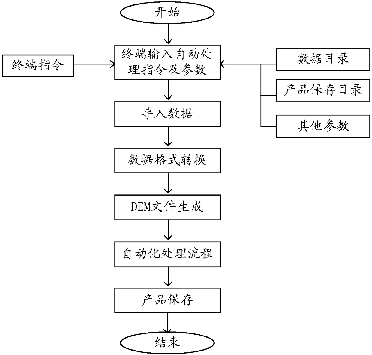
[0063] The invention provides a long-sequence automatic interferometric measurement system, which can be used for long-sequence automatic differential interferometric measurement of surface deformation. This system can be developed using the powerful Python language with many rich standard libraries, which can be applied to the processing of various spaceborne SAR data at home and abroad, and users can view the data information and image information during the processing at any time. figure 1 The module block diagram of the long time series automatic interferometry system provided by the present invention. Such as figure 1 As shown, the system provided by the present invention includes: a memory, an instruction acquisition module, a data preparation module and an automatic processing module;
[0064] The memory is used to store original SAR data and generate product data; the generated product data includes atmospheric phase analysis diagrams, residual terrain phase analysis ...
Embodiment 2
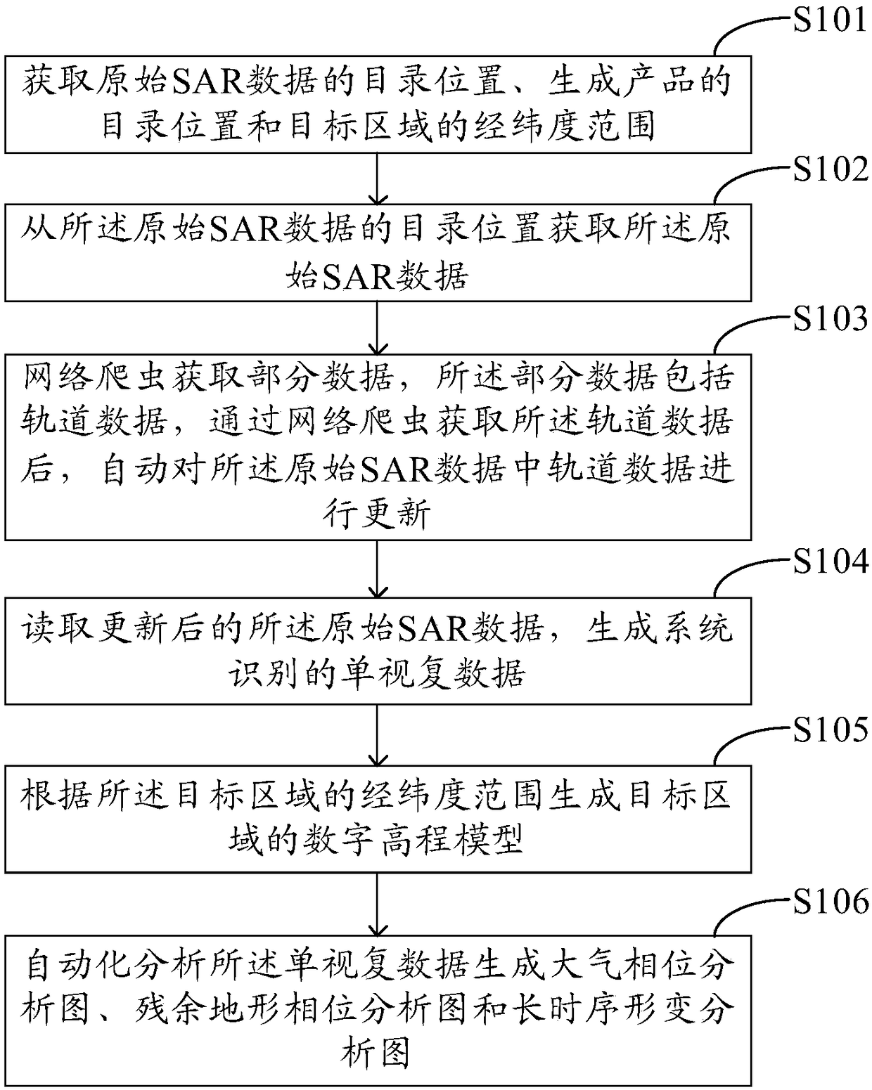
[0091] The invention provides a long-sequence automatic interference measurement method, which can be used for efficient analysis and processing of SAR data. image 3 The flow chart of the long-sequence automatic interferometry method provided by the present invention. Such as image 3 As shown, the method includes:
[0092] Step S101: Obtain the catalog location of the original SAR data, the catalog location of the generated product, and the latitude and longitude range of the target area.
[0093] Step S102: Obtain the original SAR data from the directory location of the original SAR data; the original SAR data includes SAR image data, imaging parameter data, orbit data, spatial data, time data and so on.
[0094] Step S103: The web crawler obtains part of the data, and the part of the data includes orbit data. After obtaining the orbit data through the web crawler, it automatically updates the orbit data in the original SAR data; updating the orbit data can improve the or...
PUM
 Abstract
Description
Claims
Application Information
 - R&D
- Intellectual Property
- Life Sciences
- Materials
- Tech Scout
- Unparalleled Data Quality
- Higher Quality Content
- 60% Fewer Hallucinations
Browse by: Latest US Patents, China's latest patents, Technical Efficacy Thesaurus, Application Domain, Technology Topic, Popular Technical Reports.
© 2025 PatSnap. All rights reserved.Legal|Privacy policy|Modern Slavery Act Transparency Statement|Sitemap|About US| Contact US: help@patsnap.com


