Urban road network time varying K shortest path search method capable of considering turn delays
A shortest path, urban road network technology, applied in data processing applications, forecasting, calculations, etc., can solve the problems of ignoring intersection turning delays, inconsistent travel times, and low accuracy of calculation results.
- Summary
- Abstract
- Description
- Claims
- Application Information
AI Technical Summary
Problems solved by technology
Method used
Image
Examples
Embodiment Construction
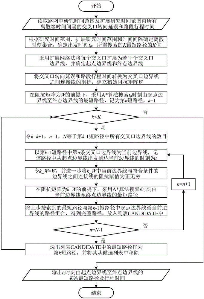
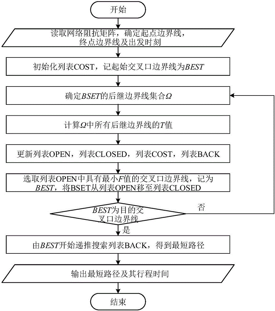
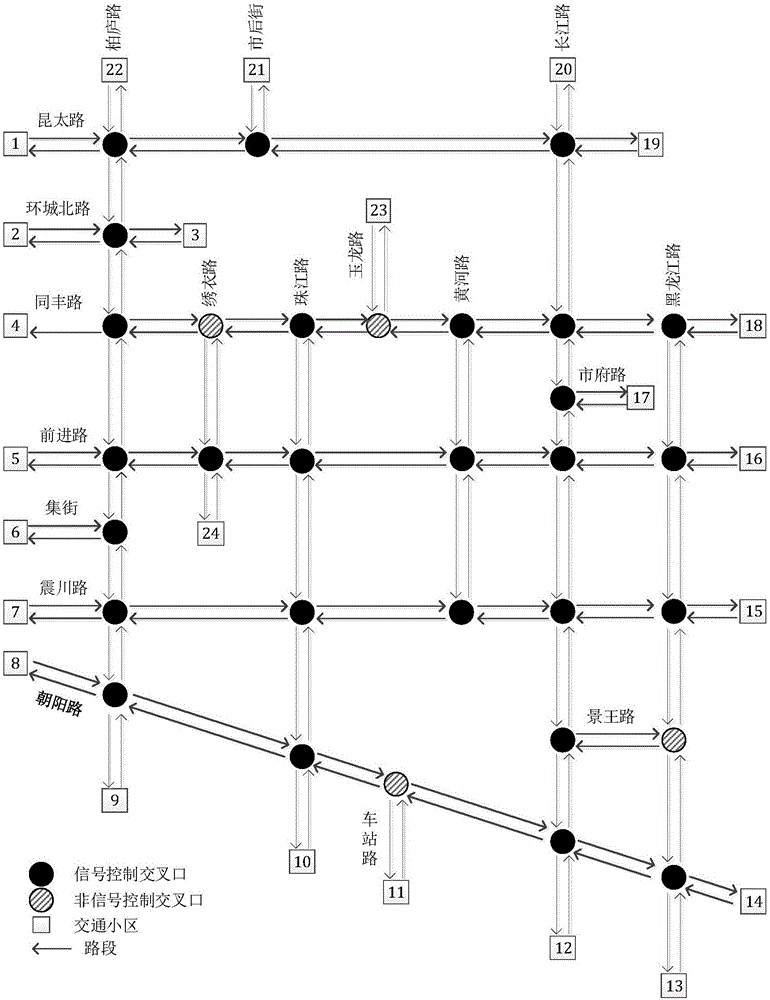
[0049] The flow chart of this embodiment is as follows figure 1 As shown, step (5) is as figure 2 As shown, the research object is the actual road network in Kunshan urban area, and the topology of the road network is as follows: image 3 shown. The research road network includes 18 roads, including 8 arterials and 10 branch roads; 31 intersections, of which 27 are signal control intersections and 4 are non-signal control intersections. In addition, combined with the road network topology and land use properties, the research road network contains 24 traffic areas to generate and attract traffic demand, which here represent the departure area and destination area of the vehicle. The present invention uses the time-varying travel time of the road section and the turning delay at the intersection as the K shortest path between the small cells searched by the network impedance. Among them, the travel time of the road section is obtained by dividing the length of the road se...
PUM
 Abstract
Description
Claims
Application Information
 - R&D
- Intellectual Property
- Life Sciences
- Materials
- Tech Scout
- Unparalleled Data Quality
- Higher Quality Content
- 60% Fewer Hallucinations
Browse by: Latest US Patents, China's latest patents, Technical Efficacy Thesaurus, Application Domain, Technology Topic, Popular Technical Reports.
© 2025 PatSnap. All rights reserved.Legal|Privacy policy|Modern Slavery Act Transparency Statement|Sitemap|About US| Contact US: help@patsnap.com


