A Multi-factor Quantitative Evaluation Method of 3D Porosity in Geological Period
A quantitative evaluation, geological period technology, applied in suspension and porous material analysis, measurement devices, seismic signal processing, etc., can solve the problem of not considering the contribution of rock composition and structural differences, cumbersome research data acquisition, and not involving 3D porosity evolution. research, etc.
- Summary
- Abstract
- Description
- Claims
- Application Information
AI Technical Summary
Problems solved by technology
Method used
Image
Examples
Embodiment 1
[0040] Embodiment 1: as figure 1 , figure 2 , image 3 , Figure 4 , Figure 5 , Image 6 , Figure 7, Figure 7, Figure 7, Figure 8 , Figure 9 , Figure 10 , Figure 11 , Figure 12 , Figure 13 as shown,
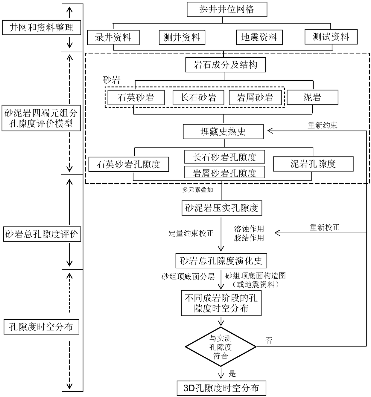
[0041] A multi-factor quantitative evaluation method for 3D porosity in geological periods belongs to the research field of 3D diagenetic numerical simulation of low-permeability-tight reservoirs, and provides technical means for the evaluation of oil and gas "sweet spots" in low-permeability-tight reservoirs.
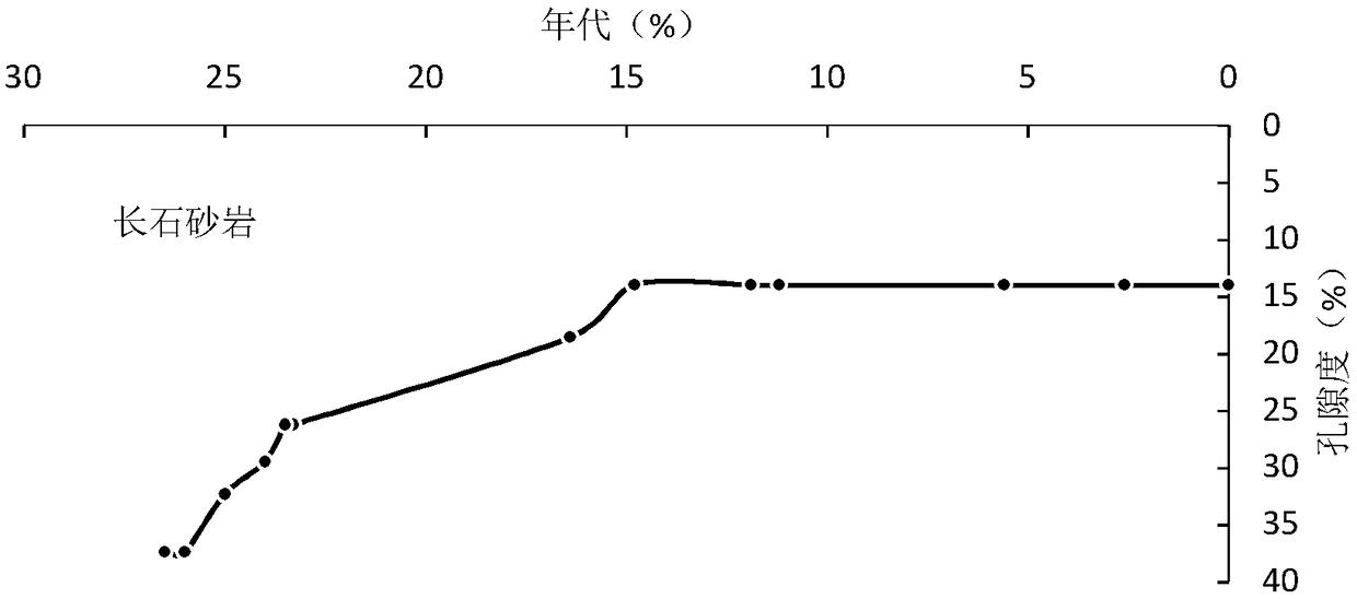
[0042] A multi-factor quantitative evaluation method for 3D porosity in the geological period. Based on different rock types in the target layer, combined with the percentage content of different rock types, the initial porosity is evaluated by weighted summation, and the cementation of the target layer is carried out Porosity spatio-temporal distribution evaluation method for reducing porosity and increasing porosity correction by dissolution and dissolu...
Embodiment 2
[0091] Embodiment 2: as figure 1 , figure 2 , image 3 , Figure 4 , Figure 5 , Image 6 , Figure 7, Figure 7, Figure 7, Figure 8 , Figure 9 , Figure 10 , Figure 11 , Figure 12 , Figure 13 as shown,
[0092] A method for quantitatively evaluating 3D porosity in geological time with multiple factors, comprising the following steps:
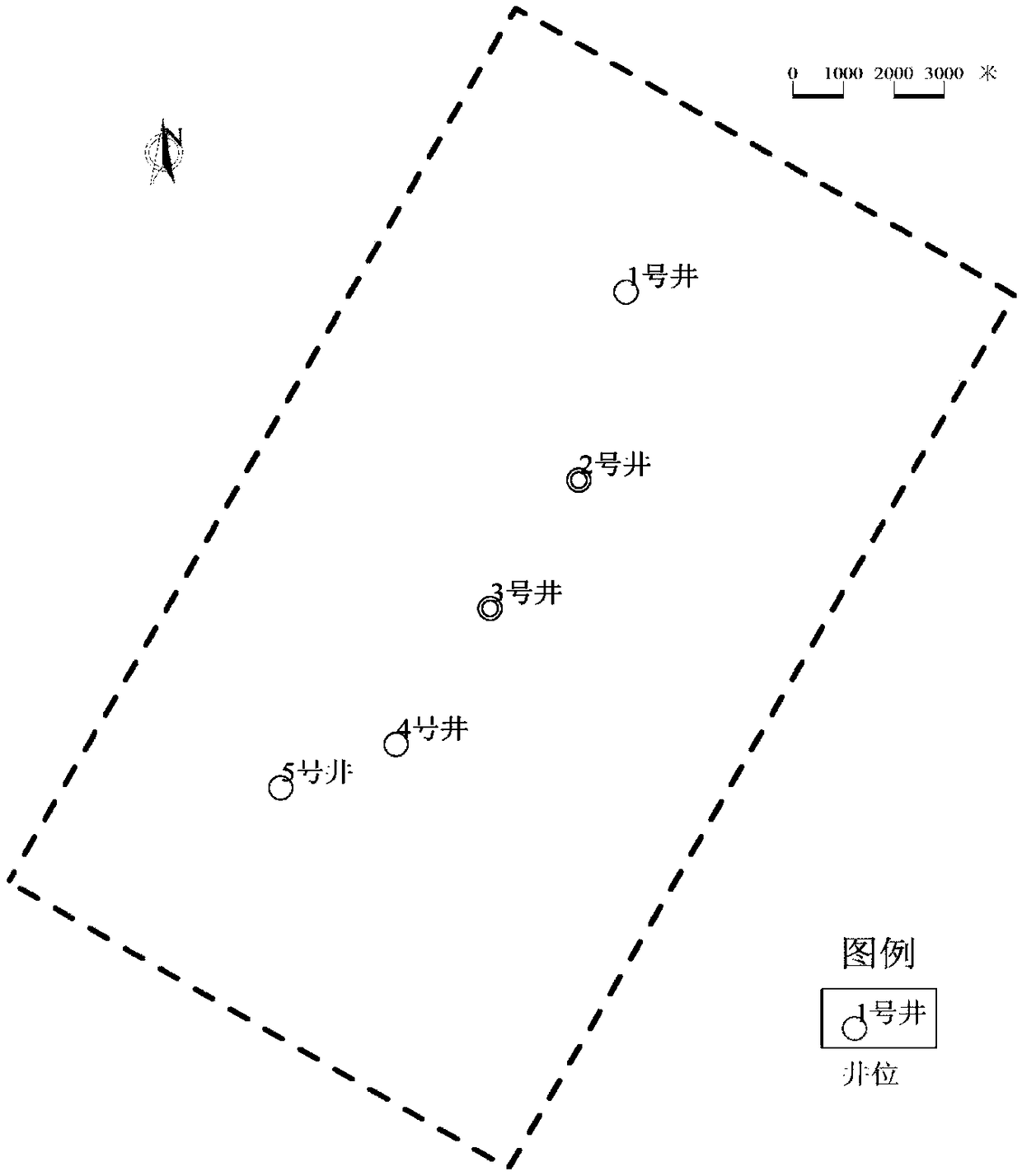
[0093] Step 1), well location selection: Based on the exploratory wells in the study area, establish a planar well location grid based on the exploration data in the study area. If the spacing is 0.5km×0.5km, the well location grid should be able to reflect the structure of the study area The range of change, or determined based on seismic data;
[0094] Step 2), arrange data: collect and organize the target layer mud logging data, well logging data, seismic data and rock whole-rock X-ray diffraction analysis test data; wherein the target layer rock whole-rock X-ray diffraction analysis test data is classified as feldspar sandst...
Embodiment 3
[0102] Embodiment 3: as figure 1 , figure 2 , image 3 , Figure 4 , Figure 5 , Image 6 , Figure 7, Figure 7, Figure 7, Figure 8 , Figure 9 , Figure 10 , Figure 11 , Figure 12 , Figure 13 as shown,
[0103] A multi-factor quantitative evaluation method for 3D porosity in the geological period. Based on different rock types and their percentages in the target layer, the initial porosity is evaluated by weighted sum method, cementation and dissolution correction, and the evaluation of the spatial and temporal distribution of porosity method, including the following steps:
[0104] Step (1), well location selection: based on the exploratory wells in the target layer of the XX Sag in the XX Basin, a planar well location grid based on the exploration data in the study area is established. The well location grid should be able to reflect the range of structural changes in the study area. Or determined based on seismic data;
[0105] like figure 1 , there are r...
PUM
 Abstract
Description
Claims
Application Information
 - Generate Ideas
- Intellectual Property
- Life Sciences
- Materials
- Tech Scout
- Unparalleled Data Quality
- Higher Quality Content
- 60% Fewer Hallucinations
Browse by: Latest US Patents, China's latest patents, Technical Efficacy Thesaurus, Application Domain, Technology Topic, Popular Technical Reports.
© 2025 PatSnap. All rights reserved.Legal|Privacy policy|Modern Slavery Act Transparency Statement|Sitemap|About US| Contact US: help@patsnap.com


