
Satellite Gravity Retrieval Method Based on 3D Interpolation Principle of Double Star Space

A technology of satellite gravity inversion and space, which is applied in cross-fields and can solve problems such as difficult promotion

Inactive Publication Date: 2011-11-30
INST OF GEODESY & GEOPHYSICS CHINESE ACADEMY OF SCI
View PDF1 Cites 32 Cited by
  • Summary
  • Abstract
  • Description
  • Claims
  • Application Information

AI Technical Summary

Problems solved by technology

[0030] To sum up, although DLSP has high theoretical solution accuracy, it is temporarily difficult to popularize in terms of the calculation speed of the current international ultra-large parallel computer (only NASA-JPL, Potsdam, Germany, etc. However, with the increasing performance of international computers, it is expected to gradually become a widely used standard method in the future; PCCG is currently widely used by many international scientific research institutions to solve GRACE (Gravity Recovery and Climate Experiment) is one of the effective methods for the earth's gravity field, but it is only suitable for solving the middle and low order earth's gravity field

Method used


Image

  • Satellite Gravity Retrieval Method Based on 3D Interpolation Principle of Double Star Space
  • Satellite Gravity Retrieval Method Based on 3D Interpolation Principle of Double Star Space
  • Satellite Gravity Retrieval Method Based on 3D Interpolation Principle of Double Star Space

Examples


Embodiment Construction

[0068] The specific implementation manners of the present invention will be further described below in conjunction with the accompanying drawings.

[0069] Application of accurate and fast satellite gravity inversion method based on the new dual star space three-dimensional interpolation principle:

[0070] 1) Using GRACE satellites (such as figure 2 As shown) the K-band measuring instrument obtains the inter-satellite velocity, the satellite orbit position and satellite orbit velocity are obtained by the GPS receiver, the non-conservative force of the satellite is obtained by the accelerometer, and the three-dimensional attitude observation data of the satellite is obtained by the stellar sensor, and the satellite orbit is quickly calculated Earth disturbance bit at . In the ground-solid system, the expression of the earth disturbance potential T(r, θ, λ) expanded according to the spherical harmonic function is

[0071] T ( r ...


PUM


Abstract

The invention relates to a method for precisely measuring an earth gravitational field, in particular to a satellite gravity inversion method based on a double-satellite spatial three-dimensional interpolation principle. An earth disturbing potential (obtained by computing an inter-satellite speed of a GRACE satellite K wave band measuring instrument, a satellite orbit position and a satellite orbit speed of a global positioning system (GPS) receiver, a satellite nonconservative force of an accelerometer and a satellite three-dimensional attitude data of a fixed star sensitive device) which is positioned on a gravity double-satellite orbit with a relatively irregular spatial position is interpolated three-dimensionally onto a reference spherical surface with a relatively regular spatial position and uniform grid division, so that the earth gravitational field is precisely and quickly inversed. By the method, satellite gravity inversion precision is high, physical meaning in the resolving process is clear, the computing speed is high, requirements on performance of a computer are low, and the method is sensitive to high-frequency signals in the gravitational field, so that the double-satellite spatial three-dimensional interpolation method is an effective method for resolving the earth gravitational field with high precision and high spatial resolution.

Description

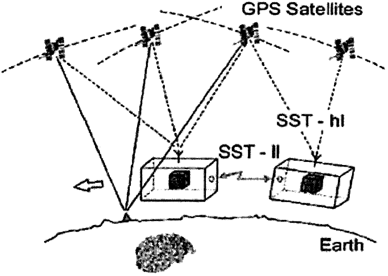
1. Technical field [0001] The present invention relates to intersecting technical fields such as satellite geodesy, geophysics, space science, particularly relate to a kind of earth disturbance position based on the gravitational binary star orbit that will be located in relatively irregular space position (by the GRACE satellite K-band measuring instrument) Inter-satellite velocity, satellite orbital position and satellite orbital velocity of GPS receiver, satellite non-conservative force of accelerometer, and satellite three-dimensional attitude data of stellar sensor are calculated) three-dimensional interpolation to spatial position is relatively regular and uniform grid division reference On the sphere, and then accurately and quickly invert the method of the Earth's gravity field. 2. Background technology [0002] Such as figure 1 As shown, the 21st century is a new era for human beings to use satellite tracking satellite high-low / low-low technology (SST-HL / LL) to enh...

Claims


Application Information

Patent Timeline
Patent Type & Authority Applications(China)
IPC IPC(8): G01V7/00
Inventor 郑伟许厚泽熊熊钟敏刘成恕
Owner INST OF GEODESY & GEOPHYSICS CHINESE ACADEMY OF SCI
Learn More