Road diagnosis method and system for urban bridges based on digital twin technology
A city and road technology, applied in image data processing, special data processing applications, image analysis, etc., can solve problems such as low work efficiency, and achieve high efficiency, strong visibility, and visualization effects
- Summary
- Abstract
- Description
- Claims
- Application Information
AI Technical Summary
Problems solved by technology
Method used
Image
Examples
Embodiment 1
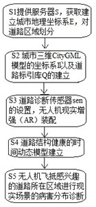
[0072] like figure 1 For the drone realistic enhancement diagnosis method for a city road, including the following steps: S1 provides server S, get the establishment of urban geographic coordinate system E, division of road areas; S2 urban semantic model coordinate system I, drone coordinate system f And the establishment of road sign library Q; S3 road diagnostic sensor SENS setting, drone reality enhancement (AR) assembly; S4 road structure health time dynamic model is established; S5 drone flying interested roads are in the region Disease distribution diagnosis of realistic scenes.
Embodiment 2
[0074] The S1 in Example 1 specifically includes a server acquisition urban geographic coordinate system, wherein the urban geographic coordinate system E specifically selection of the standard building substrate is from the south and the west of the X-axis and Y axis, and the vertices of the two are origin O The reference point is established; the road network extraction model is divided into road areas in urban roads.
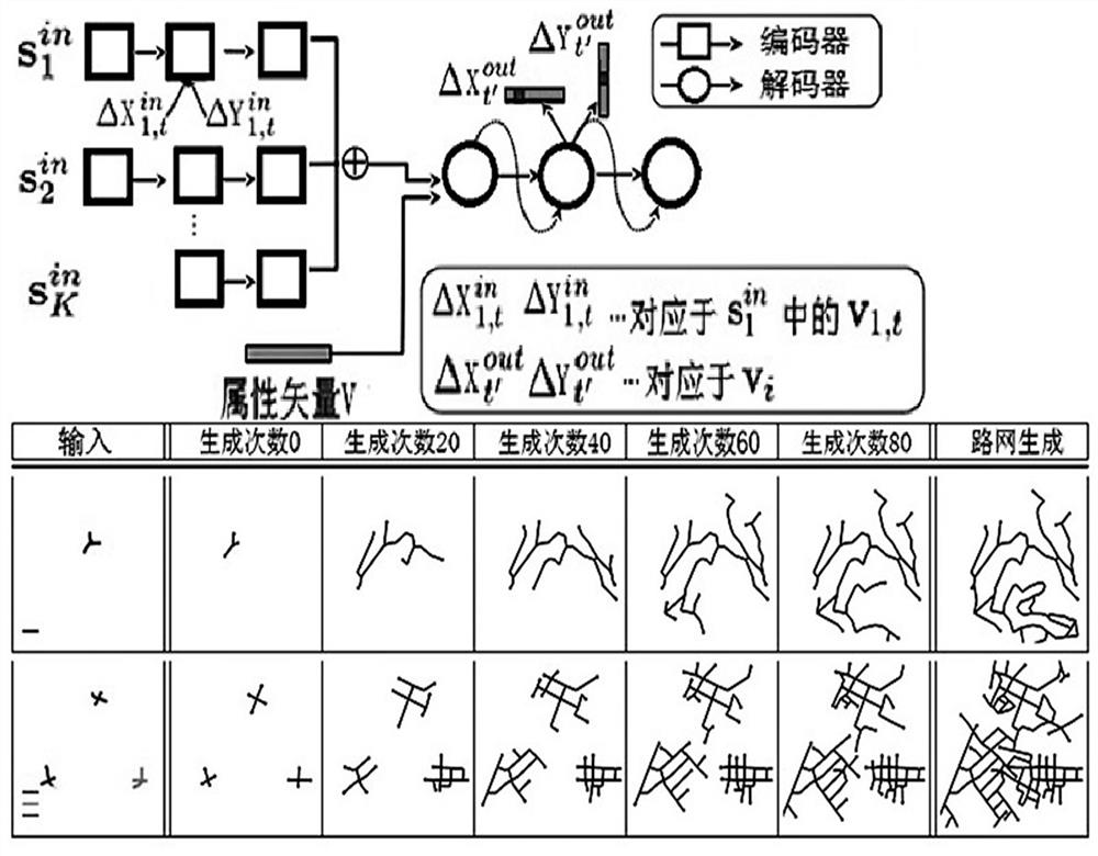
[0075] The specific road network extraction model includes using an RNN circulating neural network algorithm, such as figure 2 As shown, the road continuous node is generated by the encoder and the decoder, and the two nodes before and after the generation process are generated, and the new node input node generator will continue to generate new nodes, and the new node generated will be continued. This is connected to the road network.
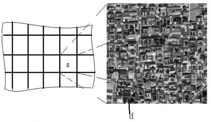
[0076] Specifically, if image 3 As shown, urban gridization processing, for each grid point, to fuse the spinning network D of ...
Embodiment 3
[0083] In Example 1, S3 specifically includes: S3-1 specifically includes, in a preset 20m distance, fixed diagnosis of photonic sound detector Sens on both sides and the road center in the road, and sets one on both sides of the road within the preset 400m distance. Walking the robot, carrying the diagnostic photographic detector by walking robots, fixed photoco detectors and walking robots each have real-time detection of the roads in the area. Using drones with a diagnostic photoco detector is scheduled to detect the roads according to detection, and the recorded data is sent to the server S, and historical data is accumulated. Among them, the robot is passed Image 6 On both sides of the road and the center, walking rails are laid in the respective preset distance zones. Adjacent diagnostic photoco detector scan ranges can cover all roads between each other, and the photocoupless signal can be efficiently identified and select the interval preset distance.
[0084] For the dete...
PUM
 Abstract
Description
Claims
Application Information
 - R&D
- Intellectual Property
- Life Sciences
- Materials
- Tech Scout
- Unparalleled Data Quality
- Higher Quality Content
- 60% Fewer Hallucinations
Browse by: Latest US Patents, China's latest patents, Technical Efficacy Thesaurus, Application Domain, Technology Topic, Popular Technical Reports.
© 2025 PatSnap. All rights reserved.Legal|Privacy policy|Modern Slavery Act Transparency Statement|Sitemap|About US| Contact US: help@patsnap.com


