
Monitoring method of freezing injury of winter wheat based on high-resolution satellite remote sensing data

A technology for satellite remote sensing data and winter wheat, applied in data processing applications, instruments, calculations, etc., can solve problems such as low accuracy and lack of quantitative models for winter wheat, and achieve the effect of rapid estimation

Active Publication Date: 2021-06-01
INST OF AGRI ECONOMICS & INFORMATION HENAN ACADEMY OF AGRI SCI
View PDF5 Cites 0 Cited by
  • Summary
  • Abstract
  • Description
  • Claims
  • Application Information

AI Technical Summary

Problems solved by technology

[0004] Aiming at the technical problems of lack of quantitative models and low precision in the existing methods of monitoring winter wheat freezing damage using satellite remote sensing data, the present invention proposes a monitoring method for winter wheat freezing damage based on high-resolution satellite remote sensing data. Through the ratio method, the amplification process is carried out, and the winter wheat frost damage is monitored with the help of the domestic Gaofen-1 satellite data, which greatly improves the accuracy and efficiency, and breaks through the traditional technology.

Method used


Image

  • Monitoring method of freezing injury of winter wheat based on high-resolution satellite remote sensing data
  • Monitoring method of freezing injury of winter wheat based on high-resolution satellite remote sensing data
  • Monitoring method of freezing injury of winter wheat based on high-resolution satellite remote sensing data

Examples


Embodiment Construction

[0038]The following will clearly and completely describe the technical solutions in the embodiments of the present invention with reference to the accompanying drawings in the embodiments of the present invention. Obviously, the described embodiments are only some, not all, embodiments of the present invention. Based on the embodiments of the present invention, all other embodiments obtained by persons of ordinary skill in the art without making creative efforts belong to the protection scope of the present invention.

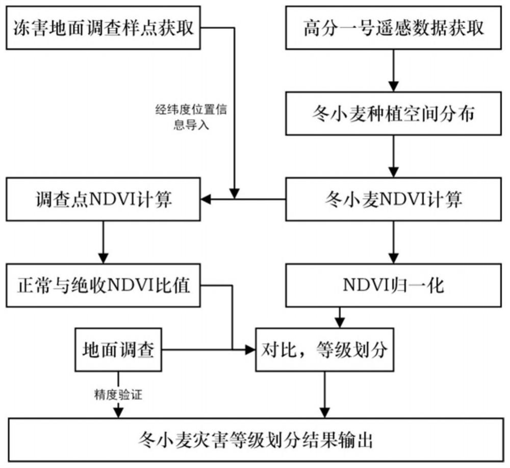
[0039] Such as figure 1 As shown, a winter wheat freezing injury monitoring method based on high-resolution satellite remote sensing data, the steps are as follows:

[0040] Step (1) Acquisition of sampling points for ground investigation: After winter wheat freeze damage occurs, use GPS locators to record the locations of normal growth and dead harvest investigation points, export them and store them in the computer as files.

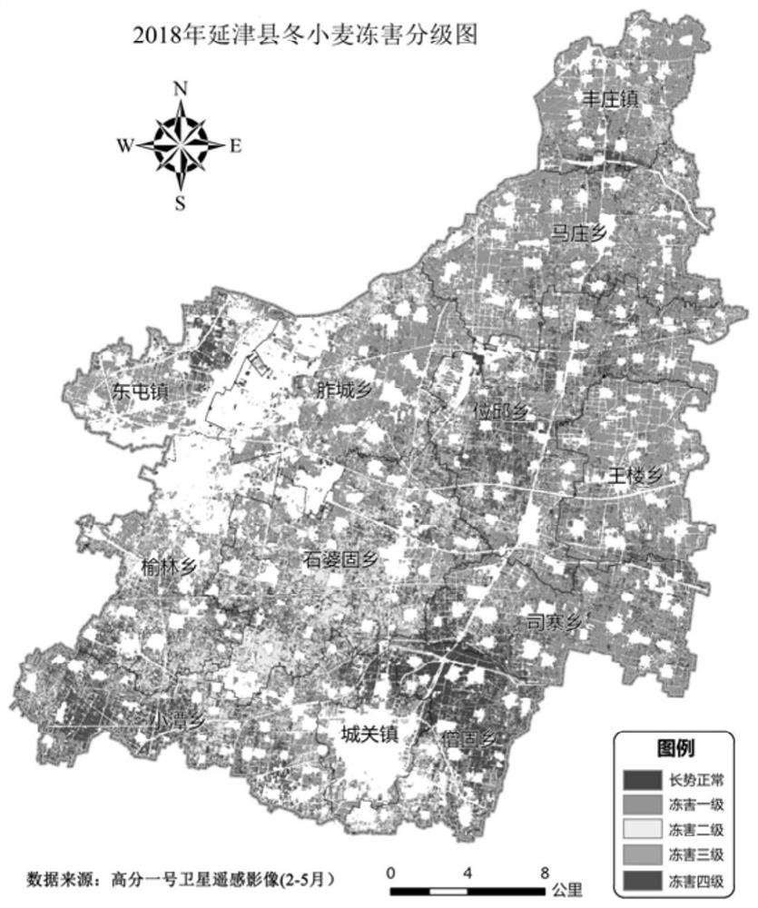
[0041] In early April 2018, win...


PUM


Abstract

The invention proposes a winter wheat freezing injury monitoring method based on high-resolution satellite remote sensing data, which is used to solve the problems of lack of quantitative models and low precision in existing winter wheat freezing injury monitoring. The steps of the present invention are: acquisition of ground survey sample points; acquisition and preprocessing of Gaofen No. 1 satellite remote sensing data; extraction of winter wheat planting space distribution; calculation of the normalized vegetation index layer of the preprocessed Gaofen satellite remote sensing data using bands , superimposed with the spatial distribution results of winter wheat planting; acquisition of winter wheat vegetation index at ground survey points; normalization of NDVI in winter wheat planting area; calculation of NDVI ratio of vegetation index; delineation of disaster level. The present invention amplifies the difference of the vegetation index through the method of ratio, quickly monitors the winter wheat freezing damage, quickly estimates the occurrence and scope of the disaster, combines the ground survey to divide the disaster level, and carries out agricultural insurance for the loss caused by the evaluation disaster. Fast claim settlement is of great significance.

Description

technical field [0001] The invention relates to the technical field of remote sensing monitoring of winter wheat freezing damage, in particular to a monitoring method for winter wheat freezing damage based on high-resolution satellite remote sensing data. Background technique [0002] Freezing injury is one of the more serious and common natural disasters of winter wheat, which has a serious impact on the growth and development of winter wheat, and ultimately affects the yield, thus making the problem of food security more prominent. In recent years, winter wheat frost damage has occurred frequently. In 2018, the severely frozen area of ​​wheat in Henan and Shandong was about 1 million mu. Freezing damage has become one of the important factors restricting the high yield of wheat. However, for a long time, the extent of frost damage has been mainly determined by observing the minimum ground temperature at fixed points, combined with the growth period of winter wheat, to esti...

Claims


Application Information

Patent Timeline
Patent Type & Authority Patents(China)
IPC IPC(8): G06Q50/02G06K9/62
CPCG06Q50/02G06F18/2411
Inventor 郭燕王来刚王利军贺佳刘婷张红利
Owner INST OF AGRI ECONOMICS & INFORMATION HENAN ACADEMY OF AGRI SCI
Learn More