A Method for Recognition and Compensation of Spatio-temporal 3D Noise in Area Array Staring Infrared Remote Sensing Images
A technology of remote sensing image and compensation method, which is applied in the field of remote sensing image processing to achieve the effects of accurate positioning, reducing input errors, and improving accuracy and convenience.
- Summary
- Abstract
- Description
- Claims
- Application Information
AI Technical Summary
Problems solved by technology
Method used
Image
Examples
Embodiment Construction
[0034] The present invention will be described in detail below in conjunction with the accompanying drawings and specific embodiments.
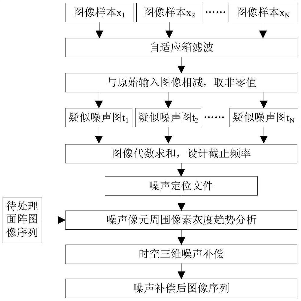
[0035] Such as figure 1 As shown, taking TEL2000 type cooling type area array long-wave infrared camera remote sensing data three-dimensional noise detection and compensation as an example, the specific implementation method of the present invention is as follows:
[0036] (1) Sample selection
[0037] Randomly select different N-format arrays to stare at infrared remote sensing images x i ,(i∈[1,N]), forming a noise analysis image sample set X={x 1 ,x 2 ,...x N};
[0038] In order to ensure the consistency of the sample data, the noise analysis image sample set needs to be the primary high-orbit surface array staring infrared image product that has undergone systematic radiation correction.
[0039] In order to ensure the diversity and universality of the sample data, the noise analysis image sample set needs to select images of differ...
PUM
 Abstract
Description
Claims
Application Information
 - R&D
- Intellectual Property
- Life Sciences
- Materials
- Tech Scout
- Unparalleled Data Quality
- Higher Quality Content
- 60% Fewer Hallucinations
Browse by: Latest US Patents, China's latest patents, Technical Efficacy Thesaurus, Application Domain, Technology Topic, Popular Technical Reports.
© 2025 PatSnap. All rights reserved.Legal|Privacy policy|Modern Slavery Act Transparency Statement|Sitemap|About US| Contact US: help@patsnap.com


