
Spatial network enhanced OSPF routing method based on determined link state

A link state and space network technology, applied in the space network field, can solve problems such as high protocol overhead, achieve the effect of reducing protocol overhead and speeding up routing convergence

Inactive Publication Date: 2018-03-23
BEIJING INST OF SPACECRAFT SYST ENG
View PDF3 Cites 10 Cited by
  • Summary
  • Abstract
  • Description
  • Claims
  • Application Information

AI Technical Summary

Problems solved by technology

However, although the OSPF+ protocol takes advantage of the topology predictability of the space network, it still needs to flood the link state information to the entire network, which still has high protocol overhead and needs to be converged.

Method used


Image

  • Spatial network enhanced OSPF routing method based on determined link state
  • Spatial network enhanced OSPF routing method based on determined link state
  • Spatial network enhanced OSPF routing method based on determined link state

Examples


Embodiment Construction

[0023] The present invention will be described in detail below with reference to the accompanying drawings and examples.

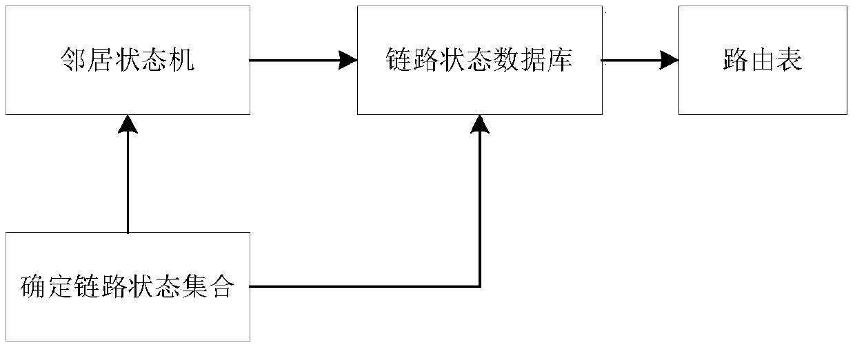
[0024] The invention provides a spatial network enhanced OSPF routing management method based on the determined link state, and the routing protocol divides the space network state into a determined link state change and an uncertain link state change.

[0025] Determining link state changes includes on-off state changes of the visibility of inter-satellite and satellite-ground links and artificially planned link state changes. It is determined that link state changes are generally caused by two factors. One is that the network nodes change from visible to invisible or from invisible to visible due to factors such as occlusion, mainly including the visibility changes of inter-satellite links and satellite links. The visibility of the ground link changes; the second is that due to the limited resources of the inter-satellite star-ground link, it cannot meet...


PUM


Abstract

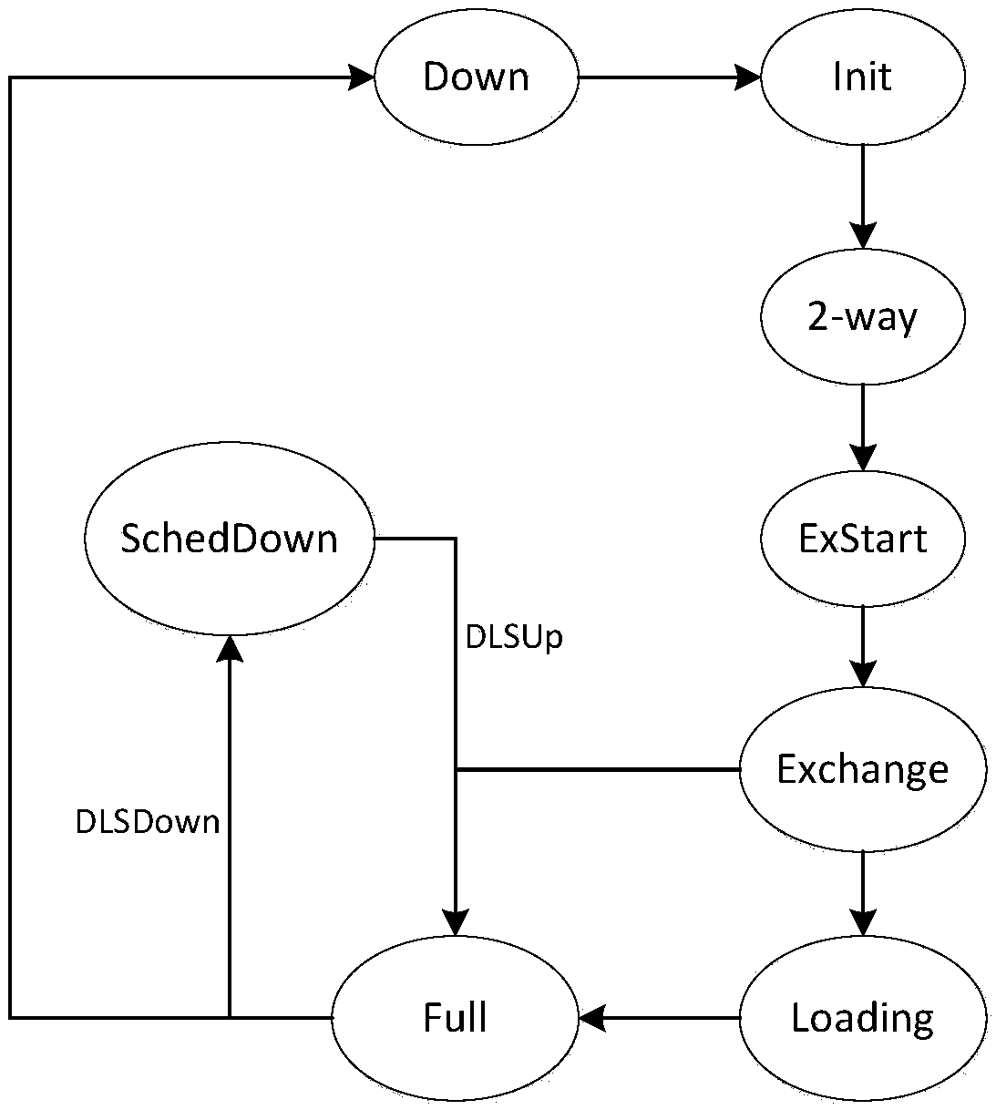
The invention discloses a spatial network enhanced OSPF routing method based on a determined link state. A routing protocol divides a spatial network state into determined link state change and undetermined link state change; the routing protocol produces a new link state notification when the determined link state change occurs, but the link state notification cannot be flooded to the network, and only a link state database and the current state of a neighbor state machine related to the link state change are updated; the original mechanism of the routing protocol is used for managing for theundetermined link state change. The spatial network enhanced OSPF routing method based on the determined link state disclosed by the invention is the low-overhead and high-performance routing protocol applied to the spatial network, the protocol overhead that the ground internet OSPF protocol is applied to the spatial network can be obviously reduced, and the routing convergence rate is accelerated.

Description

technical field [0001] The invention relates to the field of space network technology, in particular to a space network enhanced OSPF routing method based on determining the link state. Background technique [0002] The spatial information network is a network system that uses the space platform as the carrier to acquire, process and transmit spatial information in real time. Space information network can play a major role in major applications such as emergency rescue, navigation and positioning, aerospace measurement and control, and national defense security, and is of great significance to improving the overall effectiveness of my country's satellite system. [0003] The space information network is limited by resources such as orbit and spectrum, and it is difficult to expand the space-time coverage by increasing the number of space nodes and improving node capabilities. Therefore, the spatial information network presents the characteristics of large space-time span, i...

Claims


Application Information

Patent Timeline
IPC IPC(8): H04L12/721H04L12/26
CPCH04L43/0811H04L45/32H04L45/70
Inventor 燕洪成孙勇张亚航王向晖郭坚郑晋军陈忠贵张庆君李林李佼珊何熊文庞波曾连连董芳芳冯承钰
Owner BEIJING INST OF SPACECRAFT SYST ENG
Learn More