
Unmanned aerial vehicle height measuring method based on multilayer information fusion

A technology of unmanned aerial vehicles and time fusion, which is applied in the directions of measuring devices, surveying and navigation, height/horizontal measurement, etc. It can solve problems such as integral drift and height inaccuracy, and achieve high fusion accuracy, simple programming, and guaranteed stability. Effect

Active Publication Date: 2017-06-13
西安汇智大数据科技有限公司
View PDF4 Cites 10 Cited by
  • Summary
  • Abstract
  • Description
  • Claims
  • Application Information

AI Technical Summary

Problems solved by technology

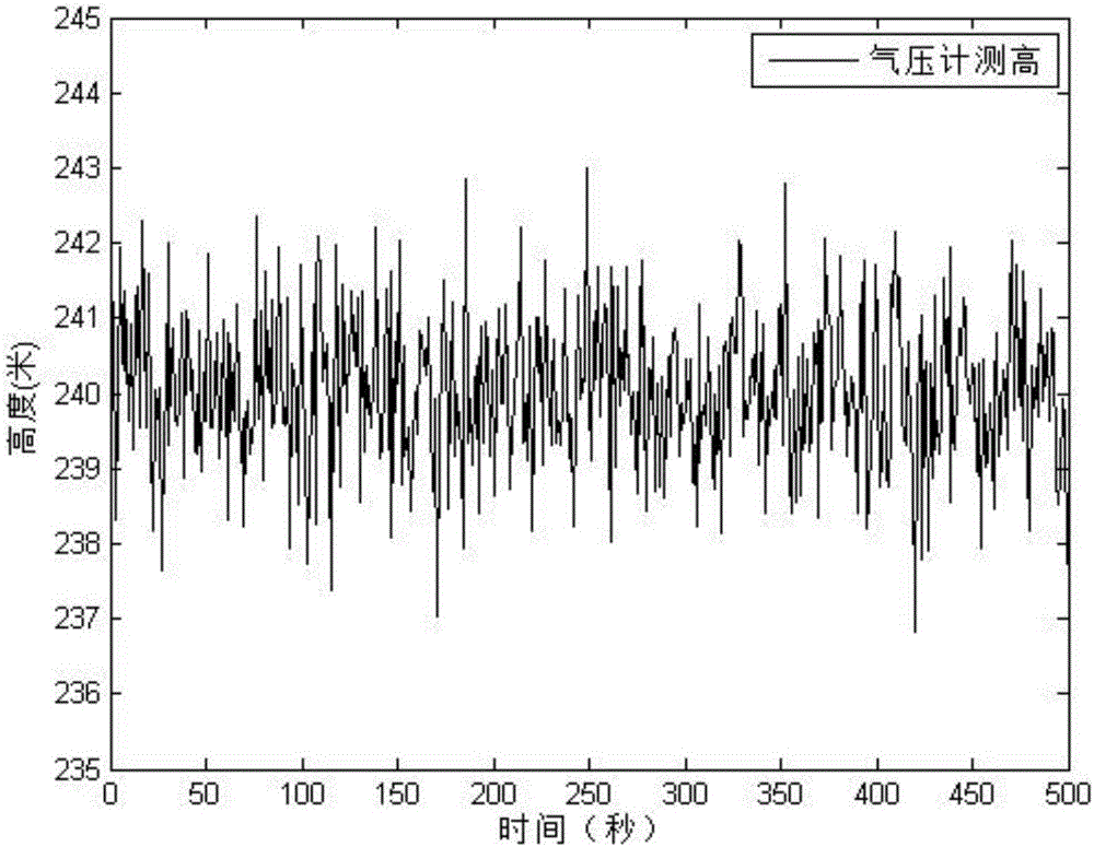
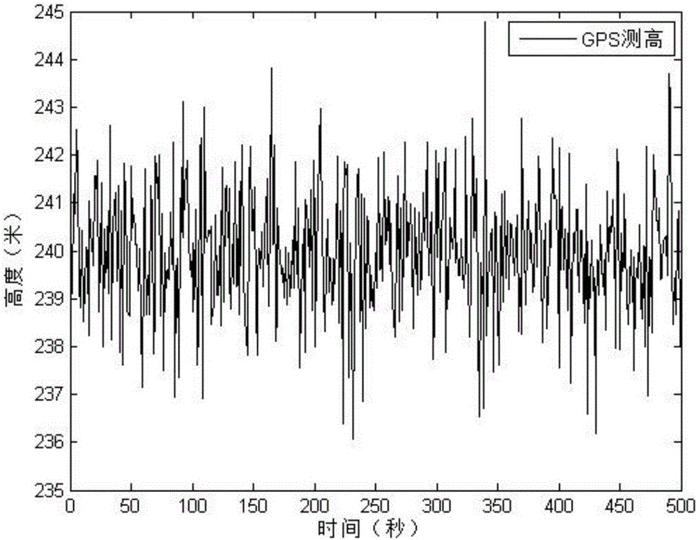
However, the air pressure is affected by atmospheric fluctuations and there will be a lot of noise, so the altitude read by the barometer is inaccurate. GPS is passive positioning. When the GPS system is turned off, the positioning system will malfunction. The accelerometer Double integration is accurate in a short period of time, but over a long period of time, there will be integral drift
Therefore, you cannot rely entirely on a single sensor for height measurement

Method used


Image

  • Unmanned aerial vehicle height measuring method based on multilayer information fusion
  • Unmanned aerial vehicle height measuring method based on multilayer information fusion
  • Unmanned aerial vehicle height measuring method based on multilayer information fusion

Examples


Embodiment Construction

[0063] Below in conjunction with accompanying drawing, the implementation process of the present invention is described in further detail:

[0064] In the process of high-speed data measurement, s heterogeneous height sensors are equipped at different spatial positions of the UAV, and the UAV height observation data obtained by each sensor at different times and spaces are different. There will be s×n observed values ​​when s sensors acquire height values ​​during the working period of n different time points. The first layer of information fusion is divided into two stages. The first stage is to derive the recursive estimation fusion estimation based on the second-step delay time based on the fusion estimation of the one-step delay time. The fusion estimation of height data, through the correction of historical data, eliminates the uncertainty of each sensor obtaining observation data based on time, improves the accuracy and reliability of single-sensor measurement data, and ...


PUM


Abstract

The invention discloses an unmanned aerial vehicle height measuring method based on multilayer information fusion. The method comprises the following steps: installing a plurality of height sensors at different spatial positions of an unmanned aerial vehicle, and acquiring unmanned aerial vehicle height observation data of each height sensor at different times and spaces; performing two-step delay time fusion for an observed value of each height sensor at different moments and estimated values at two moments before the moment, and obtaining a time fusion estimated value of the height sensor at different moments; performing spatial fusion for the time fusion estimated values of each height sensor at the same moment and obtaining a time-spatial fusion estimated value; and finally, performing self-adaptive complementary filter fusion based on parameter identification for the time-spatial fusion estimated value obtained in step 3 and measured data of an accelerometer to obtain a final fusion estimated value. The unmanned aerial vehicle height measuring method is small in calculation quantity, simple in programming and apparent in application value in the field of unmanned aerial vehicle height measurement.

Description

technical field [0001] The invention belongs to the fields of UAV control, signal processing, navigation technology, and artificial intelligence, and specifically relates to a UAV altimetry method based on multi-layer information fusion, including automatic time-space fusion based on two-step delay adaptive time-space fusion and parameter identification. Secondary Fusion Adapted to Complementary Filter Fusion. Background technique [0002] In today's society, UAVs are widely used in military, civilian, scientific research and other fields, especially rotorcraft, which have the characteristics of simple structure and convenient control, and can perform complex tasks in a small space. [0003] At the same time, the rotorcraft is a typical underactuated system, which has the characteristics of multivariable, strong coupling, nonlinear, etc., and involves many disciplines and a wide range of fields. During the flight, the state is complex, and the UAV airborne sensors are subje...

Claims


Application Information

Patent Timeline
Patent Type & Authority Applications(China)
IPC IPC(8): G01C5/00
CPCG01C5/005
Inventor 黄鹤刘一恒靳引利许哲郭璐黄莺王萍雷旭汪贵平杜晶晶盛广峰宋京王亚波袁东亮刘志浩胡宇飞
Owner 西安汇智大数据科技有限公司
Learn More