
Urban traffic-oriented traffic index calculation method

A traffic index and calculation method technology, applied in the field of intelligent transportation, can solve the problems of non-existent application scenarios and high cost

Active Publication Date: 2015-06-17
ENJOYOR COMPANY LIMITED
View PDF5 Cites 28 Cited by
  • Summary
  • Abstract
  • Description
  • Claims
  • Application Information

AI Technical Summary

Problems solved by technology

The patent "Estimation System for Road Section Traffic Index Based on UAV Measurement" provides a road section traffic index estimation system based on UAV measurement. According to the GPS positioning data of key road sections, the UAV is automatically introduced into the key road section area. Cameras and image processors perform image capture and image processing on key road sections, and estimate the traffic index of key road sections through the technical means of vehicle target recognition, but this method has problems such as high cost of implementation, and there is no application scenario yet

Method used


Image

  • Urban traffic-oriented traffic index calculation method
  • Urban traffic-oriented traffic index calculation method
  • Urban traffic-oriented traffic index calculation method

Examples


Embodiment

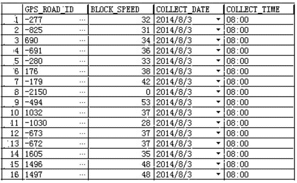
[0059] Embodiment: This embodiment adopts the microwave data and floating car data in Hangzhou during July 2014 to August 2014. The microwave detector outputs the detector number, detection time, flow rate, lane number, speed, etc. within a certain statistical period at the same time in different lanes, and the data sampling interval is 5 minutes; the floating car GPS detector outputs the detector number and road section within a certain statistical period Number, detection time, speed, etc., the data sampling interval is 5 minutes.

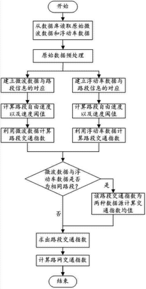
[0060] Such as figure 1 As shown, a traffic index calculation method for urban traffic, the steps are as follows:

[0061] Step 1: Read raw data from the database:

[0062] Connect to the "Hangzhou Road Conditions" database, and use PL / SQL to read microwave data and floating car data at 5-minute intervals from the database.

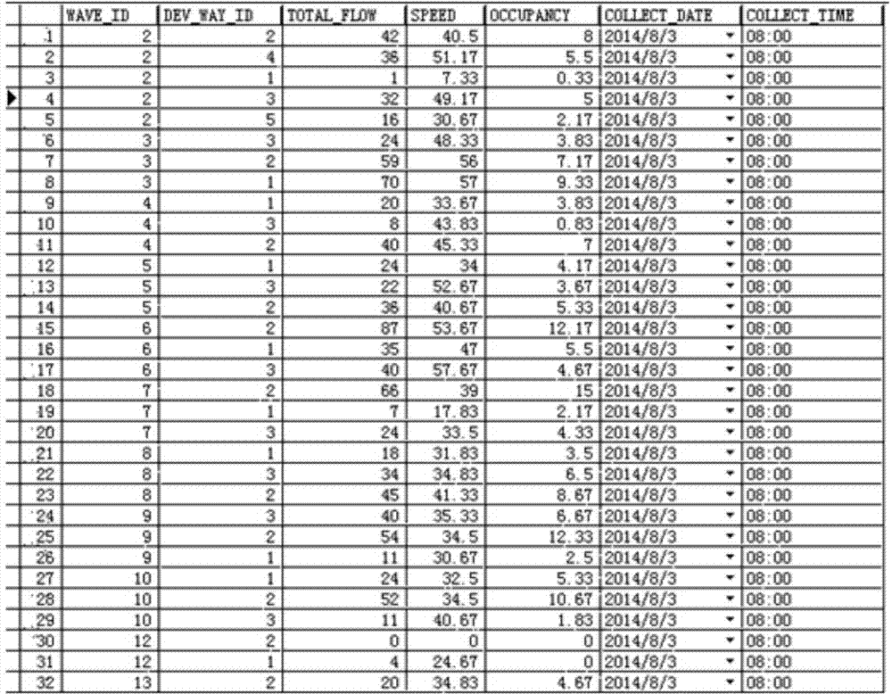
[0063] Raw microwave data such as figure 2 As shown, it has the following field information: WAVE_ID is the microwave...


PUM


Abstract

The invention relates to an urban traffic-oriented traffic index calculation method. The calculation method is defined by flow and a vehicle speed, and is based on commonly used microwave data and floating car data in urban traffic; and historical or real-time traffic indexes of a road network can be determined by adopting methods such as data fusion, statistical modeling and mathematical modeling. The urban traffic-oriented traffic index calculation method has the characteristics of high accuracy of calculation result, high adaptivity, low cost, high feasibility, simplicity and convenience of calculation process, low time complexity and high operation speed.

Description

technical field [0001] The invention relates to the field of intelligent traffic, in particular to a traffic index calculation method for urban traffic. Background technique [0002] With the continuous development of various high-tech technologies such as microelectronics technology, computer technology, digital communication technology, network technology and artificial intelligence, the three traffic situation information provided by traditional traffic service information, namely congestion, slow traffic and smooth traffic, can no longer satisfy traffic managers. and travelers' intuitive perception of the traffic situation. [0003] The traffic index integrates the spatial scope, duration, and severity of traffic congestion, and is a comprehensive indicator for quantitative evaluation of the overall operation of road network traffic. Compared with the traditional vehicle speed, flow and other parameters, it is intuitive and simple. The traffic index allows people not o...

Claims


Application Information

Patent Timeline
IPC IPC(8): G08G1/01G06F19/00
CPCG08G1/0125G16Z99/00
Inventor 赵贝贝李建元张麒李芳陈涛李丹王浩靳明豪吴越
Owner ENJOYOR COMPANY LIMITED
Learn More