Tomography method of using limb sounding data for inverting atmospheric ozone profiles
An inversion and atmospheric technology, applied in the field of atmospheric chemical remote sensing, can solve the problem of low vertical resolution of ozone
- Summary
- Abstract
- Description
- Claims
- Application Information
AI Technical Summary
Problems solved by technology
Method used
Image
Examples
Embodiment Construction
[0034]Below in conjunction with accompanying drawing and example do further detailed description:
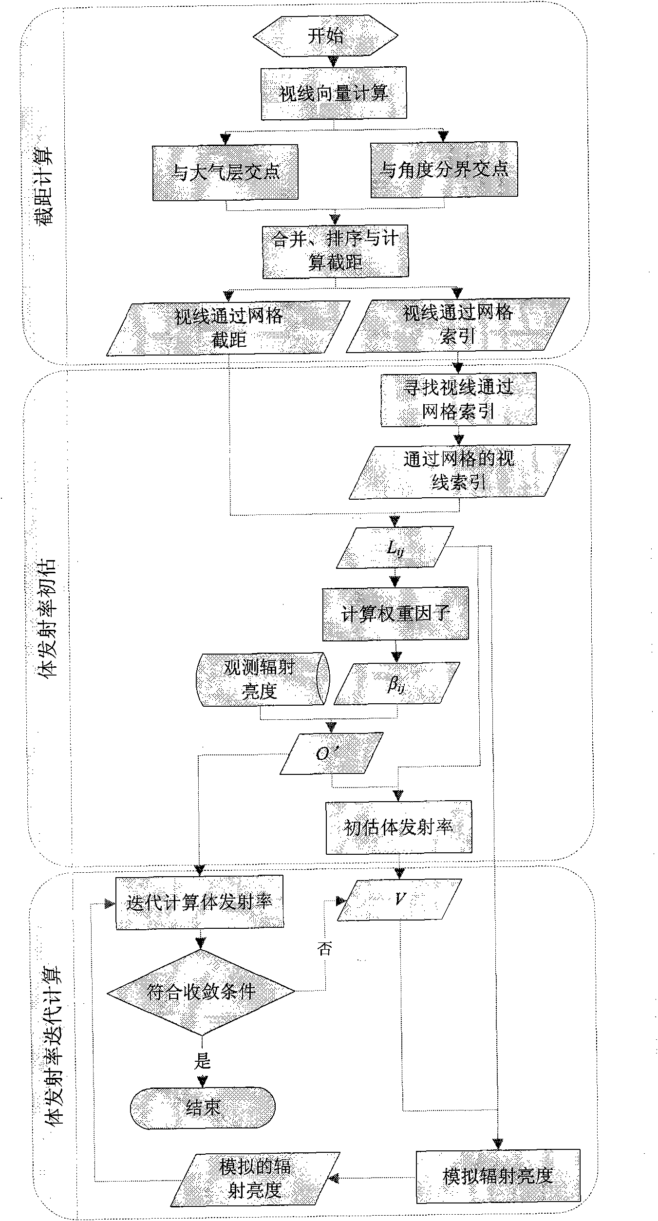
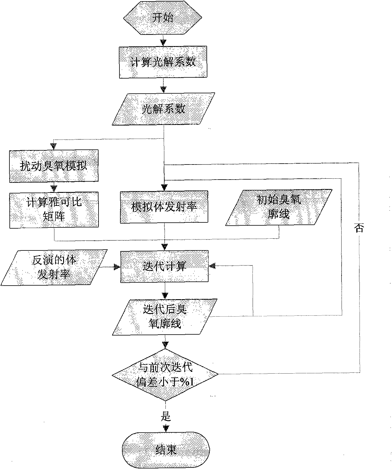
[0035] The tomographic imaging method of using limb remote sensing data to invert the atmospheric ozone profile is to use tomography technology to invert the large gas emissivity from the limb infrared remote sensing data, and then combine the photochemical model to simulate the large gas emissivity, and then use Newton iteration Methods Inversion of atmospheric ozone profile.
[0036] Step 1: Reading and preprocessing of limb remote sensing orbit data
[0037] a) Read satellite orbit data
[0038] Read the satellite orbit radiance data, satellite geographic coordinates and observation time, and read the geographic coordinates, height, and angle data of the tangent point of the radiance corresponding to the observation line of sight.
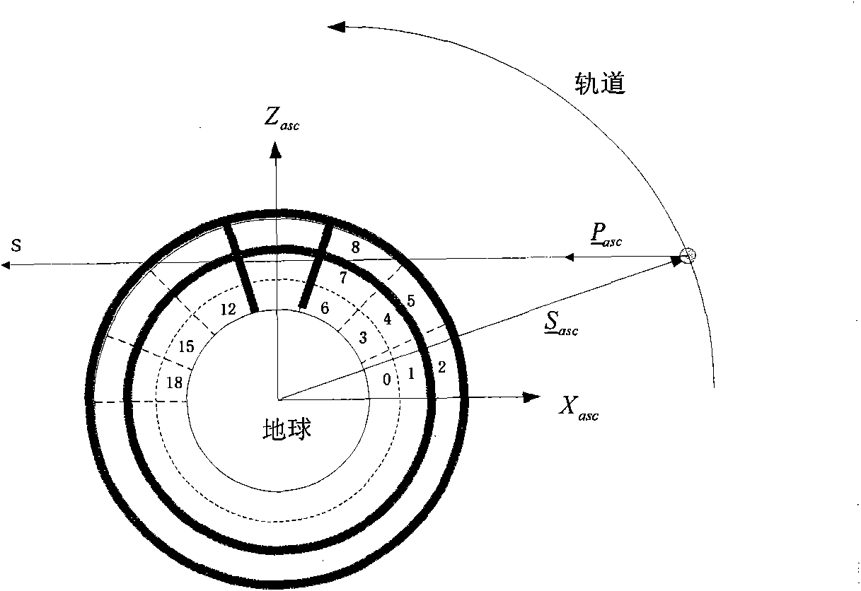
[0039] b) Calculate the Cartesian coordinates of the ascending node of the satellite and the point of tangency
[0040] According to the read ...
PUM
 Abstract
Description
Claims
Application Information
 - R&D
- Intellectual Property
- Life Sciences
- Materials
- Tech Scout
- Unparalleled Data Quality
- Higher Quality Content
- 60% Fewer Hallucinations
Browse by: Latest US Patents, China's latest patents, Technical Efficacy Thesaurus, Application Domain, Technology Topic, Popular Technical Reports.
© 2025 PatSnap. All rights reserved.Legal|Privacy policy|Modern Slavery Act Transparency Statement|Sitemap|About US| Contact US: help@patsnap.com


