
Observation condition number-based method for selecting autonomously located road sign of deep space probe

A deep space detector and autonomous positioning technology, applied in the direction of integrated navigator, etc., can solve the problem that the deep space detector does not have the method of selecting the positioning road sign independently.

Inactive Publication Date: 2010-06-30
BEIJING INSTITUTE OF TECHNOLOGYGY
View PDF0 Cites 13 Cited by
  • Summary
  • Abstract
  • Description
  • Claims
  • Application Information

AI Technical Summary

Problems solved by technology

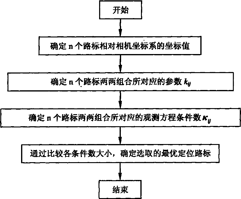
[0007] In order to solve the problem that the current deep space detectors based on landmark navigation do not have an accurate and feasible method for autonomously selecting positioning landmarks, the present invention proposes an autonomous deep space detector for a navigation system that uses dual landmark information to determine the position of deep space detectors. Positioning landmark selection method, this method is mainly based on the condition number of the observation equation to achieve

Method used


Image

  • Observation condition number-based method for selecting autonomously located road sign of deep space probe
  • Observation condition number-based method for selecting autonomously located road sign of deep space probe
  • Observation condition number-based method for selecting autonomously located road sign of deep space probe

Examples


Embodiment Construction

[0033] In order to better illustrate the purpose and advantages of the present invention, the present invention will be further described below by taking a deep-space probe for autonomous navigation using road signs as an example, with reference to the accompanying drawings and specific implementation methods.

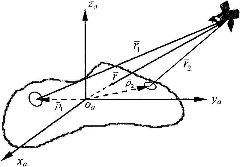
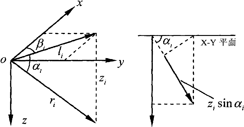
[0034]When the deep space probe is near the target celestial body, it uses an optical camera to take images of the surface of the target celestial body, extracts landmarks with obvious terrain features such as rocks and craters, and uses them as reference points for the autonomous navigation of the deep space probe. In the case that the attitude of the deep-space probe relative to the target celestial body is known, the position of the deep-space probe relative to the target celestial body can be determined by using the information of two landmark points. Airborne calculation time, two navigation landmarks are used in the navigation algorithm to carry out the autonomous...


PUM


Abstract

The invention relates to an observation condition number-based method for selecting an autonomously located road sign of a deep space probe, which is particularly applicable to an autonomously location determining system for a dual-road-sign detector, belonging to the field of autonomous navigation. By calculating and comparing the number of observation matrix conditions, the method can construct the position of the detector in a target celestial fixedly connected coordinate system by selecting two road signs, ensures the precision of determining the detector position can be greatly improved, and provides an accurate and practical located road sign autonomously selecting method for the deep space probe in low-earth orbit flight. The method not only considers the impact of the road sign position to navigation precision, but also has the characteristics of small calculation, practical analysis and the like.

Description

technical field [0001] The invention relates to a method for selecting landmarks for autonomous positioning of deep-space detectors based on observation condition numbers, which is particularly suitable for a detector autonomous location determination system with two landmarks, and belongs to the field of autonomous navigation. Background technique [0002] The near-target celestial body flight stage is the core stage of deep space exploration missions, and the main scientific investigation tasks will be completed in this stage. Therefore, high detector orbit determination accuracy is required to facilitate the collection and processing of scientific observation data. Due to the uncertainty of dynamic parameters such as the spin state of the target celestial body, the gravitational field model, and the existence of unmodeled interference forces, the navigation method adopted by the detector must have strong robustness. At the same time, deep space target celestial bodies are...

Claims


Application Information

Patent Timeline
IPC IPC(8): G01C21/24
Inventor 崔平远朱圣英徐瑞乔栋尚海滨
Owner BEIJING INSTITUTE OF TECHNOLOGYGY
Learn More