Establishing quality parameters of a digital map
a technology of quality parameters and digital maps, applied in the direction of navigation instruments, instruments, process and machine control, etc., can solve the problems of relative and absolute geometric errors during the data collection process, and errors are possible due to changes in road sections
- Summary
- Abstract
- Description
- Claims
- Application Information
AI Technical Summary
Benefits of technology
Problems solved by technology
Method used
Image
Examples
Embodiment Construction
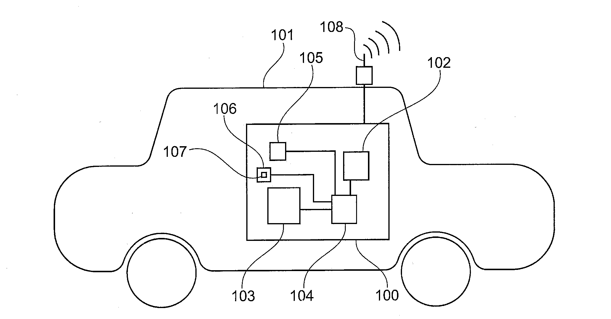
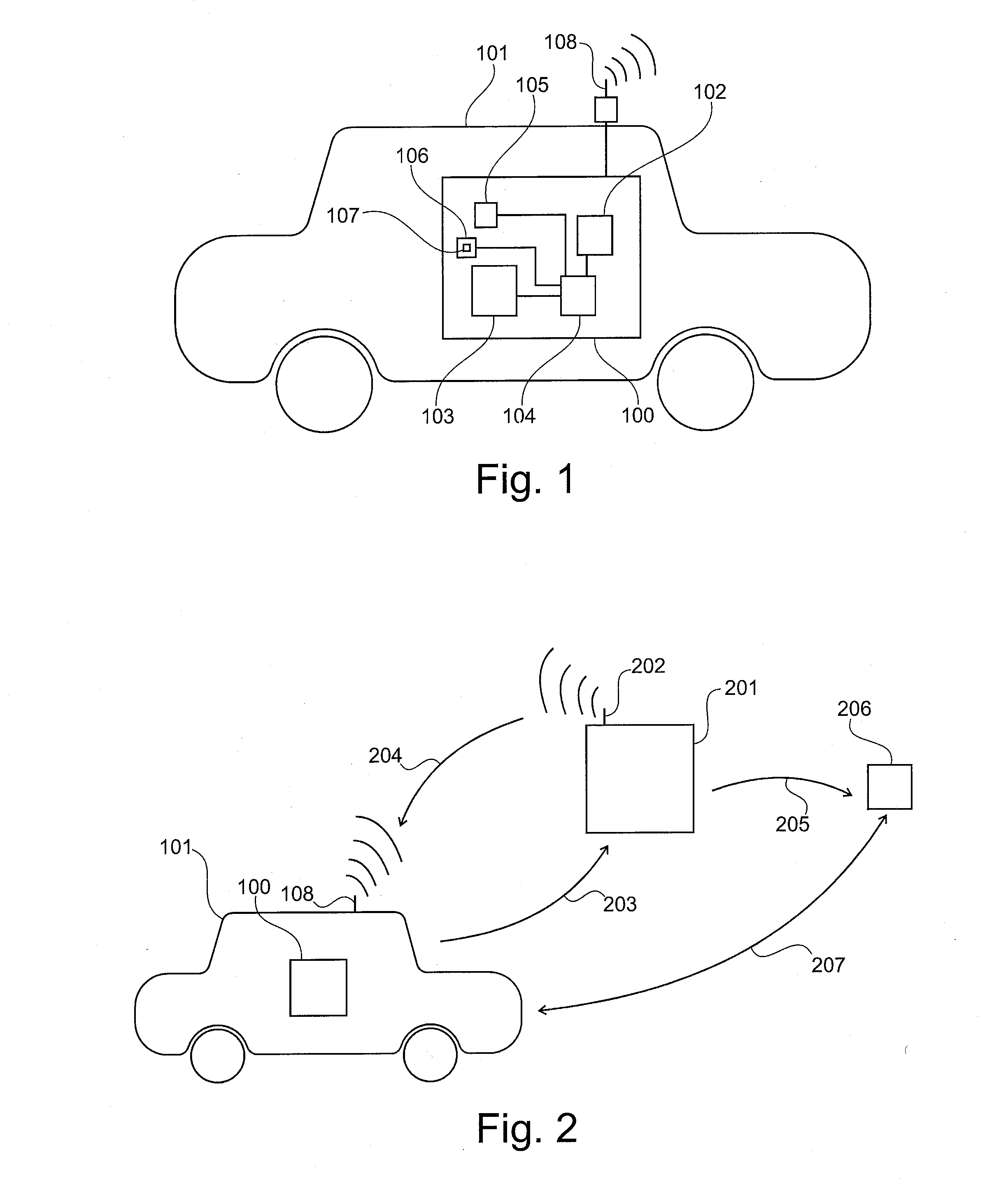
[0061]FIG. 1 shows a vehicle 101 having a device 100 for establishing quality parameters for a driver assistance system 105. The device 100 has here, in addition to the driver assistance system, a position-determining unit 102 which can be embodied, for example, as a GPS receiver. The measuring unit 103 can be embodied by means of a wide variety of sensors or detectors. For example, a speedometer, a spring travel sensor, an ESP sensor, an optical detector, a beam sensor, a direction sensor, a distance sensor or a steering wheel rotational angle sensor may constitute the measuring unit 103. Each communication between the individual elements in the vehicle can take place in a wireless or, if desired, wire-bound fashion. Furthermore, a computing unit 104 is present in the device 100. In this context, the computing unit is designed to extract a stored value from a digital map 107, wherein the digital map can be stored, for example, in a storage unit 106. The position-determining unit is...
PUM
 Abstract
Description
Claims
Application Information
 - R&D
- Intellectual Property
- Life Sciences
- Materials
- Tech Scout
- Unparalleled Data Quality
- Higher Quality Content
- 60% Fewer Hallucinations
Browse by: Latest US Patents, China's latest patents, Technical Efficacy Thesaurus, Application Domain, Technology Topic, Popular Technical Reports.
© 2025 PatSnap. All rights reserved.Legal|Privacy policy|Modern Slavery Act Transparency Statement|Sitemap|About US| Contact US: help@patsnap.com


