Digital identification method of urban and rural settlement system and medium

An identification method and settlement technology, applied in data processing applications, complex mathematical operations, predictions, etc., can solve the problems of consuming manpower and material resources, lack of scientifically effective, quantitative, and systematic identification rules, and cannot be used as effective references to avoid a large number of The cost of manpower and material resources, the effect of improving scientificity and improving accuracy

Pending Publication Date: 2022-04-26
SOUTHEAST UNIV
View PDF0 Cites 0 Cited by
  • Summary
  • Abstract
  • Description
  • Claims
  • Application Information

AI Technical Summary

Problems solved by technology

[0003] The current identification methods of urban and rural settlement systems mainly have the following two problems: on the one hand, when identifying urban and rural settlement systems, it takes a planning team of 10 people half a month to complete the field research, which consumes a lot of manpower and material resources. In urban system planning, only one map is used to express, and rely on the subjective judgment of planners, lacking scientific and effective measurement standards
On the other hand, the existing system identification methods mostly use administrative divisions or population size as a single factor to identify urban and rural settlement systems, and lack scientific, effective, quantitative, and systematic identification rules.
Therefore, this kind of urban-rural settlement system identification method cannot accurately divide the internal hierarchical structure of urban-rural settlements, cannot provide a scientific and effective identification method to determine the urban-rural settlement system, and cannot be used as an effective reference for planning practitioners in urban system planning policies

Method used


Image

  • Digital identification method of urban and rural settlement system and medium
  • Digital identification method of urban and rural settlement system and medium
  • Digital identification method of urban and rural settlement system and medium

Examples


Embodiment Construction

[0070] The technical methods in the embodiments of the present invention will be clearly and completely described below in conjunction with the accompanying drawings in the embodiments of the present invention. Apparently, the described embodiments are only some, not all, embodiments of the present invention. Based on the embodiments of the present invention, all other embodiments obtained by persons of ordinary skill in the art without creative efforts fall within the protection scope of the present invention.

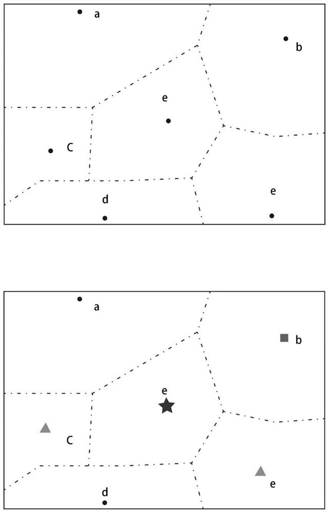
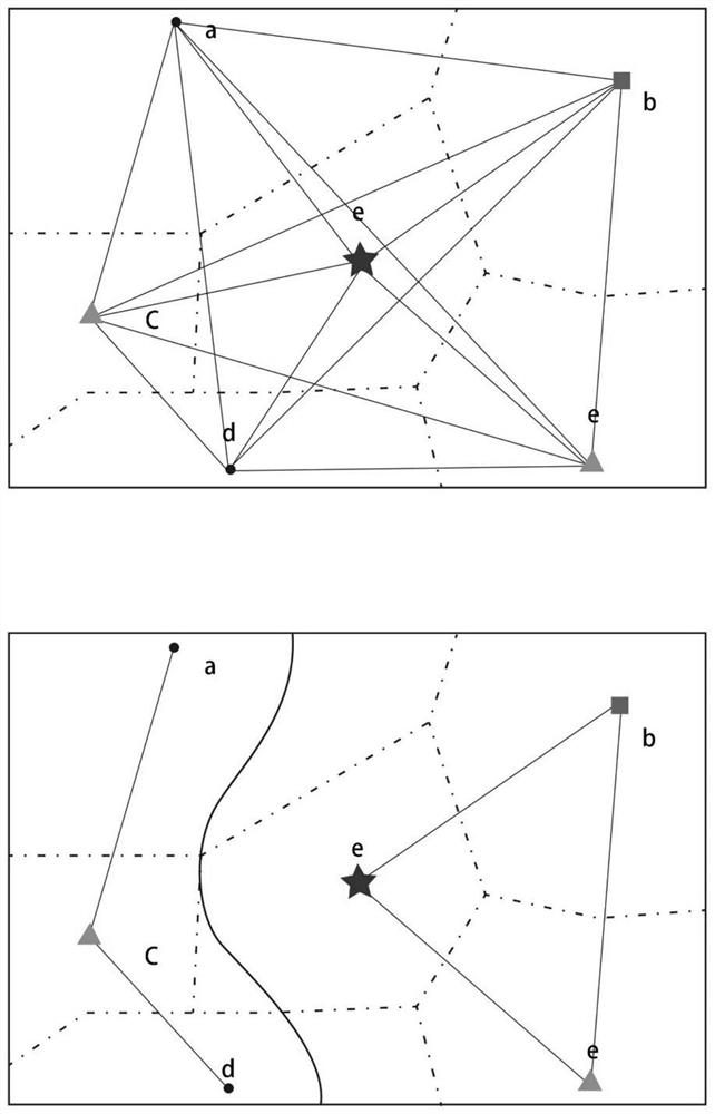
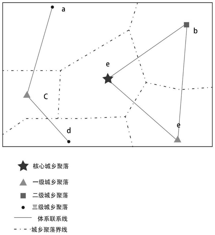
[0071] The invention discloses a digital identification method and medium for urban and rural settlement systems. The digital identification method includes urban and rural settlement information input and space sand table construction, urban and rural settlement system node identification, urban and rural settlement system connection line identification, and urban and rural settlement system identification result output and interactive display.

[0072] The technical ...


PUM


Abstract

The invention discloses a digital identification method of an urban and rural settlement system and a medium. The digital identification method comprises the following steps: inputting urban and rural settlement information and constructing a space sand table; identifying urban and rural settlement system nodes through the urban and rural settlement energy values; potential connection lines are screened through urban and rural settlement external influence range division, and then urban and rural settlement system connection lines are identified; outputting an urban and rural settlement system identification result, and performing interactive display; the medium comprises the urban and rural settlement system which is digitally identified by adopting the method. According to the method, the urban and rural settlement can be graded scientifically and effectively based on the urban and rural settlement energy value, the urban and rural settlement system under the digital identification method is obtained by quantitatively screening the connection lines between the urban and rural settlement, and a systematic and efficient path method is provided for constructing the urban system space structure current situation graph for urban system planning.

Description

technical field [0001] The invention belongs to the planning field of urban and rural settlement systems, and relates to a digital identification method and medium for urban and rural settlement systems. Background technique [0002] In the context of the reform of national land and space planning, policies issued at the national level emphasize that spatial planning needs to achieve regional coordination, classification and grading, and collaborative governance. resource allocation. Emphasize the integrated development of urban and rural areas, promote the flow of urban and rural elements, comprehensively consider the distribution of villages, optimize the allocation of various resources in towns and villages, and realize the coordinated development of urban and rural space, population, and economic and industrial regions. The "Urban Planning Compilation Measures" promulgated by the Ministry of Construction requires that the structure and layout of the city (county) urban ...

Claims


Application Information

Patent Timeline
Patent Type & Authority Applications(China)
IPC IPC(8): G06Q10/04G06Q10/06G06Q50/26G06F17/11
CPCG06Q10/047G06Q10/06393G06Q50/26G06F17/11
Inventor 史宜杨俊宴郑坤仪慕容卓一陈代俊张方圆史北祥
Owner SOUTHEAST UNIV
Why Eureka
Try Eureka