Satellite signal positioning and error correction method and system, positioning terminal and program
A satellite signal and error correction technology, applied in the field of communication, can solve problems such as failure of normal communication and degradation of communication quality
- Summary
- Abstract
- Description
- Claims
- Application Information
AI Technical Summary
Problems solved by technology
Method used
Image
Examples
Embodiment 1
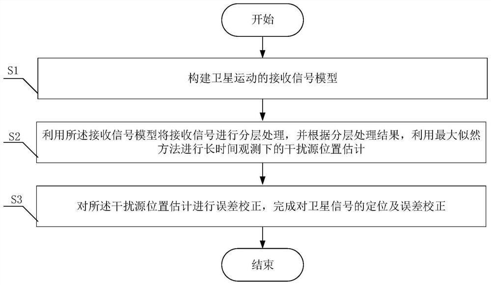
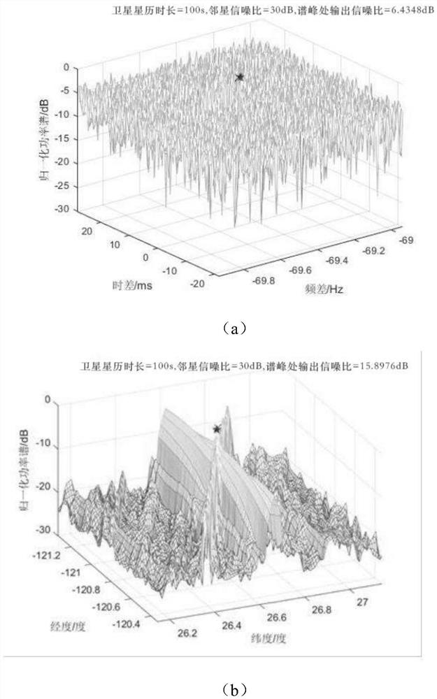
[0072] The traditional positioning method includes two steps: firstly, the time difference of arrival (TDOA) and frequency difference of arrival (FDOA) and other measurement parameters are estimated by using algorithms such as the mutual ambiguity function method, and then these measurement parameters are used Locate the source of interference. In the satellite interference source positioning scenario, due to the low side lobes of the transmitting antenna of the interference source, the signal-to-noise ratio of the received signal of the adjacent satellite near the main star is very low. At this time, it is difficult to accurately estimate TDOA and FDOA directly using algorithms such as the mutual ambiguity function method. In order to obtain a higher processing gain for the weak signal of the adjacent star, the signal processing time can be increased to increase the processing gain when the bandwidth of the signal transmitted by the interference source is fixed. A problem th...
Embodiment 2
[0184] Such as Figure 5 As shown, the embodiment of the present invention provides a satellite signal positioning and error correction system, including: a model building module for building a received signal model of satellite motion;
[0185] In the embodiment of the present invention, the expression of the received signal model is as the formula (15) in Embodiment 1.
[0186] The location estimation module is used to use the received signal model to perform layered processing on the received signal, and according to the layered processing result, and use the maximum likelihood method to estimate the location of the interference source under long-term observation;
[0187] In the embodiment of the present invention, the maximum likelihood method is used to estimate the location of the interference source under long-term observation, and the received signal is segmented into two layers, wherein the segmented signal of the first layer adopts non-coherent processing, and the s...
Embodiment 3
[0192] The present invention provides a positioning terminal, including:
[0193] one or more processors;
[0194] storage means for storing one or more programs;
[0195] When the one or more programs are executed by the one or more processors, the one or more processors implement the described positioning and error correction method.
[0196] In the embodiments of the present invention, the positioning terminal may be implemented by software and / or hardware, and the positioning terminal may execute any method in Embodiment 1, and / or execute any block diagram in Embodiment 2, the positioning The terminal is used in the scenario of satellite interference source positioning.
[0197] The present invention provides a computer-readable storage medium, which stores a computer program, and the computer program is executed by a processor to implement the positioning and error correction method.
[0198] In an embodiment of the present invention, a computer-readable storage medium...
PUM
 Abstract
Description
Claims
Application Information
 - R&D
- Intellectual Property
- Life Sciences
- Materials
- Tech Scout
- Unparalleled Data Quality
- Higher Quality Content
- 60% Fewer Hallucinations
Browse by: Latest US Patents, China's latest patents, Technical Efficacy Thesaurus, Application Domain, Technology Topic, Popular Technical Reports.
© 2025 PatSnap. All rights reserved.Legal|Privacy policy|Modern Slavery Act Transparency Statement|Sitemap|About US| Contact US: help@patsnap.com


