
Indoor three-dimensional point cloud automatic registration method for pole extraction

A 3D point cloud and pole technology, which is applied to the details of 3D image data, image data processing, instruments, etc., can solve the problems of spending a lot of time, result influence, lack of texture information, etc., to increase the amount of calculation and calculation time, The effect of satisfying reliability and accuracy, and simple parameter setting

Pending Publication Date: 2021-06-29
王程
View PDF0 Cites 13 Cited by
  • Summary
  • Abstract
  • Description
  • Claims
  • Application Information

AI Technical Summary

Problems solved by technology

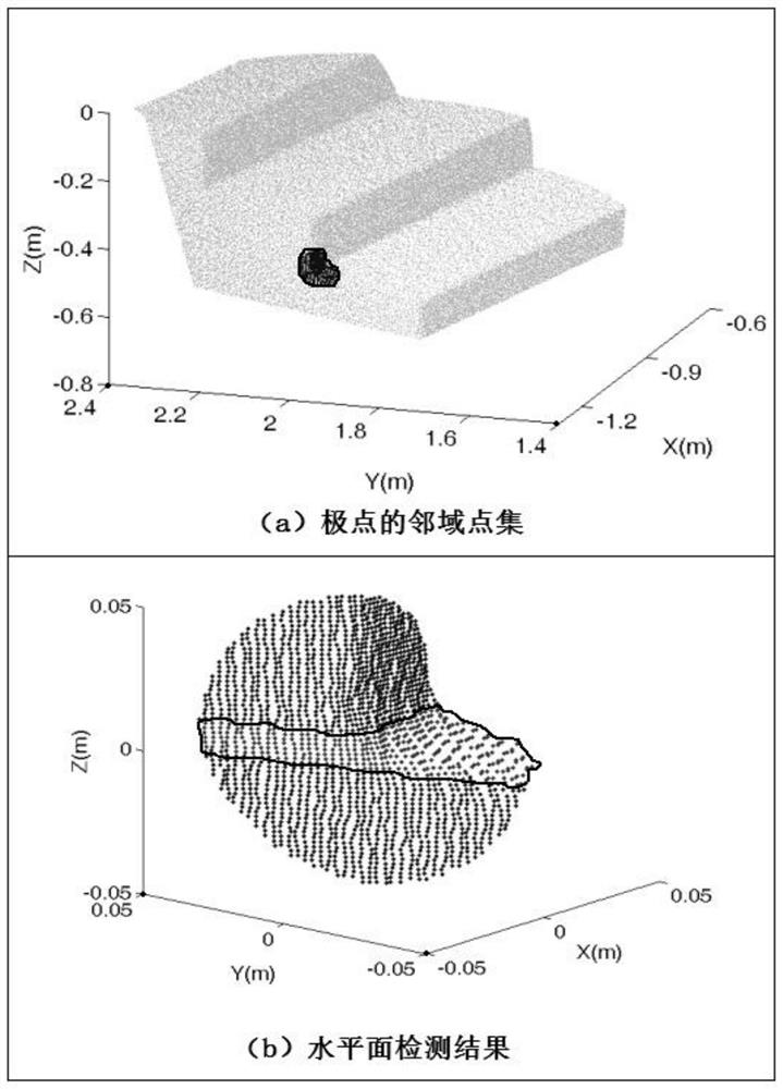
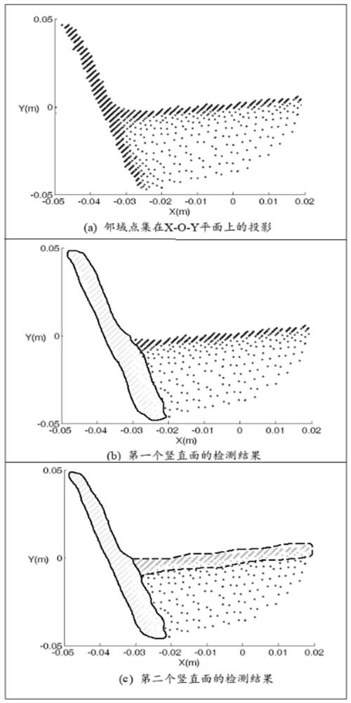
[0007] First, limited by the visibility conditions of the indoor environment, some feature surfaces or feature lines of the ground laser point cloud have not been completely scanned, and the incomplete scanning has brought great difficulties to the extraction of feature surfaces or feature lines. In indoor scenes, there are Many stable poles exist on building interior components, including steps, columns, and wall footings. A large number of ground laser point cloud data only have three-dimensional information of scanned points, but lack texture information. The poles can reflect the characteristics of the interior structure of the building. The poles reflecting the interior structure are used for 3D point cloud registration. There are widely horizontal and vertical planes in the interior structure of the building. Many poles are obtained by the intersection of these planes. However, the existing technology There is a lack of effective use of this feature, and it is impossible to avoid the network construction and normal direction estimation of point cloud data, and it is impossible to solve the automatic registration of multi-station ground laser scanning point cloud data in architectural indoor scenes;
[0008] Second, when extracting feature points, feature lines, and feature surfaces during point cloud data processing, the method of constructing an irregular triangulation network or estimating the normal direction and curvature of each scanning point position is used, but only a single-station ground laser There are tens of millions of scanning points in the scanning data. It is necessary to traverse the entire point cloud data multiple times to construct a network or estimate the normal direction, which will seriously affect the data processing efficiency. Another method in the existing technology is to follow a certain interval or a certain ratio Thinning point cloud data reduces the amount of calculation and improves point cloud processing efficiency. Although this method can improve the efficiency of algorithm operation, thinning point cloud data will reduce the accuracy of point cloud registration. In point cloud In the registration process, only the thinned point cloud data cannot be used;
Due to the large number of poles extracted from each point cloud data, if the Euclidean distance invariant is directly used for matching, it will take a lot of time to traverse all possible matching combinations without providing an initial value;
[0010] Fourth, the pole matching result records all matching possibilities of each pole, which contains a large number of wrong pole matching results. If the initial value of the error observation equation solution is calculated directly using the three-dimensional coordinates of any two pairs of matching poles, the wrong pole matching It will make the initial value inaccurate, and the matching result of the extreme point is used as the observation value, and the wrong matching result will have a great impact on the result
[0012] Sixth, the point cloud registration method process in the prior art does not calculate the registration parameters for the point cloud data, and compared with the results calculated by manually selecting targets, the accuracy and reliability are low. The reliability and accuracy of the technical point cloud automatic registration method cannot meet the work requirements, and it requires manual layout of targets, complex parameter setting, low degree of automation, and low registration efficiency

Method used


Image

  • Indoor three-dimensional point cloud automatic registration method for pole extraction
  • Indoor three-dimensional point cloud automatic registration method for pole extraction
  • Indoor three-dimensional point cloud automatic registration method for pole extraction

Examples


Embodiment Construction

[0076] The technical scheme of the indoor three-dimensional point cloud automatic registration method for extracting extreme points provided by the present invention will be further described below in conjunction with the accompanying drawings, so that those skilled in the art can better understand the present invention and implement it.

[0077]Restricted by the indoor environment visibility conditions, some feature surfaces or feature lines of the ground laser point cloud have not been completely scanned, and the incomplete scanning has brought great difficulties to the extraction of feature surfaces or feature lines. In indoor scenes, there are many stable poles on the interior components of buildings, including steps, columns, and footings. A large number of ground laser point cloud data only have three-dimensional information of scanned points, but lack texture information. The ubiquitous poles in the building can reflect the characteristics of the interior structure of th...


PUM


Abstract

According to an indoor three-dimensional point cloud automatic registration method for pole extraction, on the premise of avoiding network construction and normal direction estimation of point cloud data, automatic registration of multi-station ground laser scanning point cloud data in an indoor scene of a building is achieved, and the method mainly comprises two parts of pole extraction and point cloud registration. The method is analyzed and verified by using real indoor point cloud data of a building, registration parameter calculation is performed on multiple groups of point cloud data, a registration result is compared with a result calculated through a manual target selection mode, and the precision and reliability of the method are further verified. According to the point cloud automatic registration method based on pole extraction provided by the invention, the reliability and the precision meet the working requirements, the target does not need to be manually arranged, the parameter setting is simple, and the automation degree is high.

Description

technical field [0001] The invention relates to an indoor three-dimensional point cloud automatic registration method, in particular to an indoor three-dimensional point cloud automatic registration method for extracting extreme points, and belongs to the technical field of point cloud automatic registration. Background technique [0002] Architectural indoor surveying and mapping is to measure and collect the size, shape, spatial position and attributes of various elements in the internal environment of the building. Architectural indoor surveying and mapping plays an important role in building construction, indoor navigation, and historical building protection. Terrestrial laser scanning is an effective means to obtain three-dimensional information of ground objects using lidar ranging technology, and it is being developed and applied more and more in the field of architectural surveying and mapping. In the process of processing building indoor point cloud data, steps such...

Claims


Application Information

Patent Timeline
Patent Type & Authority Applications(China)
IPC IPC(8): G06T7/33G06K9/46G06T17/10G06T19/00
CPCG06T7/33G06T17/10G06T19/00G06T2200/04G06T2207/10028G06T2210/04G06V10/44
Inventor 王程何克慧
Owner 王程
Learn More