Vehicle emergency navigation method with space-time characteristic situation information

A navigation method and vehicle technology, applied in directions such as navigation, mapping and navigation, road network navigator, etc., can solve problems affecting navigation decision-making, emergency navigation performance impact, traffic accidents, etc.

Active Publication Date: 2021-05-14
BEIJING UNIV OF TECH
View PDF6 Cites 4 Cited by
  • Summary
  • Abstract
  • Description
  • Claims
  • Application Information

AI Technical Summary

Problems solved by technology

These situational data with spatio-temporal characteristics and serious impact on the road network, as well as the changing urban road network environment, bring opportunities and challenges to the development of vehicle emergency navigation
When the road weight and structural topology information in the situational traffic road network change, the road network cannot enter a stable state for a period of time. At present, most navigation methods cannot provide timely guidance for drivers in the time-varying situational road network environment. Effective decision-making, when planning emergency routes for vehicles, the number of vehicles on a certain route will increase rapidly in a short period of time, which will induce various secondary traffic jams and traffic accidents
In addition, due to the continuous change of road weight due to the dynamically changing road network environment, and the insufficient utilization of the situational data of road network changes, the conventional path planning method cannot converge to a global optimal solution, which affects the decision-making after navigation. The performance of emergency navigation is severely affected

Method used


Image

  • Vehicle emergency navigation method with space-time characteristic situation information
  • Vehicle emergency navigation method with space-time characteristic situation information
  • Vehicle emergency navigation method with space-time characteristic situation information

Examples


Embodiment Construction

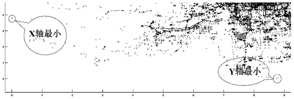
[0045] This patent is developed and tested by Java language, crawling Tencent map to obtain the historical speed data of the road network, the road network data comes from OSM, through the experiment, the effective grid of the road network and the prediction of the speed of the road network are realized, and the sudden occurrence of the city is simulated. The road network data at the time of the incident was compared with other path planning algorithms to verify the effectiveness of the architecture. A total of four groups were set up in the experiment. Experiment 1 verified the effectiveness of the road network prediction model GLN; Experiment 2 calculated the grid evacuation ability through the DGPR algorithm; Experiment 3 verified BSHP by comparing it with other path planning methods in a changing road network environment. high efficiency; Experiment 4 verifies the effectiveness of the present invention through simulation.

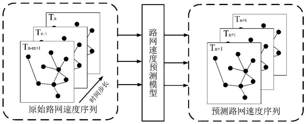
[0046] This patent first converts the coordinate ...


PUM


Abstract

The invention discloses a vehicle emergency navigation method with space-time characteristic situation information, and the overall architecture of the vehicle emergency navigation is composed of three parts: a vehicle evacuation area recommendation layer, a road network data index layer and a vehicle path planning layer from bottom to top. A simplification effect is achieved while the structural integrity of the road network is ensured, so that rapid updating of situation information is improved, and a rapid mapping mechanism of a path is realized; and finally, in a vehicle path planning layer, a heuristic dynamic path planning algorithm is provided for urban emergencies by combining the processing results of the road network in the previous two layers, and vehicle emergency path planning is realized through recommended evacuation areas and analysis of situation information of roads. According to the invention, the vehicle can drive from the emergency area to the safe area in the shortest time, a good vehicle evacuation effect is achieved, and a route planned by emergency navigation of the vehicle is more accurate and reliable.

Description

technical field [0001] The invention belongs to the field of urban vehicle emergency navigation, and relates to road network speed data prediction, road network situation information layered update, and a vehicle emergency path planning method based on the situation road network. Background technique [0002] With the continuous advancement of urbanization in our country, the urban traffic network has become more complex, the entire urban traffic network has been heavily loaded, and the problems of urban traffic congestion and unreasonable allocation of traffic resources are prominent. When emergencies occur in cities, vehicle congestion becomes more severe over time. Especially in the real traffic network, the state of the road network is affected by many factors and has complex and changeable characteristics, such as traffic flow, weather conditions, emergencies and traffic control, etc. will all affect the state of the traffic network It has an impact and leads to drasti...

Claims


Application Information

Patent Timeline
IPC IPC(8): G01C21/34
CPCG01C21/343Y02T10/40
Inventor 袁磊迟远英丁治明杨博文刘遵豪常盟盟侯治刚
Owner BEIJING UNIV OF TECH
Why Eureka
Try Eureka