
Urban flight route planning system and method for unmanned aerial vehicle based on Cell-ID

A flight route and planning system technology, which is applied in control/adjustment system, three-dimensional position/course control, vehicle position/route/height control, etc., can solve the problem of unstable and not very stable flight of drones in cities, and achieve Reliable and stable flight, the effect of solving safety problems

Pending Publication Date: 2020-10-02
萧县航迅信息技术有限公司
View PDF8 Cites 0 Cited by
  • Summary
  • Abstract
  • Description
  • Claims
  • Application Information

AI Technical Summary

Problems solved by technology

Through the actual test, the base station signal also has signal coverage in low-altitude areas, but it is not very stable due to mirror reflection and wireless signal multipath effects.
[0003] This has caused a lot of trouble for drones flying in cities, making drones flying in cities very unstable, and it is urgent to solve this problem

Method used


Image

  • Urban flight route planning system and method for unmanned aerial vehicle based on Cell-ID
  • Urban flight route planning system and method for unmanned aerial vehicle based on Cell-ID
  • Urban flight route planning system and method for unmanned aerial vehicle based on Cell-ID

Examples


Embodiment Construction

[0033] The application will be further described below in conjunction with the accompanying drawings. The following examples are only used to illustrate the technical solutions of the present invention more clearly, but not to limit the protection scope of the present application.

[0034] A UAV urban flight route planning system based on Cell-ID: including: 360-degree narrow-wave antenna, UAV and multiple communication base stations;

[0035] The 360-degree narrow-wave antenna is installed under the drone, and there is data interactive transmission between the drone and the plurality of communication base stations;

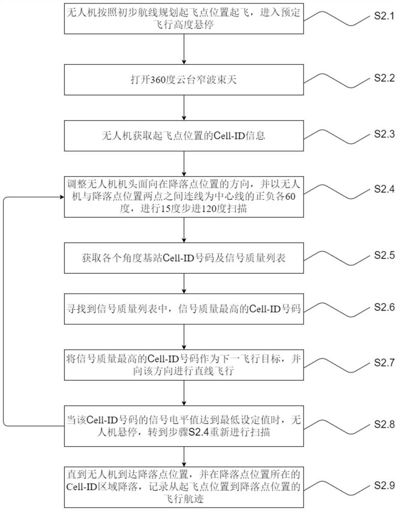
[0036] The 360-degree narrow-wave antenna is used for direction finding of wireless signals. Through data interaction with the communication base station at the location, the Cell-ID number with the best communication quality at a certain latitude and longitude is obtained, and the latest cell-ID number at the next location is obtained through statistics. Strong...


PUM


Abstract

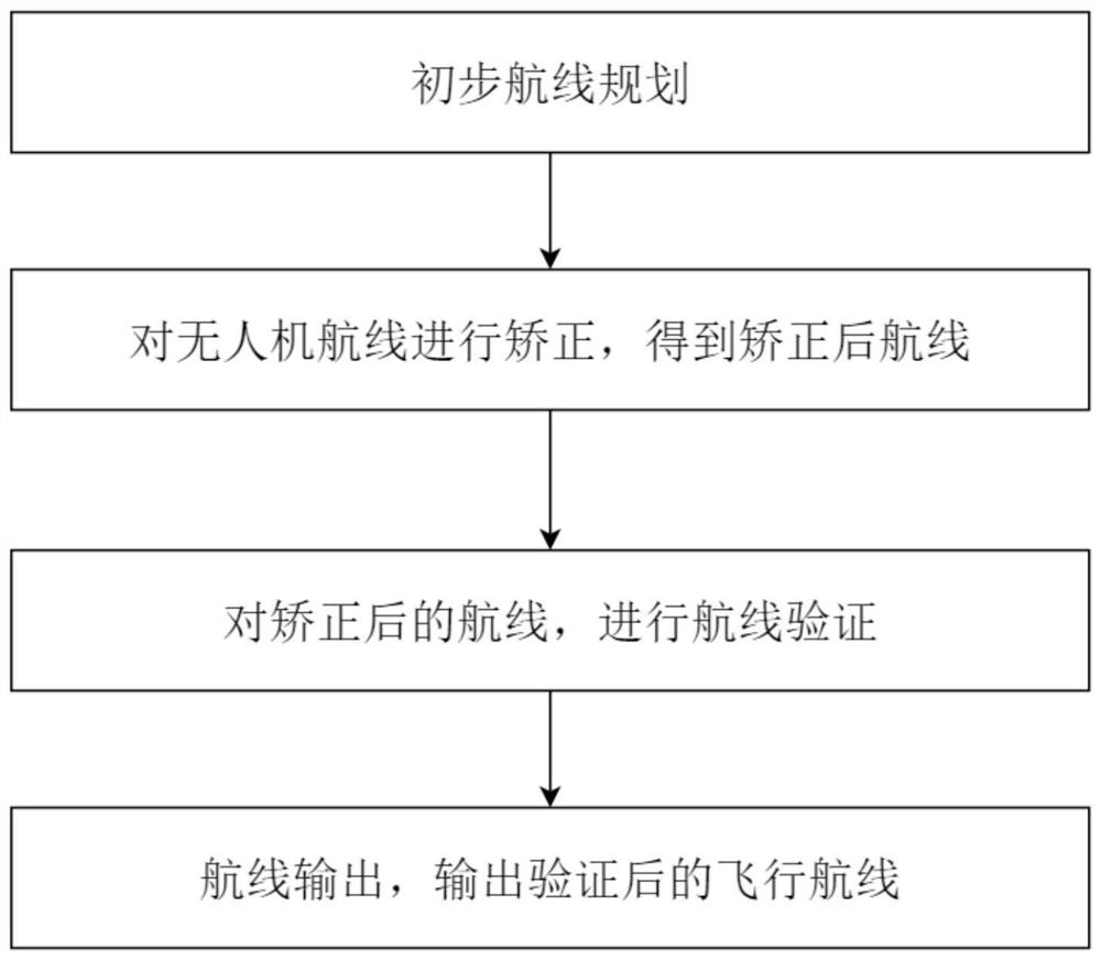
The invention discloses an urban flight route planning system and method for an unmanned aerial vehicle based on Cell-ID. The system comprises a 360-degree narrow-band antenna, an unmanned aerial vehicle and a plurality of communication base stations, wherein the 360-degree narrow-band antenna is installed below the unmanned aerial vehicle, and the data interaction transmission exists between theunmanned aerial vehicle and the plurality of communication base stations. The planning method comprises the following steps: carrying out the preliminary route planning; correcting the route of the unmanned aerial vehicle to obtain a corrected route; carrying out route verification on the corrected route; outputting the flight route, and outputting the verified flight route. The route planned by using the method can guarantee the data communication quality in the flight process, so the unmanned aerial vehicle is not influenced by mirror reflection and a wireless signal multipath effect, the urban flight safety problem of the unmanned aerial vehicle is solved, and the flight of the unmanned aerial vehicle is reliable and stable.

Description

technical field [0001] The invention belongs to the technical field of unmanned aerial vehicles, and in particular relates to a planning system and method for urban flight routes of unmanned aerial vehicles based on cell-ID. Background technique [0002] UAVs are now widely used in all walks of life, but when UAVs fly in cities, the data transmission link is affected by urban factors such as tall buildings and cannot be effectively guaranteed. The location of the outdoor base station in the operator's network city is basically at a relatively high position, and the signal coverage area is basically visible. Through the actual test, the base station signal also has signal coverage in the low-altitude area, but it is not very stable due to the influence of mirror reflection and wireless signal multipath effect. [0003] This has caused a lot of trouble for drones flying in cities, making drones flying in cities very unstable, and it is urgent to solve this problem. Contents...

Claims


Application Information

Patent Timeline
IPC IPC(8): G05D1/10
CPCG05D1/101Y02D30/70
Inventor 王雅栋陶伟张云翔
Owner 萧县航迅信息技术有限公司
Learn More