Spatial aggregation scale selection method for geographic big data

A scale selection, big data technology, applied in the field of geographic information analysis

Active Publication Date: 2020-09-11
CENT SOUTH UNIV
View PDF9 Cites 2 Cited by
  • Summary
  • Abstract
  • Description
  • Claims
  • Application Information

AI Technical Summary

Problems solved by technology

Less attention has been paid to spatial interaction data, most of which focus on the distance attenuation effect, using the gravity model to study the scale effect related to spatial interaction, but these studies are limited to theoretical models, and a small number of studies focus on the interaction matrix Changes in community structure in , that is, changes in clustering patterns

Method used


Image

  • Spatial aggregation scale selection method for geographic big data
  • Spatial aggregation scale selection method for geographic big data
  • Spatial aggregation scale selection method for geographic big data

Examples


Embodiment Construction

[0046] The present invention will be further described below in conjunction with the embodiments and accompanying drawings, but the present invention is not limited in any way. Any transformation or replacement based on the teaching of the present invention belongs to the protection scope of the present invention.

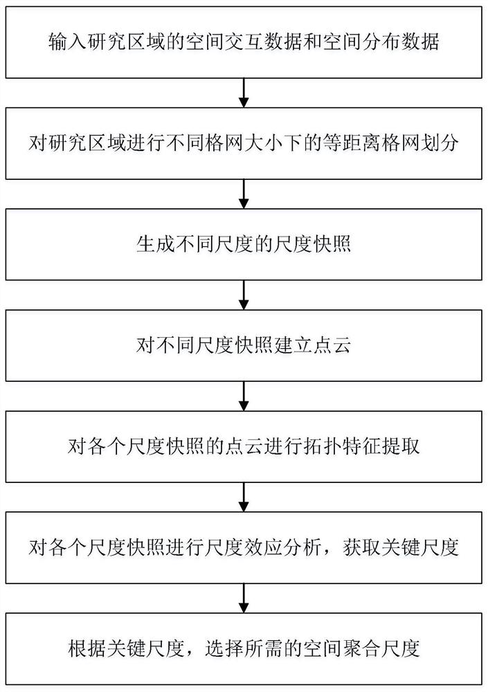
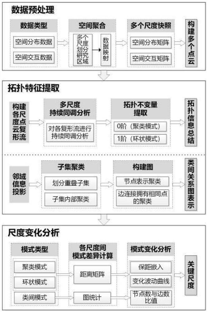
[0047] like figure 1 As shown, a spatial aggregation scale selection method for geographic big data includes the following steps:

[0048] Step 1, input the spatial interaction data or spatial distribution data of the study area;

[0049] Step 2: Divide the study area into a regular grid with equidistant distances, and select the grid size as [s 1 ,s 2 ,...,s M ],Ascending;

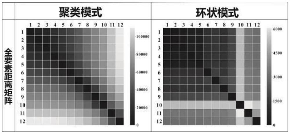
[0050] Step 3, for spatial interaction data: map the departure point and arrival point to the divided grid, and map the interaction between point pairs into the interaction between grids, and a new spatial interaction matrix can be obtained for each scale , that is, M scale snapshots, ass...


PUM


Abstract

The invention discloses a spatial aggregation scale selection method for geographic big data. The spatial aggregation scale selection method comprises the steps of performing equidistant grid divisionon a research area under different grid sizes; generating scale snapshots of different scales; establishing point clouds for snapshots of different scales; carrying out topological feature extractionon the point cloud of each scale snapshot; performing scale effect analysis on each scale snapshot to obtain a key scale; and selecting a required spatial aggregation scale according to the key scale. According to the method, a topology analysis method is introduced; clustering modes, annular modes and inter-class modes of data under different aggregation scales are described through multi-ordertopology invariants, the influence of the scale effect is quantified through evolution of the modes, then scale mutation points are found to judge a proper research scale range, and therefore the selected spatial aggregation scale better meets actual requirements.

Description

technical field [0001] The invention belongs to the technical field of geographic information analysis, and relates to a method for selecting a spatial aggregation scale for geographic big data. Background technique [0002] Geographic data mining is inseparable from scale. Generally speaking, big geographic data are spatio-temporal data at individual granularity, but when conducting research on man-land relationships, researchers will focus on larger spatio-temporal granularity, which needs to be converted from individual granularity to group level. Therefore, in order to understand urban space, it is inevitable to carry out the operation of time-spatial aggregation, that is, we need to divide the research area into multiple spatial units in advance, map the data and spatial units, and then use the predefined spatial The unit is used as the basic research unit to carry out the analysis. Most studies use regular grids to divide the research area, and there is no uniform sp...

Claims


Application Information

Patent Timeline
Patent Type & Authority Applications(China)
IPC IPC(8): G06F16/2458G06F16/28G06F16/29
CPCG06F16/2462G06F16/2465G06F16/285G06F16/29
Inventor 李海峰朱佳玮陶超肖俊
Owner CENT SOUTH UNIV
Why Eureka
Try Eureka