Ecological environment evaluation method based on DPSIR model
A technology of ecological environment and evaluation method, applied in the field of ecological environment, can solve the problems of lack of intuition, incapability of accurate positioning, etc., and achieve the effect of visualization and intuition
- Summary
- Abstract
- Description
- Claims
- Application Information
AI Technical Summary
Problems solved by technology
Method used
Image

Examples
Embodiment 1
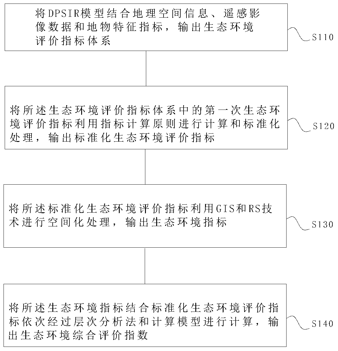
[0059] like figure 1 As shown, an ecological environment assessment method based on the DPSIR model includes the following steps:
[0060] S110. Combining the DPSIR model with geospatial information, remote sensing image data and feature indicators to output an ecological environment evaluation index system;
[0061] S120. Calculate and standardize the first ecological environment evaluation index in the ecological environment evaluation index system using the index calculation principle, and output the standardized ecological environment evaluation index;
[0062] S130. Perform spatial processing on the standardized ecological environment evaluation index using GIS and RS technology, and output the ecological environment index;
[0063] S140. Combine the ecological environment index with the standardized ecological environment evaluation index to calculate through analytic hierarchy process and calculation model in sequence, and output an ecological environment comprehensive...
Embodiment 2
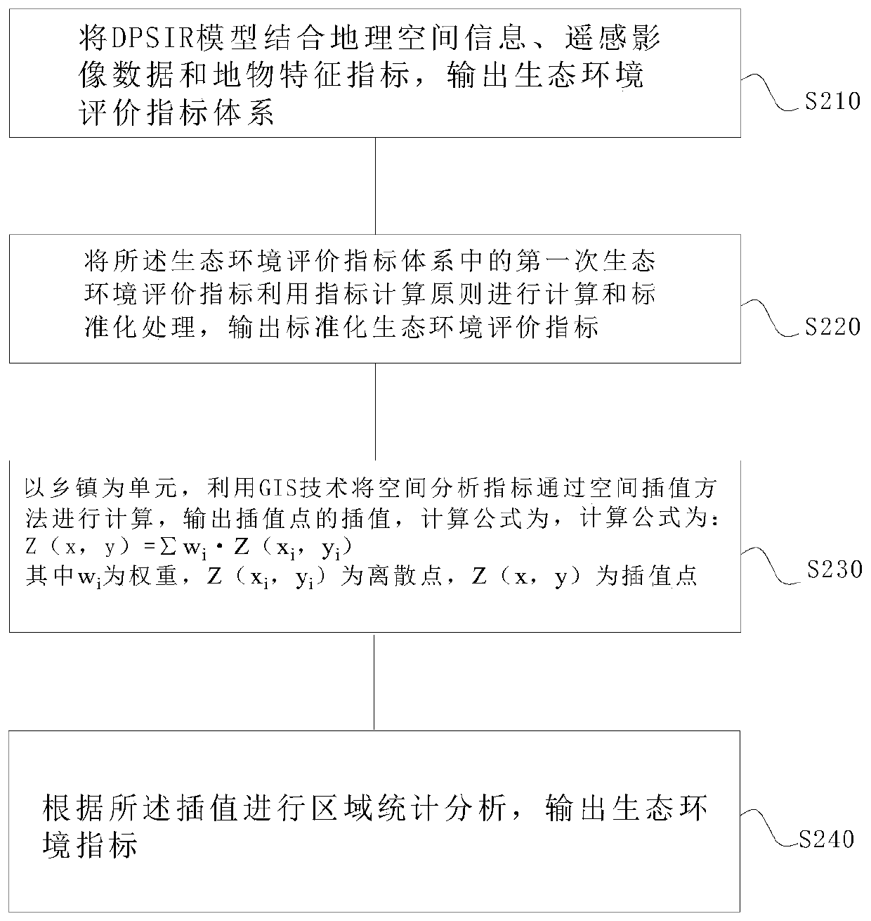
[0069] like figure 2 As shown, an ecological environment assessment method based on the DPSIR model, including:
[0070] S210. Combining the DPSIR model with geospatial information, remote sensing image data and feature indicators to output an ecological environment evaluation index system;
[0071] S220. Calculate and standardize the first ecological environment evaluation index in the ecological environment evaluation index system using the index calculation principle, and output the standardized ecological environment evaluation index;
[0072] S230. Taking the township as a unit, using GIS technology to calculate the spatial analysis index through the spatial interpolation method, and output the interpolation value of the interpolation point, the calculation formula is:
[0073]
[0074] where w i is the weight, Z(x i ,y i ) is a discrete point, and Z(x, y) is an interpolation point.
[0075] S240. Perform regional statistical analysis according to the interpolati...
Embodiment 3
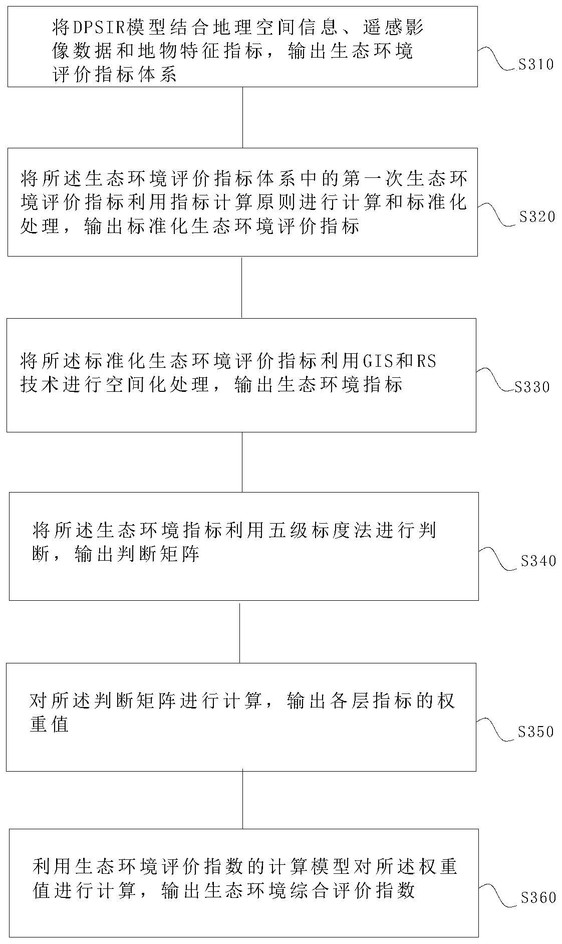
[0079] like image 3 As shown, an ecological environment assessment method based on the DPSIR model, including:
[0080] S310. Combining the DPSIR model with geospatial information, remote sensing image data and feature indicators to output an ecological environment evaluation index system;
[0081] S320. Calculate and standardize the first ecological environment evaluation index in the ecological environment evaluation index system using the index calculation principle, and output the standardized ecological environment evaluation index;
[0082] S330. Perform spatial processing on the standardized ecological environment evaluation index using GIS and RS technology, and output the ecological environment index;
[0083] S340, judge the ecological environment index using the five-level scaling method, and output a judgment matrix;
[0084] S350. Calculate the judgment matrix, and output the weight values of the indexes of each layer;
[0085] S360. Using the calculation mo...
PUM
 Abstract
Description
Claims
Application Information
 - R&D
- Intellectual Property
- Life Sciences
- Materials
- Tech Scout
- Unparalleled Data Quality
- Higher Quality Content
- 60% Fewer Hallucinations
Browse by: Latest US Patents, China's latest patents, Technical Efficacy Thesaurus, Application Domain, Technology Topic, Popular Technical Reports.
© 2025 PatSnap. All rights reserved.Legal|Privacy policy|Modern Slavery Act Transparency Statement|Sitemap|About US| Contact US: help@patsnap.com