Flight rice transplanting system for unmanned aerial vehicle, and rice transplanting method
A technology of unmanned aerial vehicles and flying missions, which is applied in planting methods, aircraft, control/regulation systems, etc., can solve the problems of unmanned aerial vehicle transplanting rice seedlings that are not stable enough, not intelligent enough, etc., to improve stability and intelligence, and improve Efficiency and manpower saving effect
- Summary
- Abstract
- Description
- Claims
- Application Information
AI Technical Summary
Problems solved by technology
Method used
Image
Examples
Embodiment 1
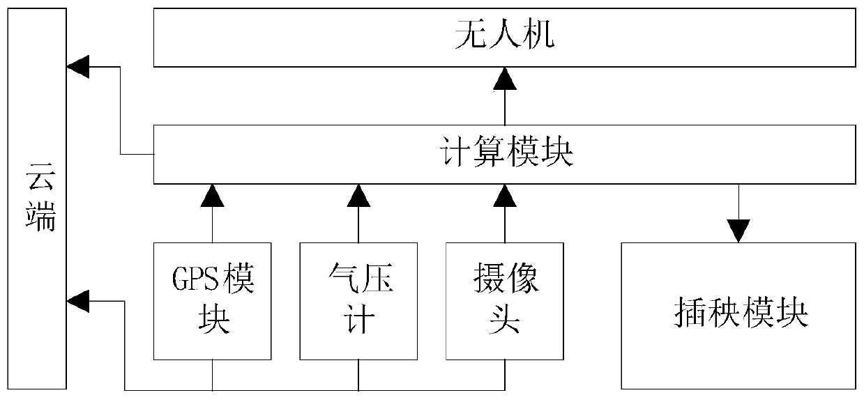
[0048] This embodiment provides a flying rice transplanting system of an unmanned aerial vehicle, such as figure 1 As shown, the system includes: the cloud, the UAV, and the GPS module, barometer, camera, computing module, and rice transplanting module carried by the UAV;
[0049] The GPS module is used to obtain the GPS information of the drone, and send the GPS information to the computing module and the cloud;
[0050] The barometer is used to obtain the altitude information of the drone, and send the altitude information to the computing module and the cloud;
[0051] The camera is used to take video images of the farmland and send the video image information to the computer module and the cloud;
[0052] The calculation module processes the video image according to the video image information, constructs map information by combining GPS information and height information, and sends the image processing result and map information to the cloud;
[0053] The cloud plans th...
Embodiment 2
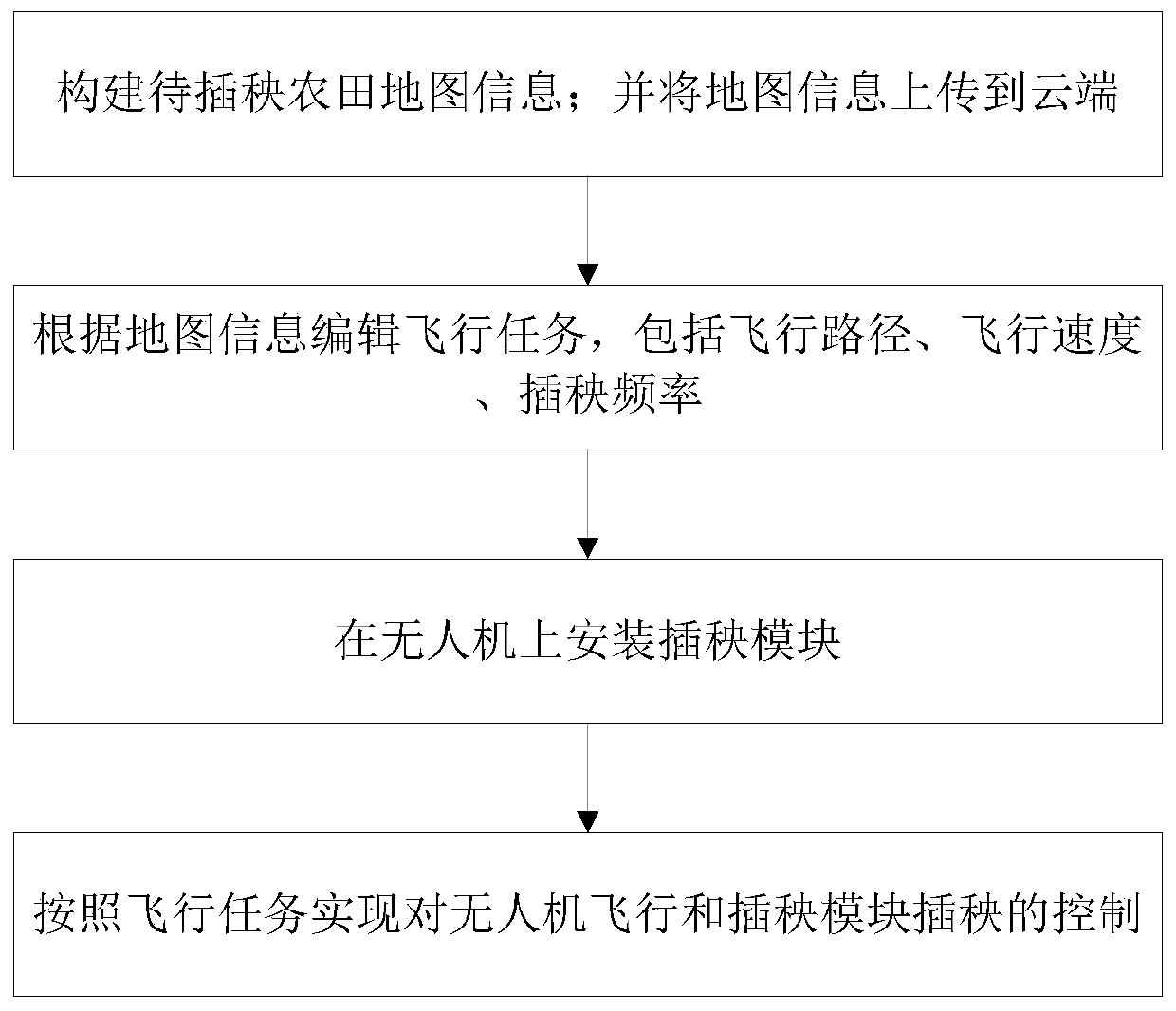
[0065] This embodiment provides a UAV intelligent flight transplanting method, the rice transplanting method is applied to the rice transplanting system described in Embodiment 1, such as image 3 As shown, the method includes the following steps:
[0066] S1: Without installing the transplanting module, control the UAV to fly around the farmland to be transplanted; realize the collection of GPS information, height information, and video image information;
[0067] The calculation module constructs the map information of the farmland to be transplanted according to the GPS information, height information, and video image information; and uploads the map information to the cloud;
[0068] S2: Edit flight missions in the cloud based on map information, including flight path, flight speed, and rice transplanting frequency;
[0069] S3: Install the rice transplanting module on the UAV;
[0070] S4: Send the flight task edited in the cloud to the calculation module, and the calcu...
PUM
 Abstract
Description
Claims
Application Information
 - R&D
- Intellectual Property
- Life Sciences
- Materials
- Tech Scout
- Unparalleled Data Quality
- Higher Quality Content
- 60% Fewer Hallucinations
Browse by: Latest US Patents, China's latest patents, Technical Efficacy Thesaurus, Application Domain, Technology Topic, Popular Technical Reports.
© 2025 PatSnap. All rights reserved.Legal|Privacy policy|Modern Slavery Act Transparency Statement|Sitemap|About US| Contact US: help@patsnap.com


