
Method using mobile phone signaling data location to switch traffic flow speed

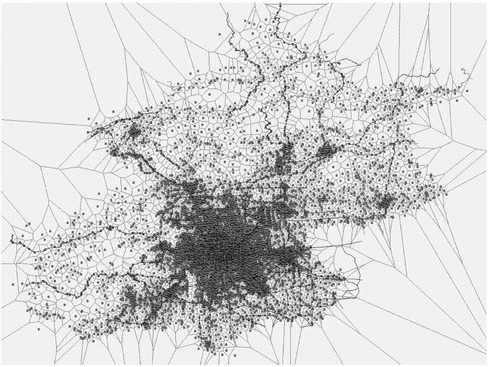
A technology of data location and mobile phone signaling, which is applied in the direction of traffic flow detection, traffic control system, road vehicle traffic control system, etc., and can solve the problems of microwave detector influence, coverage area influence, detection accuracy reduction, etc.

Inactive Publication Date: 2017-08-01
BEIJING JIAOTONG UNIV
View PDF4 Cites 16 Cited by
  • Summary
  • Abstract
  • Description
  • Claims
  • Application Information

AI Technical Summary

Problems solved by technology

The traditional monitoring methods mainly include GPS floating car detection, microwave detection, video detection and coil detection, etc., but all kinds of detection methods have certain deficiencies: GPS floating car detection has high detection accuracy, but because taxis with GPS are mainly active in In the central area of ​​the city, the coverage area is affected; the detection of microwave detectors is greatly affected by road conditions and requires a certain installation space; video detection is greatly affected by weather and light; the detection accuracy of coil detection will decrease when the traffic flow is too large

Method used


Image

  • Method using mobile phone signaling data location to switch traffic flow speed
  • Method using mobile phone signaling data location to switch traffic flow speed
  • Method using mobile phone signaling data location to switch traffic flow speed

Examples


Embodiment 1

[0109] Example 1: West Fifth Ring Xiangquan Bridge-Xingshikou Bridge

[0110] The total length of the Xiangquan Bridge-Xingshikou Bridge section of the West Fifth Ring Road is about 4.3 kilometers, spanning a total of 12 base stations. The CELLIDs of these base stations are extracted and relabeled sequentially from south to north, and the numbers are calibrated sequentially from 001 to 012. Such as Image 6 shown. According to the standard switching sequence acquisition method of the target road section, the key switching points of the road section are extracted. At the same time, it is stipulated that the direction from south to north is the forward direction, and the opposite direction is the reverse direction. From this, the Xiangquan Bridge-Xingshikou Bridge section can be determined The standard switching sequence for forward and reverse directions.

[0111] According to the switching sequence calibration algorithm of the target road section, the road section 1 is calib...

Embodiment 2

[0113] Example 2: Shangqing Bridge on the North Fifth Ring Road - Laiguangying Bridge

[0114] The total length of the section from Shangqing Bridge to Laiguangying Bridge on the North Fifth Ring Road is about 8.8 kilometers, spanning a total of 25 base stations. The CELLIDs of these base stations are extracted and relabeled sequentially from west to east, and the numbers are calibrated sequentially from 101 to 125. Such as Figure 9shown. According to the standard switching sequence acquisition method of the target road section, the key switching points of the road section are extracted. At the same time, it is stipulated that the direction from west to east is the forward direction, and the opposite direction is the reverse direction. From this, the Shangqing Bridge-Laiguangying Bridge section can be determined The standard switching sequence for forward and reverse directions.

[0115] According to the switching sequence calibration algorithm of the target road section, t...


PUM


Abstract

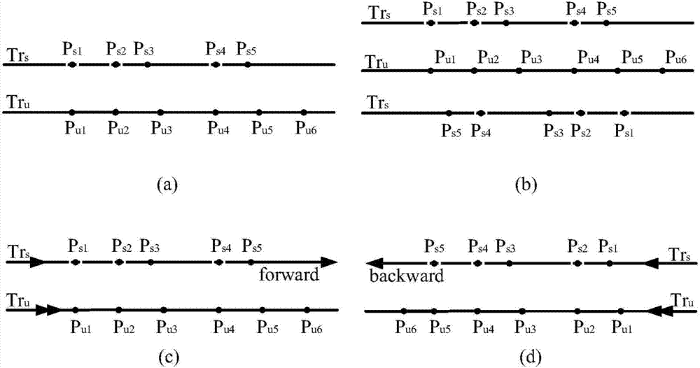
The invention is directed to the technical field of road traffic running speed on road monitoring, and particularly relates to a method using the mobile phone signaling data location to switch the traffic flow speed. The method comprises the steps that S1 a Tyson polygon formed by a base station is used as the coverage of the base station; S2 the forward switching sequence and the reverse switching sequence of a target road are constructed, and a GIS platform is used to acquire the road distance set and the reverse distance set under the single base station coverage; S3 based on the base station label and the switching time, the switching trajectory of the user base station is extracted; S4 trajectory matching degree verification is carried out on the user trajectory sequence and a standard switching sequence; S5 the speed of a successfully matched user is acquired; and S6 the steps from S3 to S5 are carried out on all users to acquire the traffic flow speed of the target road. Through the example of comparison with the traffic flow speed detected by a microwave detector, the fact that the traffic flow speed acquisition method based on location switching can effectively acquire the traffic flow speed of the road is verified.

Description

technical field [0001] The present invention is oriented to the technical field of on-the-way monitoring of road traffic operating speed, and in particular relates to a method for obtaining traffic flow speed by using mobile phone signaling data position switching. Background technique [0002] With the continuous development of urban traffic and the increasing travel demand of people, while facilitating road traffic management, it also puts forward higher requirements for the acquisition of road traffic speed flow. The traditional monitoring methods mainly include GPS floating car detection, microwave detection, video detection and coil detection, etc., but all kinds of detection methods have certain deficiencies: GPS floating car detection has high detection accuracy, but because taxis with GPS are mainly active in In the central area of ​​the city, the coverage area is affected; the detection of microwave detectors is greatly affected by road conditions and requires a cer...

Claims


Application Information

Patent Timeline
IPC IPC(8): G08G1/01H04W4/04
CPCG08G1/012
Inventor 董宏辉贾利民秦勇刘锴王旭昭杨振宇单庆超
Owner BEIJING JIAOTONG UNIV
Learn More