
Access control method of spatial database

An access control and database technology, applied in the field of access control of spatial databases, can solve problems such as the inability to directly apply spatial database protection and the complexity of spatial data models, and achieve the effect of improving efficiency and ensuring response speed.

Active Publication Date: 2014-06-18
ZHEJIANG UNIV
View PDF5 Cites 8 Cited by
  • Summary
  • Abstract
  • Description
  • Claims
  • Application Information

AI Technical Summary

Problems solved by technology

[0006] Due to the large amount of data in spatial databases, the complexity of spatial data models, and the joint management of attribute data and spatial data, traditional database authorization methods cannot be directly applied to the protection of spatial databases. To establish a more targeted authorization method for it based on characteristics such as

Method used


Image

  • Access control method of spatial database
  • Access control method of spatial database
  • Access control method of spatial database

Examples


Embodiment Construction

[0065] The present invention will be described in detail below in conjunction with specific embodiments.

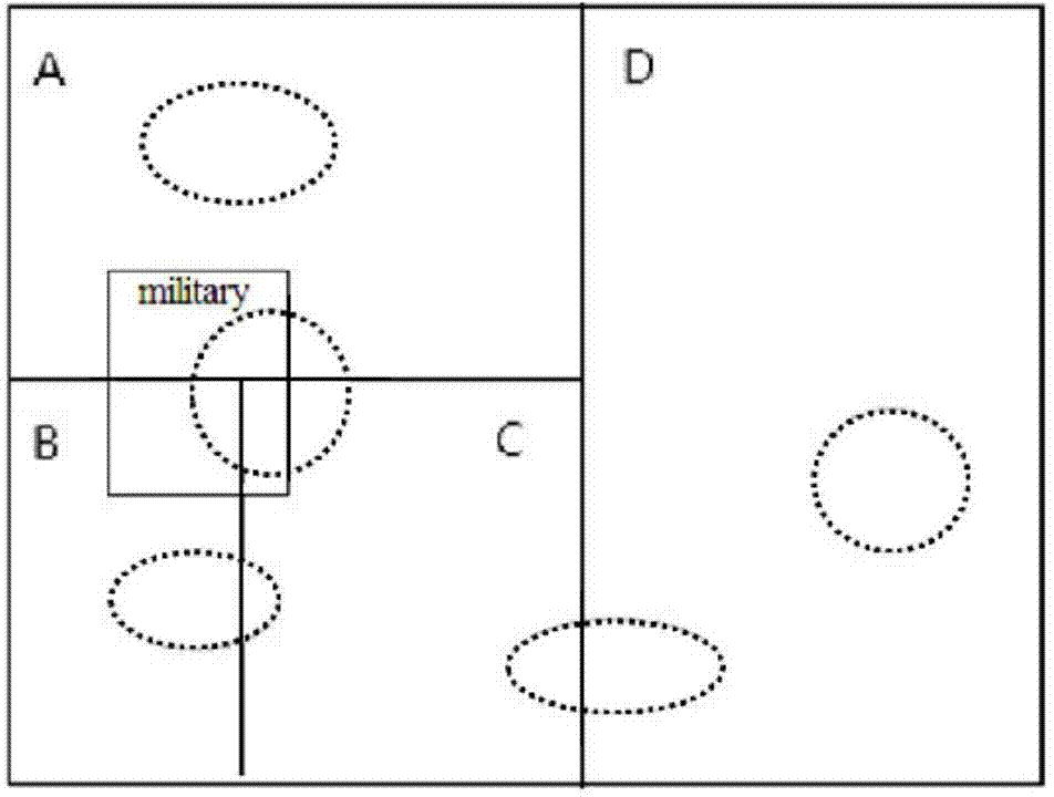
[0066] The access control method of the spatial database of this embodiment is oriented to petroleum resources, and the spatial range partition of the spatial database and the distribution of petroleum resources are as follows: figure 1 As shown, the spatial range of the spatial database is T, which is divided into four spatial regions A, B, C and D. The spatial range of the spatial database includes a military area, which is a sensitive area.

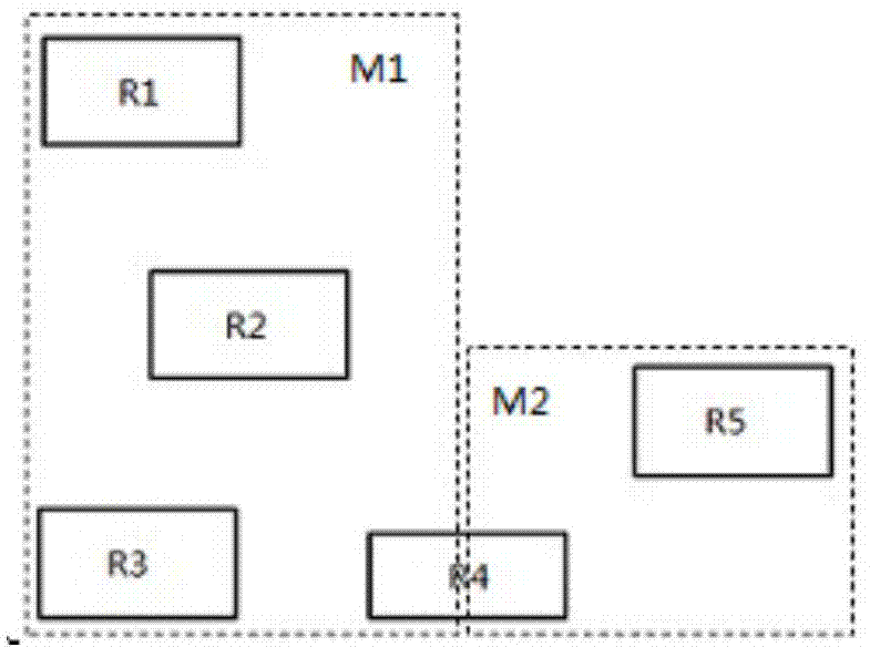
[0067] In addition, the spatial database includes 5 oil fields, and the minimum enclosing rectangles corresponding to each oil field are R1, R2, R3, R4, and R5 respectively. Among them, the reserves of the oil fields corresponding to R4 are above 2000 units, and the reserves of other oil fields All below 2000 units.

[0068] The corresponding R+ tree is constructed according to the spatial entity in the spatial database, and the ...


PUM


Abstract

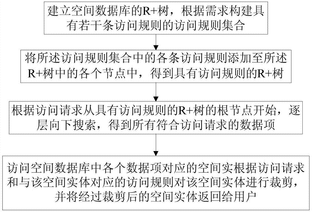
The invention discloses an access control method of a spatial database. The access control method comprises the following steps of realizing authorization of the spatial database by adding access rules into an R+ tree, searching the R+ tree added with the access rules according to an access request, obtaining a spatial entity from the spatial database according to the searched result, further cutting the spatial entity according to the access request and the corresponding access rules, and returning the cut spatial entity to a user. The access control method disclosed by the invention not only supports the authorization of the spatial entity, but also supports the authorization of fine-grit splitting of the entities; the access control rules can only cover one part of the spatial entity, simultaneously, the twice queries such as judgment of the access rules and the spatial search are combined into once query, and in once query, the result of query of the user is determined and corresponding information is returned, so that the query efficiency of authorization is improved and the response speed in accessing spatial vector data with permission limitation is ensured.

Description

technical field [0001] The invention relates to the field of computer information security, in particular to an access control method for a spatial database. Background technique [0002] The development of space remote sensing and information technology makes the application of space data more and more extensive, and the access, management and visualization research of space data have entered into daily life. Recently, many companies and organizations have provided spatial data query, access and analysis services for governments and companies in decision-making through geographic information systems. However, the exposure of some sensitive geographical locations (such as military bases) poses national security threats. [0003] The implementation of the existing authorization methods in the database mainly includes access control list, access control matrix, query rewriting and other methods. However, vector analysis of spatial data is time-consuming. Once there are too m...

Claims


Application Information

Patent Timeline
Patent Type & Authority Applications(China)
IPC IPC(8): G06F17/30G06F21/62
CPCG06F16/2246G06F21/6218
Inventor 吴朝晖梁杰超刘娜陈华钧郑国轴杨建华
Owner ZHEJIANG UNIV
Learn More