Agricultural economy electronic map data service interface method
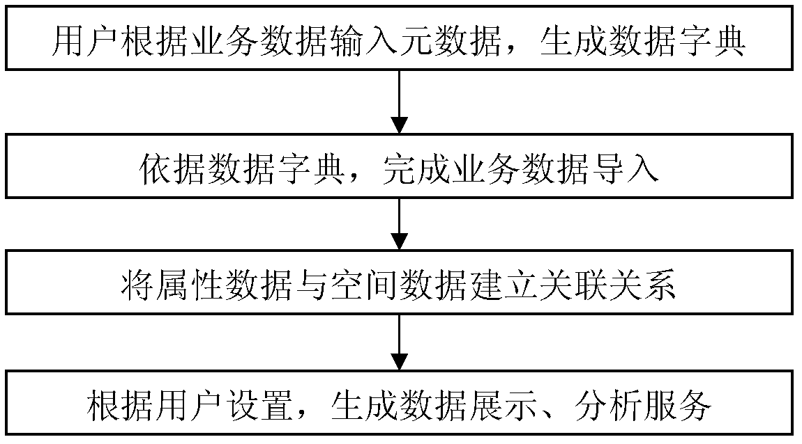
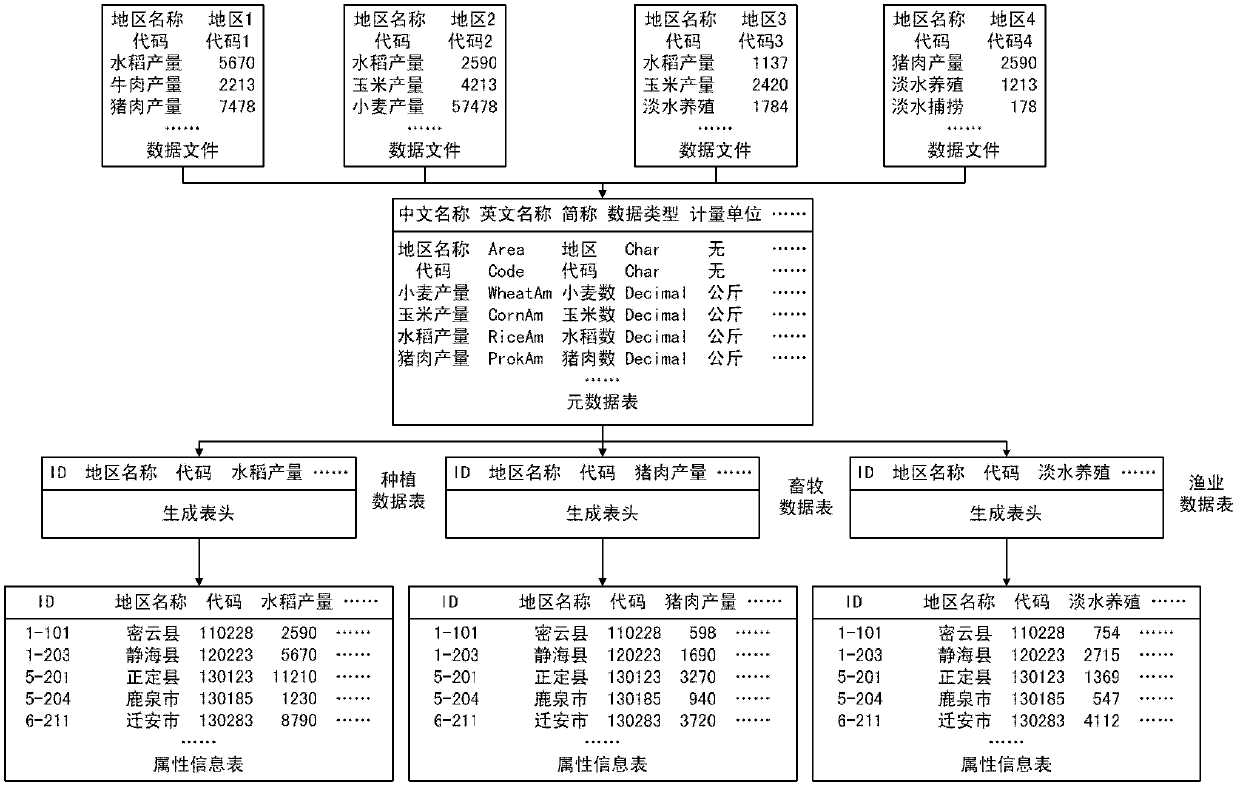
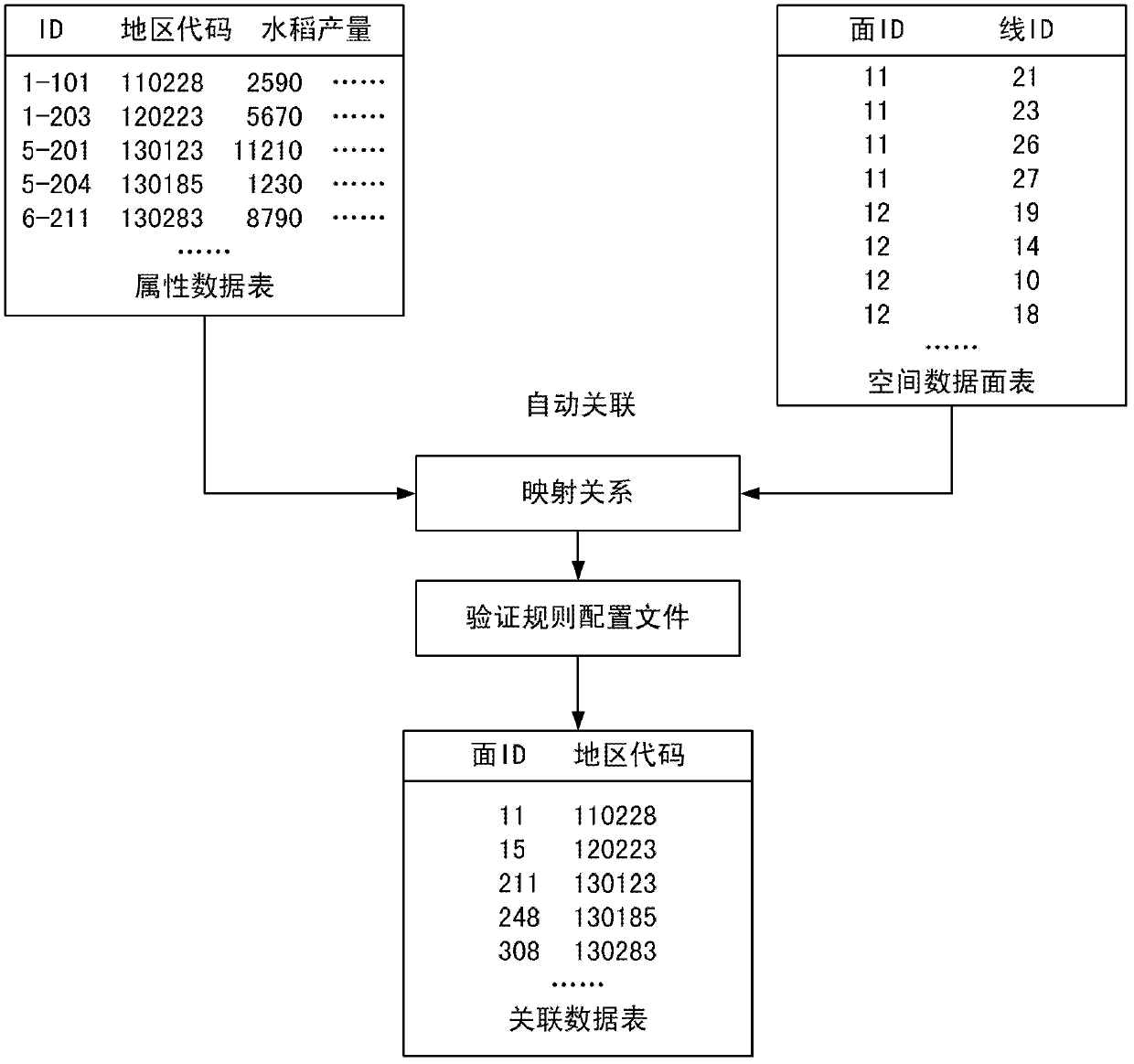
An electronic map and data service technology, applied in the field of agricultural information, to reduce the difficulty of secondary development, quickly personalize electronic map data services, and avoid repeated construction.
- Summary
- Abstract
- Description
- Claims
- Application Information
AI Technical Summary
Problems solved by technology
Method used
Image
Examples
Embodiment Construction
[0014] The basic data of agricultural economy are data with spatial connotation, and the basic data of agricultural economy are closely related to geographic information. GIS manages both geospatial information and database attribute data. It organically combines graphics with corresponding attribute information, realizes the connection between graphics and databases, and can be used for collection, storage, management and analysis of geographic related information. The application of geographic information system can not only display the information with geographical attributes in a graphical way, but also realize the dynamic query and analysis of information resources, make information resources be shared to a greater extent, and improve the convenience of information visualization and application. Using the thematic map analysis of GIS to make various types of thematic maps, you can intuitively see the spatial distribution of data from the maps.
[0015] The invention provi...
PUM
 Abstract
Description
Claims
Application Information
 - R&D
- Intellectual Property
- Life Sciences
- Materials
- Tech Scout
- Unparalleled Data Quality
- Higher Quality Content
- 60% Fewer Hallucinations
Browse by: Latest US Patents, China's latest patents, Technical Efficacy Thesaurus, Application Domain, Technology Topic, Popular Technical Reports.
© 2025 PatSnap. All rights reserved.Legal|Privacy policy|Modern Slavery Act Transparency Statement|Sitemap|About US| Contact US: help@patsnap.com


