Digital level capable of automatically measuring
A technology of digital leveling and automatic measurement, which is applied in the direction of measuring devices, height/level measurement, instruments, etc.
- Summary
- Abstract
- Description
- Claims
- Application Information
AI Technical Summary
Problems solved by technology
Method used
Image
Examples
Embodiment 1
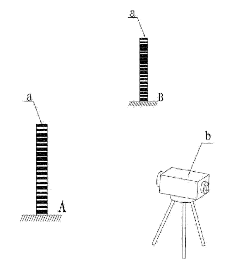
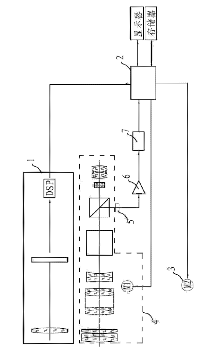
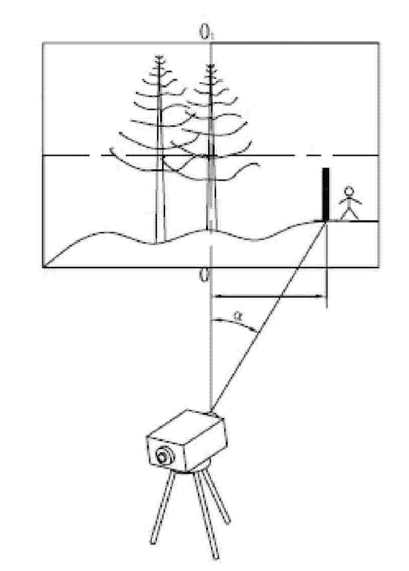
[0025] See Figure 1-6, a digital level for automatic measurement of the present invention, comprising: a wide-angle camera processing system 1, which is used to find a scale a around under the drive of a horizontal rotating base 3, and then calculate the azimuth and distance where the scale a is located; The system 4 is used to adjust the orientation through the horizontal rotation base 3 according to the azimuth and distance of the scale a, and automatically adjusts the focus after aligning with the scale a; the CCD device 5 is used to obtain the scale through the telescope focusing system 4 after focusing The precise image of a; CPU unit 2, for controlling the horizontal rotation base 3 to rotate corresponding angles according to the azimuth and distance where the scale a is located so that the telescope focusing system 4 is aligned with the scale a, and then drives the telescope focusing system 4 to the corresponding focal length, and acquire the image of the scale a forme...
Embodiment 2
[0034] On the basis of embodiment 1, the digital level for automatic measurement of the present embodiment has the following deformations:
[0035] The laser reflective film or laser reflective coating is provided on the used scale a; Light to determine the azimuth and distance where the scale a is located; the level b also includes: a CPU unit 2, a telescope focusing system 4 and a CCD device 5; the CPU unit 2 controls the rotation of the horizontal rotating base 3 according to the azimuth and distance of the scale a to the azimuth, and control the telescope focusing system 4 to automatically focus, and obtain the image of the scale a formed in the CCD device 5, and finally calculate the elevation and distance of the scale a, and store it in the memory.
[0036] Wherein, the pattern on the used scale a is a black and white barcode; when the CPU unit 2 controls the quasi-scale a to focus, the CPU unit 2 drives the horizontal rotating base 3 and the telescope focusing system 4 ...
Embodiment 3
[0038] On the basis of embodiment 1, the digital level for automatic measurement of the present embodiment has the following deformations:
[0039] The used scale a is provided with a GPS receiver for detecting the position of the scale a and a wireless signal transmitting device for transmitting the position information of the detected scale a as a wireless signal.
[0040] The level b includes: a wireless signal receiver for receiving the wireless signal and obtaining the position information of the scale a, a GPS receiver for detecting the position of the level b, a CPU unit 2, a horizontal rotating base 3, a telescope Focusing system 4 and CCD device 5; CPU unit 2 calculates the azimuth and distance of scale a relative to level b according to the position information of level b and the position information of scale a, and then rotates horizontally according to the azimuth and distance The base 3 adjusts the orientation of the telescope focusing system 4, then controls the ...
PUM
 Abstract
Description
Claims
Application Information
 - R&D
- Intellectual Property
- Life Sciences
- Materials
- Tech Scout
- Unparalleled Data Quality
- Higher Quality Content
- 60% Fewer Hallucinations
Browse by: Latest US Patents, China's latest patents, Technical Efficacy Thesaurus, Application Domain, Technology Topic, Popular Technical Reports.
© 2025 PatSnap. All rights reserved.Legal|Privacy policy|Modern Slavery Act Transparency Statement|Sitemap|About US| Contact US: help@patsnap.com


