
Method for the location of mobile terminals, related systems and terminal, computer program products thereof

a technology for mobile terminals and related systems, applied in the direction of instruments, measurement devices, electrical appliances, etc., can solve the problems of hardly receiving or not receiving signals from satellite-based and terrestrial location systems, affecting and reducing the performance of statistical filters. to achieve the effect of improving the accuracy of location actions

Inactive Publication Date: 2011-01-18
TELECOM ITALIA SPA
View PDF13 Cites 21 Cited by
  • Summary
  • Abstract
  • Description
  • Claims
  • Application Information

AI Technical Summary

Benefits of technology

The present invention provides a method for improving the accuracy of location action in situations where the standard hypotheses on the statistical distribution of measurement errors in statistical filters of conventional type are not met, such as in location systems using terrestrial cellular networks or satellite-based systems. The method involves using a statistical filter, such as a Kalman filter, that takes into account the measurement errors in the network and the additional measurements from devices like accelerometers and altimeters. The method is adaptable to various statistical distributions of the measurement errors and can provide optimal results even in cases where the errors have non-Gaussian distributions. The method is also faster than conventional solutions and can improve the accuracy and speed of convergence of the location system.

Problems solved by technology

The prior art considered in the foregoing leaves however at least two basic problems unsolved.
Experiences show however that when such arrangement are used in the case of measurements related to terrestrial cellular networks, the performance of the statistical filters is appreciably diminished to the point of making the use of such statistical filters practically useless.
Additionally, not unlike satellite-based systems (that may suffer from poor reception or lack of reception, i.e. lack of “visibility” of satellites in urban canyons and indoor), terrestrial systems may also be adversely affected by phenomena such as multipath or insufficient field strength, these phenomena possibly leading to environments where signals from both satellite-based and terrestrial location systems can be hardly received or are not received at all.

Method used


Image

  • Method for the location of mobile terminals, related systems and terminal, computer program products thereof
  • Method for the location of mobile terminals, related systems and terminal, computer program products thereof
  • Method for the location of mobile terminals, related systems and terminal, computer program products thereof

Examples


Embodiment Construction

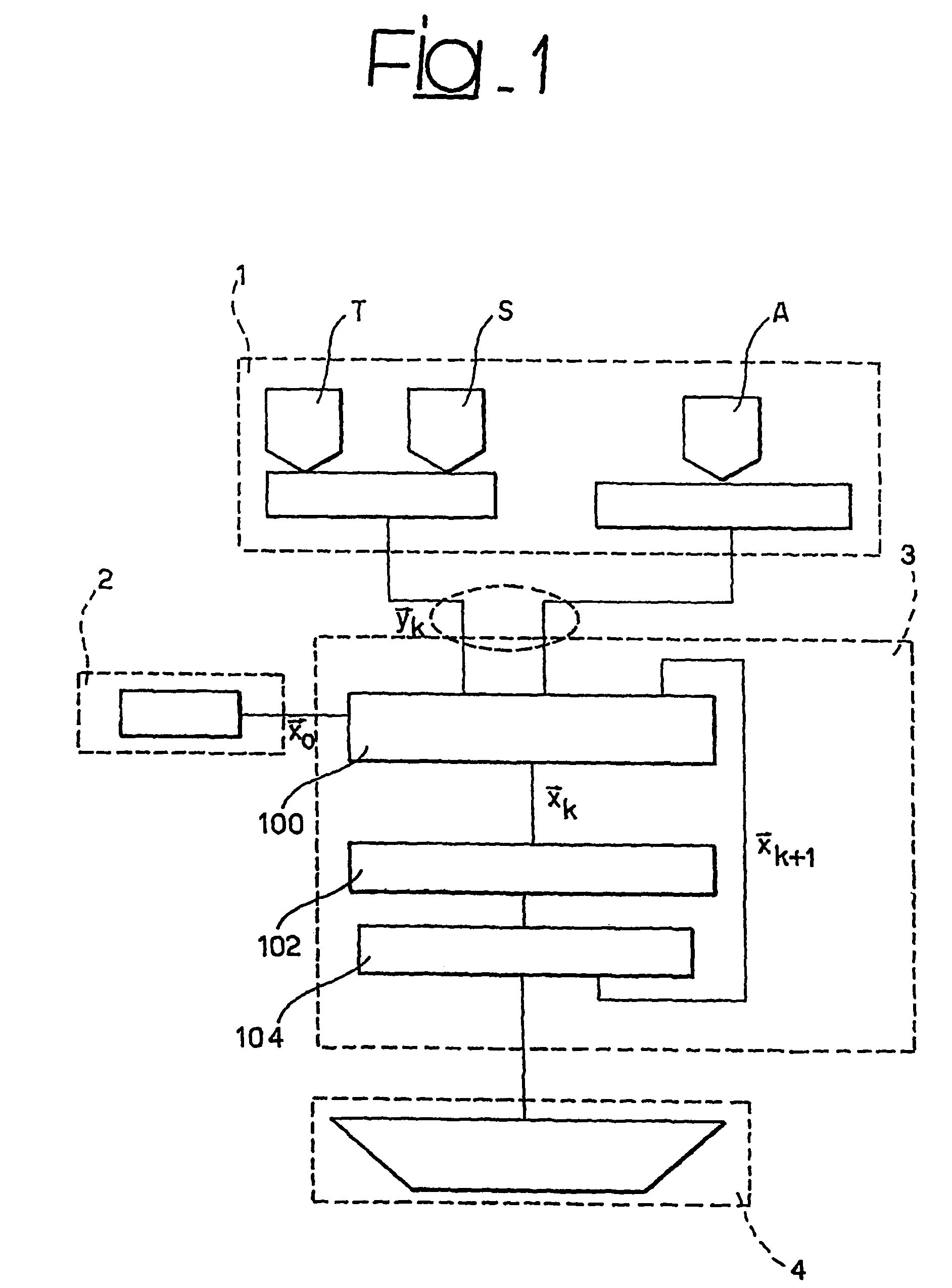
[0035]By way of introduction to the description of an exemplary embodiment of the arrangement disclosed herein, some basic principles of Kalman filter theory will be briefly summarized here. This is done by referring specifically to the arrangement known as the so-called “Extended Kalman Filter” or, briefly, EKF.

[0036]Once again, it is worth recalling that reference to a Kalman filter is in no way intended to limit the scope of the invention that in fact encompasses use of any statistical filter or predictor of a known type.

[0037]For the sake of simplicity, it will be assumed that the mobile terminal to be located is still (i.e. not in motion), and the additional measurement provided to the location system is the altitude above sea level of the terminal. The measurements provided by the terrestrial cellular networks are typically the propagation times of the radio frequency signals.

[0038]According to basic EKF theory, such a scenario can be described as follows.

[0039]{x_k+1=f⁡(x_k)+...


PUM


Abstract

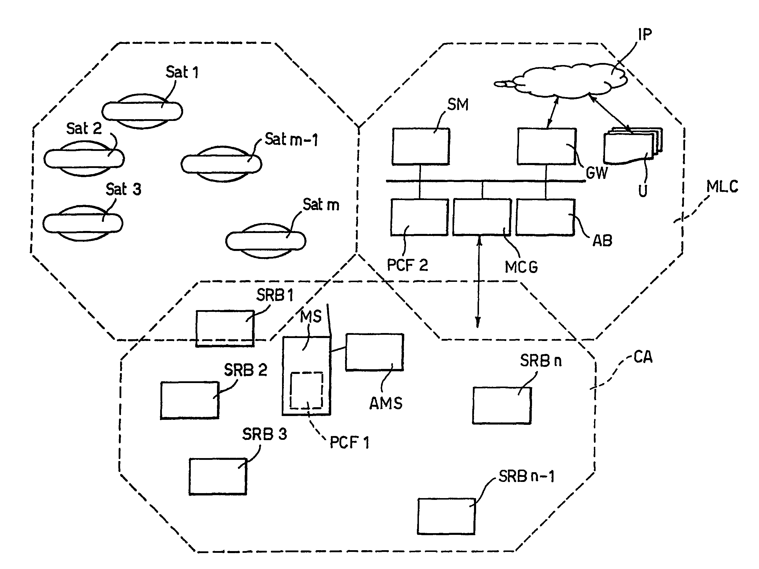
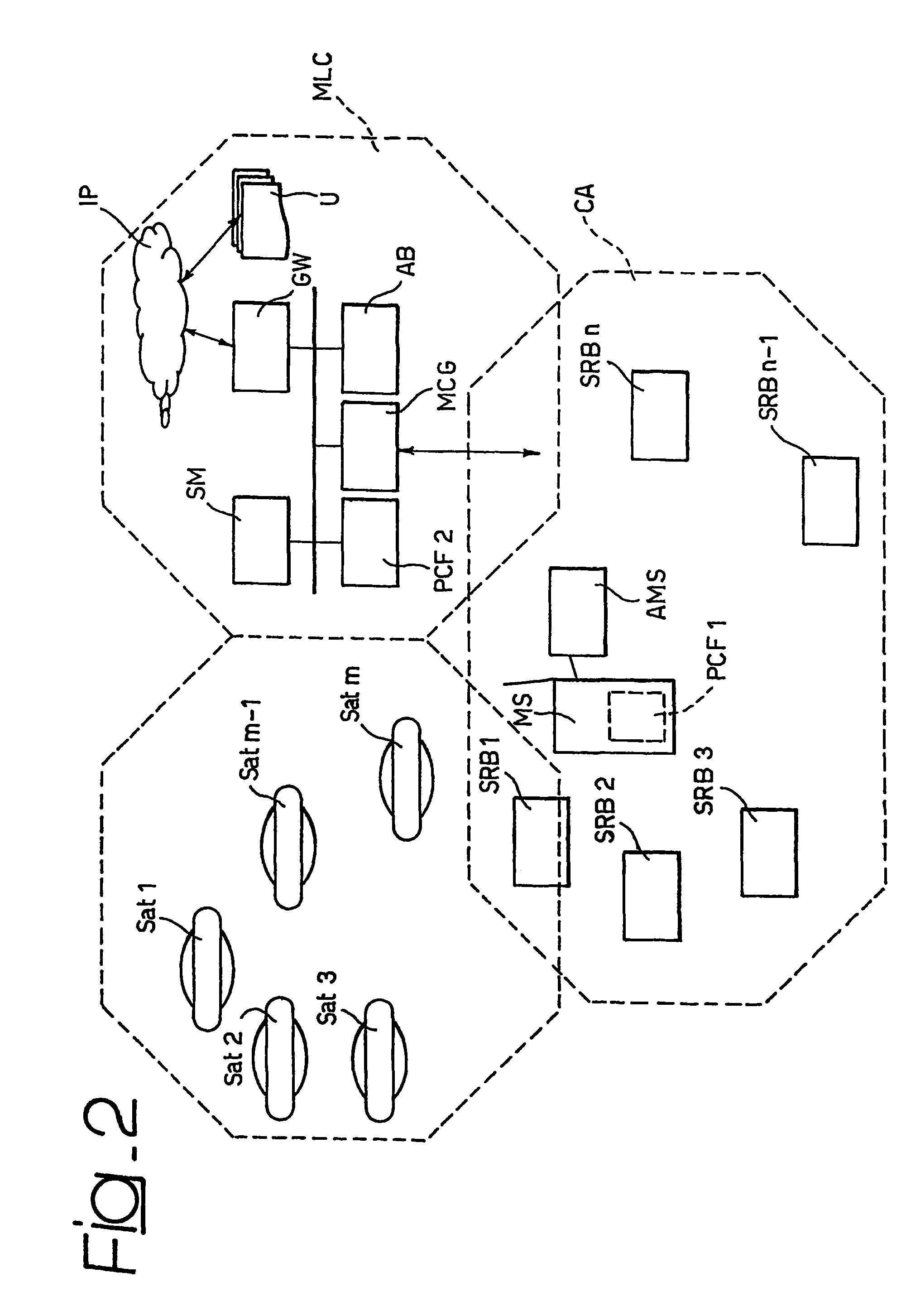
A method for determining the location coordinates of a mobile terminal with respect to reference elements adapted to send toward the mobile terminal radioelectric signals involves the steps of measuring the radioelectric signals to derive respective measurements, the measurements being affected by measurement errors, and subjecting the measurements to state-based statistical filtering, such as, a Kalman filtering, to derive therefrom the location coordinates of the mobile terminal. At least some of the reference elements are terrestrial reference elements and in the statistical filtering at least one further state is included in addition to the coordinates. The further state is representative of the measurement errors. The terminal is adapted to be mounted on a vehicle, such as, a motorcar, and to have associated therewith a measurement source, such as, an altimeter adapted to provide additional measurements indicative of the location, e.g., the altitude, and / or the displacement of the mobile terminal.

Description

CROSS REFERENCE TO RELATED APPLICATION[0001]This application is a national phase application based on PCT / EP2003 / 006381, filed Jun. 17, 2003, the content of which is incorporated herein by reference.[0002]1. Field of the Invention[0003]The present invention relates to techniques for the location of mobile units or terminals.[0004]2. Description of the Related Art[0005]A number of techniques are known in the art that permit the location of mobile units in a given area; exemplary of such a system is the satellite-based positioning system known as the Global Positioning System (GPS).[0006]Other arrangements exploit the features of certain terrestrial communication systems, such as cellular mobile telecommunication systems, for the location of mobile terminals.[0007]Most location systems known in the art operate by taking distance measurements with respect to absolute references (or measurements, such as propagation time measurements of radio-frequency signals, that can be related to di...

Claims


Application Information

Patent Timeline
Patent Type & Authority Patents(United States)
IPC IPC(8): H04W24/00H04W24/02H04W64/00
CPCG01S19/09H04W64/00G01S19/45H04W64/006
Inventor ANNUNZIATO, ARMANDOSALIO, STEFANO
Owner TELECOM ITALIA SPA
Learn More