
GNSS optimized aircraft control system and method

a control system and aircraft technology, applied in the direction of process and machine control, navigation instruments, instruments, etc., can solve the problems of misapplication of material, precise distribution control, and a number of process errors in the position determination process

Active Publication Date: 2011-10-27
EFC SYST
View PDF2 Cites 35 Cited by
  • Summary
  • Abstract
  • Description
  • Claims
  • Application Information

AI Technical Summary

Benefits of technology

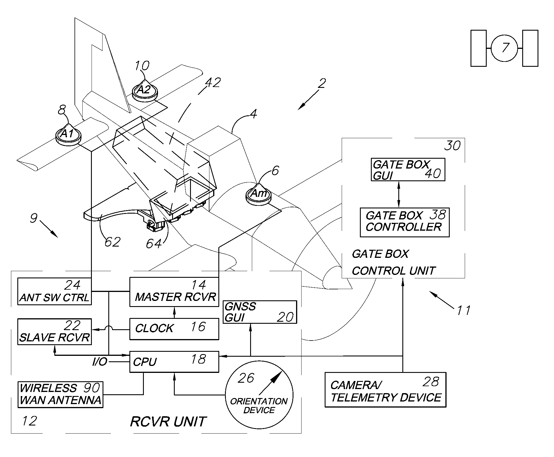
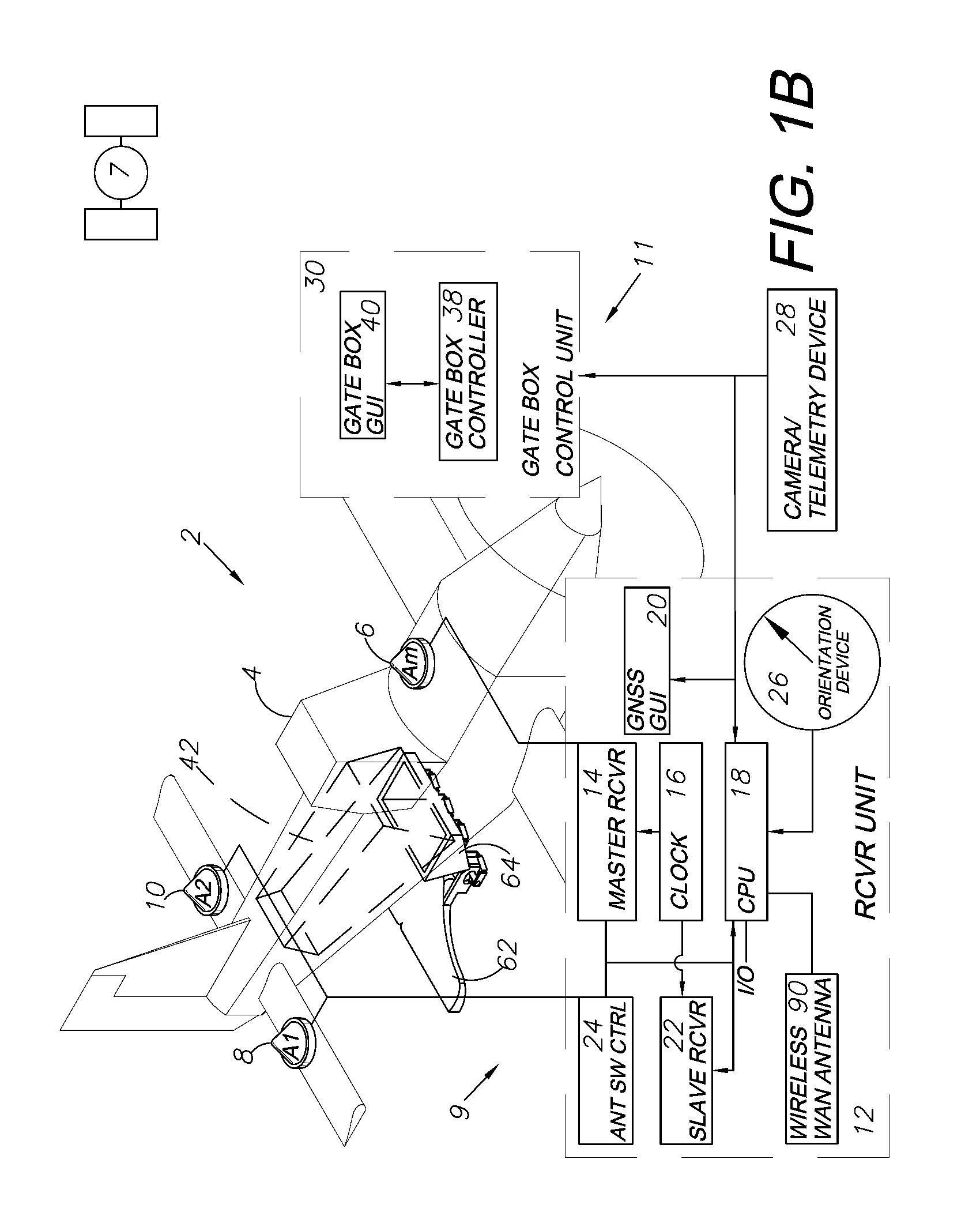
[0017]Information that GNSS can provide to the pilot of an aircraft includes not only the current position, but extends to providing the pilot with knowledge of the ideal flight path to provide relatively even distribution of dry material over the desired tract of land. An integrated system will use the GNSS system to control the gate box of the hydraulic crop dusting system. The GNSS guidance system will recognize the ideal time to open or close the gate, how far to open the gate and how much to alter the gate opening during flight based on fluctuations in ground speed. The gate positions can also change automatically based on data entered into a pre-designed map of varying rates. The opening and changing of gate positions are intended to achieve a continual optimal desired output while the guidance system is ensuring an even distribution of the dry material. Other exemplary embodiments include an aerial camera for photography or videography, a telemetry device, a laser altimeter and components, including software, for aerial mapping and surveying. Automatic and assisted landing functions can be accomplished with the DGNSS-based control system supplemented with the laser altimeter.

Problems solved by technology

However, precise distribution control presents challenges with existing equipment.
However, factors such as the altitude of the aircraft, the ground speed of the aircraft, temperature, humidity, moisture content of the material and ambient wind speed and direction can affect the results.
Flying too high or too low can distort the swath of the spread and result in misapplication of the material.
In standalone GPS systems that determine a receiver's antenna position coordinates without reference to a nearby reference receiver, the process of position determination is subject to errors from a number of sources.
These include errors in the GPS satellite's clock reference, the location of the orbiting satellite, ionosphere-induced propagation delay errors, and troposphere refraction errors.

Method used


Image

  • GNSS optimized aircraft control system and method
  • GNSS optimized aircraft control system and method
  • GNSS optimized aircraft control system and method

Examples


Embodiment Construction

I. Introduction and Environment

[0029]As required, detailed aspects of the present invention are disclosed herein; however, it is to be understood that the disclosed aspects are merely exemplary of the invention, which may be embodied in various forms. Therefore, specific structural and functional details disclosed herein are not to be interpreted as limiting, but merely as a basis for the claims and as a representative basis for teaching one skilled in the art how to variously employ the present invention in virtually any appropriately detailed structure.

[0030]Global navigation satellite systems (GNSSs) are broadly defined to include GPS (U.S.), Galileo (Europe, proposed), GLONASS (Russia), Beidou / Compass (China, proposed), IRNSS (India, proposed), QZSS (Japan, proposed) and other current and future positioning technology using signals from satellites, with or without augmentation from SBAS or terrestrial reference correction sources. Inertial navigation systems (INS) include gyrosc...


PUM


Abstract

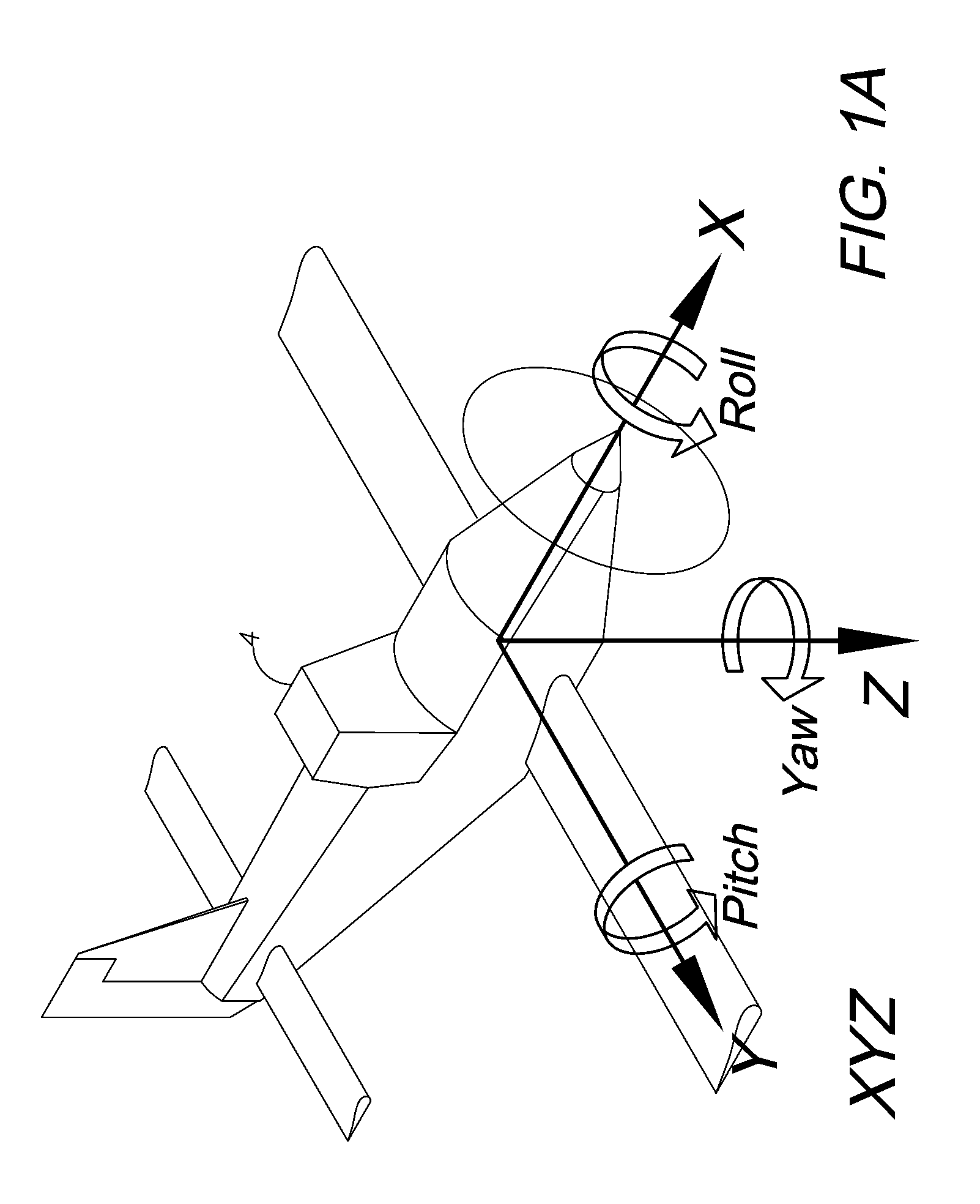
A GNSS system in combination with a hydraulically-actuated, airborne dispenser for a dry material crop dusting system to optimize the distribution of dry materials over a particular tract of land. A GNSS subsystem is included using at least one GNSS antenna and one GNSS receiver located on the aircraft. The aircraft is equipped with an electronic / hydraulic crop dusting subsystem connected to a GNSS CPU. The GNSS ranging signals received by the antennas are processed by a receiver and processor system for determining the vehicle's position and dynamic attitude in three dimensions (3D). A graphical user interface (GUI) placed in the vehicle will give the driver a real-time view of his or her current bearing as well as a calculated “optimal path” based on calculations and variable data, such as wind speed and direction, material moisture content, altitude, air speed and other conditions. The system is adapted for operation in a differential GNSS (DGNSS) mode utilizing a base station at a fixed location.

Description

CROSS-REFERENCE TO RELATED APPLICATION[0001]This application is related to and claims priority in U.S. Provisional Patent Application Ser. No. 61 / 252,994, filed Oct. 19, 2009, which is incorporated herein by reference.BACKGROUND OF THE INVENTION[0002]1. Field of the Invention[0003]The present invention relates generally to aircraft guidance and control with differential global navigation satellite systems (DGNSSs), and in particular to a DGNSS-based system and method for optimizing crop dusting with dry materials.[0004]2. Description of the Related Art[0005]GNSS guidance and control are widely used for vehicle and personal navigation and a variety of other uses involving precision location in geodesic reference systems. GNSS, which includes the Global Positioning System (GPS) and other satellite-based positioning systems, can achieve greater accuracy with known correction techniques, including a number of commercial satellite based augmentation systems (SBASs).[0006]Aircraft are oft...

Claims


Application Information

Patent Timeline
Patent Type & Authority Applications(United States)
IPC IPC(8): G06F7/00
CPCA01B79/005G05D1/0202G01S19/54G01S19/14B64D1/16
Inventor GUYETTE, GREG S.MCVAY, IANHENNESSEY, PATRICK H.COLLINS, DENNIS M.
Owner EFC SYST
Learn More