
Methods and systems for deducing road geometry and connectivity

Active Publication Date: 2006-07-13
BLACKBERRRY CORP
View PDF11 Cites 161 Cited by
  • Summary
  • Abstract
  • Description
  • Claims
  • Application Information

AI Technical Summary

Benefits of technology

[0009] In one embodiment of the present invention, a method for generating an improved database representing a road network is provided. The method generally comprises the following steps. A baseline road in the road network is defined, wherein the defining comprises replacing an original representation of the baseline road in the database with new data, and wherein the new data have a greater accuracy than the original representation. The new data are collected from one or more vehicles traveling a route in the road network. The route is divided into one or more route segments. Each route segment is assigned as an on-baseline segment, an off-baseline segment, an off-baseline to on-baseline transition, an on-baseline to off-baseline transition, or a within-baseline transition. The collected data a for each route segment are processed and added to the improved database.
[0010] In another embodiment, the present invention provides a method for generating an improved database representing a road network. This method generally comprises the steps of recording a plurality of vehicle position data points from one or more vehicles traveling on a baseline road such that all of the available directions of tr

Problems solved by technology

Most currently available methods for developing navigation databases are generally labor intensive and therefore involve substantial development costs and / or limitations in accuracy and “drivability” of the resultant database.
However, the TIGER database has several severe limitations that restrict, if not prevent, its utility as a “out of the box” navigation database.
Specifically, absolute positional representations of roads are quite mediocre.
While freeways and other major traffic arteries are represented in the database, their database locations are strongly uncorrelated with reality.
This presents a problem for use with accurate position-finding equipment such as global positioning satellite (GPS) receivers—the positional fix for a vehicle on a real road may return a nonsensical “off-road” position in the database.
Additionally, the database does not accurately represent fine-scale road connectivity.
Use of a database with these features for vehicle navigation would lead to nonsensical driving directions such turning from an overcrossing onto a perpendicular road whose street level is many meters below the grade of the first road.

Method used


Image

  • Methods and systems for deducing road geometry and connectivity
  • Methods and systems for deducing road geometry and connectivity
  • Methods and systems for deducing road geometry and connectivity

Examples


Embodiment Construction

[0028] The following detailed descriptions of various exemplary embodiments are provided to illustrate some of the aspects and advantages of the present invention. The descriptions provided are not meant to limit the scope of the invention in any way. The full scope of the invention should be construed in light of the claims which are appended hereto.

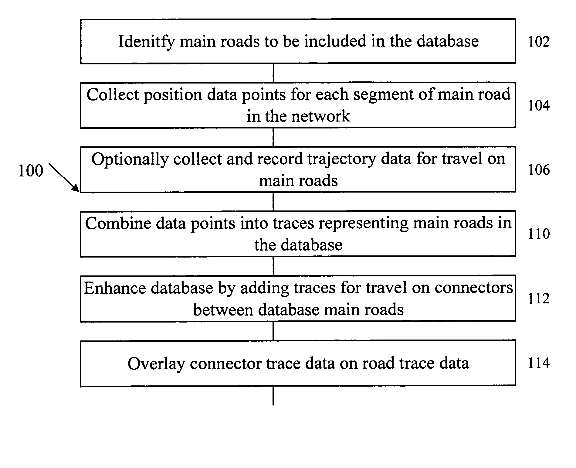
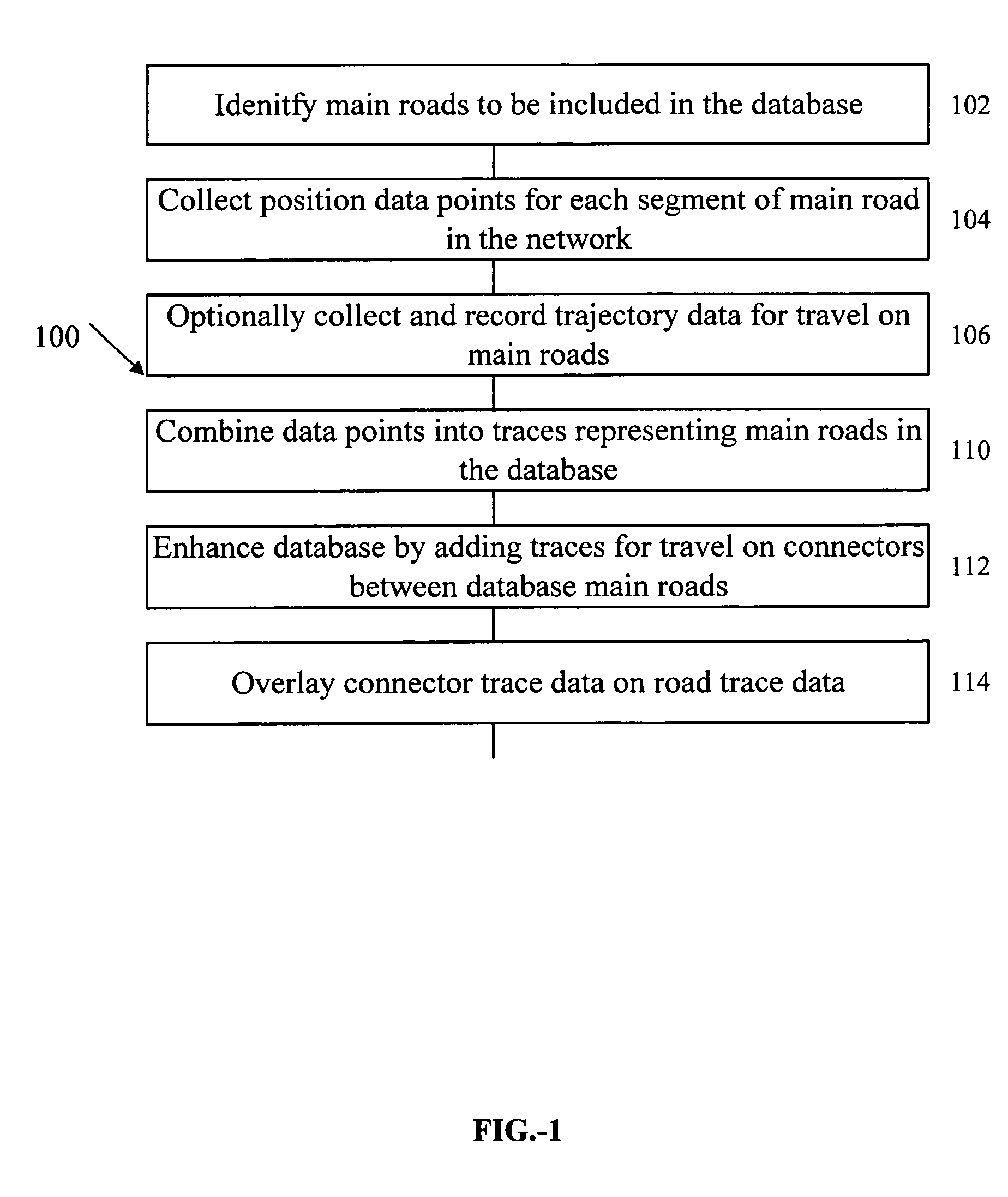
[0029] The present invention generally provides methods for preparing a drivable navigation database using position and / or trajectory data collected from vehicles traveling within a road network. In general, the present invention provides a method for generating a drivability database representing a road network in a region. Exemplary steps of this general method are summarized in the flowchart 100 of FIG. 1. The road network represented by the baseline database may include a subset of the roads in a region. The represented roads are advantageously those that carry a large fraction of the vehicular traffic in the region. One or more cr...


PUM


Abstract

Methods and systems for generating, deriving, and enhancing drivable road databases are provided. A baseline road in a road network is defined and position and / or trajectory data collected by vehicles traveling the baseline road are compiled and compared to a representation of the baseline road in an existing database. Identity and / or other property information about the road are assigned form the existing database to the new database.

Description

RELATED APPLICATIONS [0001] This application claims the priority of U.S. Provisional Application for Patent Ser. No. 60 / 632,276, filed 30 Nov. 2004. This application is related to copending U.S. patent application Ser. Nos. 10 / 272,039, entitled “Enhanced Mobile Communication Device, and Transportation Application Thereof;” Ser. No. 10 / 436,967, entitled “Hierarchical Floating Car Data Network;” Ser. No. 10 / 436,926, entitled “Methods for Communicating between Elements in a Hierarchical Floating Car Data Network;” Ser. No. 10 / 437,205, entitled “Enhanced Mobile Communication Device with Extended Radio, and Applications;” and Ser. No. 10 / 436,691, entitled “Enhanced Dead Reckoning Method,” the disclosures of which are incorporated herein by reference. BACKGROUND OF THE INVENTION [0002] 1. Field of the Invention [0003] The present invention relates generally to the field of road navigation databases. More specifically, the present invention is directed toward a method for developing and / or...

Claims


Application Information

Patent Timeline
IPC IPC(8): G01C21/32
CPCG08G1/20G01C21/32G08G1/01G01C21/3844G01C21/3841G01C21/3819
Inventor SMARTT, BRIAN E.
Owner BLACKBERRRY CORP
Learn More