Section extraction method based on point cloud mathematical model
An extraction method and technology of point cloud data, applied in the field of surveying and mapping, can solve the problems of low degree of automation, low efficiency, no open programming interface, etc., to reduce the mutual extraction of data, speed up the design process, and achieve the effect of iteration
- Summary
- Abstract
- Description
- Claims
- Application Information
AI Technical Summary
Problems solved by technology
Method used
Image
Examples
Embodiment Construction
[0033] The present invention will be described in detail below with reference to specific embodiments.
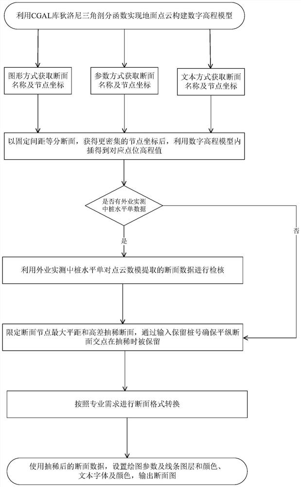
[0034] like figure 1 As shown, the present invention specifically comprises the following steps:
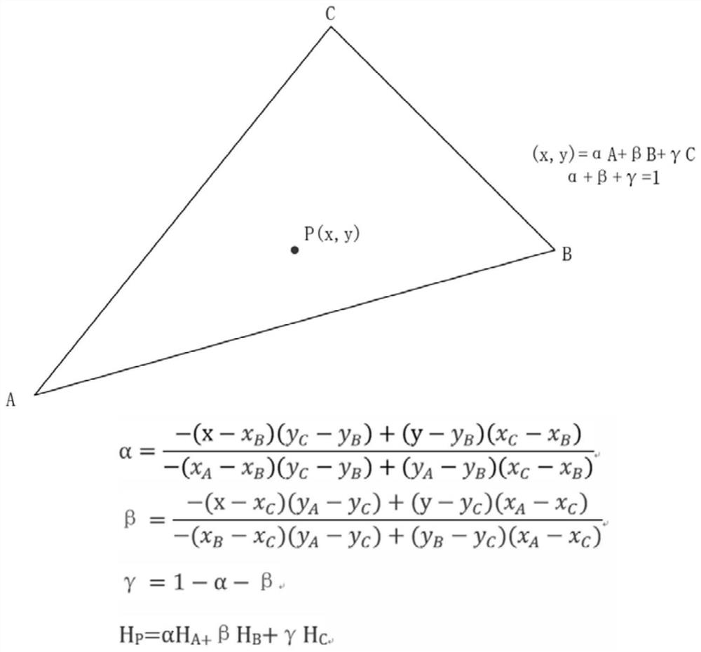
[0035] S1: Select the ground point cloud data obtained after data processing such as calibration, calculation, filtering, and classification. The data format is LAS. The required point cloud data range can be determined through point cloud combination map retrieval. The two-dimensional Delaunay triangulation algorithm provided in the computational geometry algorithm library CGAL is used to construct the digital model, and the output format is the triangulation digital elevation model of PLY. CGAL is a large-scale geometric data structure and algorithm library based on C++. When the point cloud builds the digital model, it reads the ground point cloud and stores it into the CGAL::Point_set_3 point set, traverses the point set with the TIN structure and constructs a two-dimensi...
PUM
 Abstract
Description
Claims
Application Information
 - Generate Ideas
- Intellectual Property
- Life Sciences
- Materials
- Tech Scout
- Unparalleled Data Quality
- Higher Quality Content
- 60% Fewer Hallucinations
Browse by: Latest US Patents, China's latest patents, Technical Efficacy Thesaurus, Application Domain, Technology Topic, Popular Technical Reports.
© 2025 PatSnap. All rights reserved.Legal|Privacy policy|Modern Slavery Act Transparency Statement|Sitemap|About US| Contact US: help@patsnap.com


