Remote sensing image-based farmland health state prediction method, apparatus and device, and storage medium
A technology of health status and remote sensing images, which is applied in the field of devices, equipment and storage media, and farmland health status prediction methods based on remote sensing images. The effect of improving accuracy and efficiency, reducing labor costs, and shortening the forecast cycle
- Summary
- Abstract
- Description
- Claims
- Application Information
AI Technical Summary
Problems solved by technology
Method used
Image
Examples
Embodiment 1
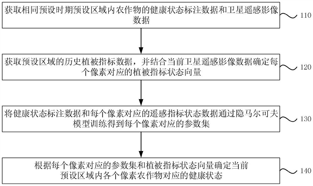
[0035] figure 1 It is a flow chart of a method for predicting farmland health status based on remote sensing images provided in Embodiment 1 of the present invention, figure 2 is a schematic diagram of the state transition of the hidden Markov model provided in Embodiment 1 of the present invention. This embodiment is applicable to the method of intelligently and efficiently predicting the health status of agricultural land in the agricultural prevention and control management platform. software and / or hardware, the device can be configured in the server of the management platform, refer to figure 1 , including the following steps:
[0036] Step 110, obtaining the health status labeling data and satellite remote sensing image data of crops in the preset area in the same preset period;
[0037] Among them, the satellite remote sensing image data includes multiple pixels, and each pixel corresponds to a remote sensing index status data;
[0038] Specifically, experts can be...
Embodiment 2
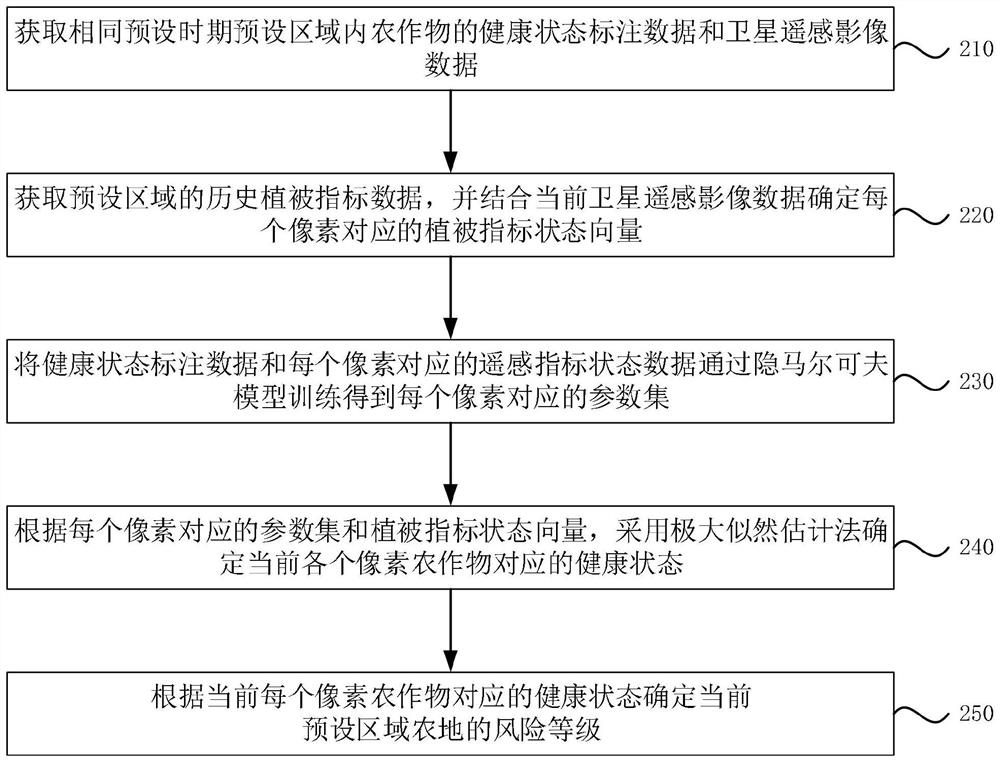
[0062] image 3 It is a flow chart of a method for predicting farmland health status based on remote sensing images provided in Embodiment 2 of the present invention. On the basis of the first embodiment above, optionally, refer to image 3 , the method specifically includes the following steps:
[0063] Step 210, obtaining the health status labeling data and satellite remote sensing image data of the crops in the preset area in the same preset period;
[0064] Step 220, acquiring the historical vegetation index data of the preset area, and combining the current satellite remote sensing image data to determine the vegetation index state vector corresponding to each pixel;
[0065] Step 230: Train the health status tag data and the remote sensing indicator status data corresponding to each pixel through hidden Markov model training to obtain a parameter set corresponding to each pixel;
[0066] Step 240 , according to the parameter set corresponding to each pixel and the veg...
Embodiment 3
[0076] Figure 4 It is a structural block diagram of an apparatus for predicting farmland health status based on remote sensing images provided in Embodiment 3 of the present invention. The embodiment of the present invention also provides a device for predicting the health status of agricultural land based on remote sensing images, refer to Figure 4 , the device 100 includes:
[0077] The health state labeling data and satellite remote sensing image data acquisition module 10 is used to obtain the health state labeling data and satellite remote sensing image data of crops in the preset area in the same preset period; wherein, the satellite remote sensing image data includes a plurality of pixels, and each A pixel corresponds to a remote sensing index status data;
[0078] The historical vegetation index data acquisition module 20 is used to acquire the historical vegetation index data of the preset area;
[0079] The vegetation index state vector determination module 30 i...
PUM
 Abstract
Description
Claims
Application Information
 - R&D Engineer
- R&D Manager
- IP Professional
- Industry Leading Data Capabilities
- Powerful AI technology
- Patent DNA Extraction
Browse by: Latest US Patents, China's latest patents, Technical Efficacy Thesaurus, Application Domain, Technology Topic, Popular Technical Reports.
© 2024 PatSnap. All rights reserved.Legal|Privacy policy|Modern Slavery Act Transparency Statement|Sitemap|About US| Contact US: help@patsnap.com


