Remote sensing image scene classification method based on image transformation and BoF model
A remote sensing image and scene classification technology, which is applied in the field of image processing, can solve problems such as unsatisfactory remote sensing image effects, and achieve the effects of improving scene classification accuracy, excellent effect performance, and excellent anti-noise performance
- Summary
- Abstract
- Description
- Claims
- Application Information
AI Technical Summary
Problems solved by technology
Method used
Image
Examples
Embodiment
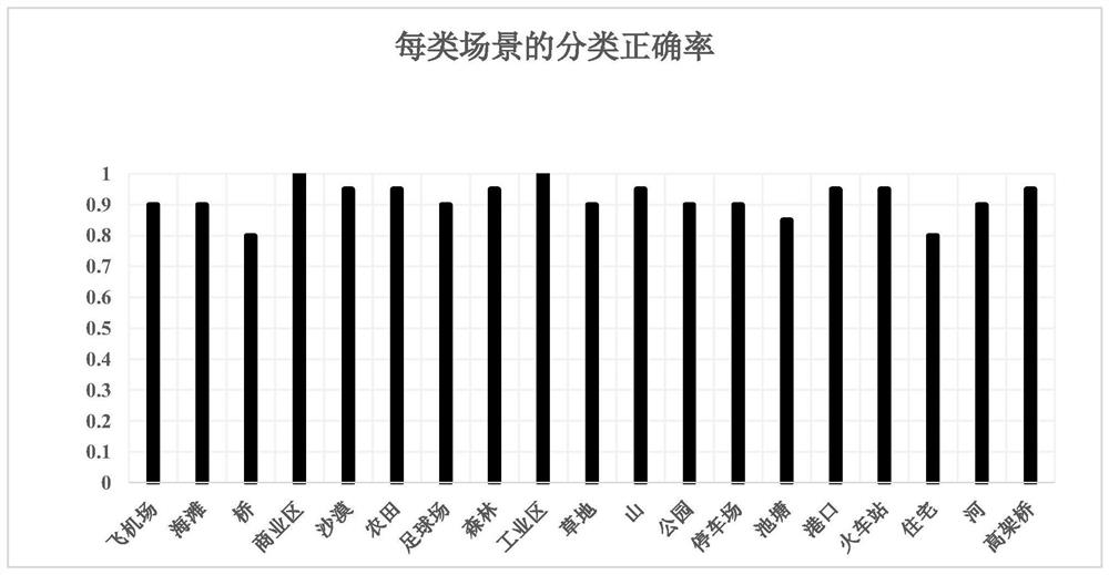
[0052] Such as figure 1 As shown, the remote sensing image scene classification method based on image transformation and BoF model. In order to evaluate the classification accuracy and stability of this method, the simulation experiment of the embodiment uses the WHU-RS19 remote sensing image library, which contains 19 types of scene images such as airports, beaches, and bridges, and each type contains 50 images of 600×600 pixels. Remote sensing images in JPG format, 19 types of scenes were used in the experiment, 50%, 60%, 70%, and 80% of each type of scene were used as training sets, and the remaining images were used as test sets; figure 2 It is an example of a remote sensing image in this embodiment. Perform the following steps:
[0053] Step 1: Extract the improved Radon and SIFT local fusion feature descriptions of Patches of various remote sensing images in the training set and the improved Radon global feature descriptions of various entire remote sensing images, an...
PUM
 Abstract
Description
Claims
Application Information
 - R&D
- Intellectual Property
- Life Sciences
- Materials
- Tech Scout
- Unparalleled Data Quality
- Higher Quality Content
- 60% Fewer Hallucinations
Browse by: Latest US Patents, China's latest patents, Technical Efficacy Thesaurus, Application Domain, Technology Topic, Popular Technical Reports.
© 2025 PatSnap. All rights reserved.Legal|Privacy policy|Modern Slavery Act Transparency Statement|Sitemap|About US| Contact US: help@patsnap.com


