Track electronic map generation method

A technology of map generation and orbital electronics, which can be applied to the generation of 2D images, artificial life, biological models, etc. It can solve the problem of lack of dynamic adjustment process, reduce manual measurement links, avoid fitting errors, and improve fitting accuracy. Effect

Active Publication Date: 2020-06-26
LANZHOU JIAOTONG UNIV +1
View PDF17 Cites 1 Cited by
  • Summary
  • Abstract
  • Description
  • Claims
  • Application Information

AI Technical Summary

Problems solved by technology

The above methods are all based on the accurate division of line segments, and a single mode fitting is performed on the curves in the section. There is no dynamic adjustment process in the curve fitting. If the division of line segments is unreasonable, this method will cause large errors.

Method used


Image

  • Track electronic map generation method
  • Track electronic map generation method
  • Track electronic map generation method

Examples


Embodiment Construction

[0022] In order to make the object, technical solution and advantages of the present invention clearer, the present invention will be further described in detail below in combination with specific embodiments and with reference to the accompanying drawings. It should be understood that these descriptions are exemplary only, and are not intended to limit the scope of the present invention. Also, in the following description, descriptions of well-known structures and techniques are omitted to avoid unnecessarily obscuring the concept of the present invention.

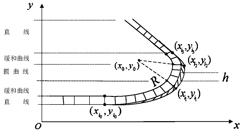
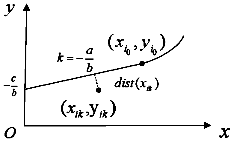
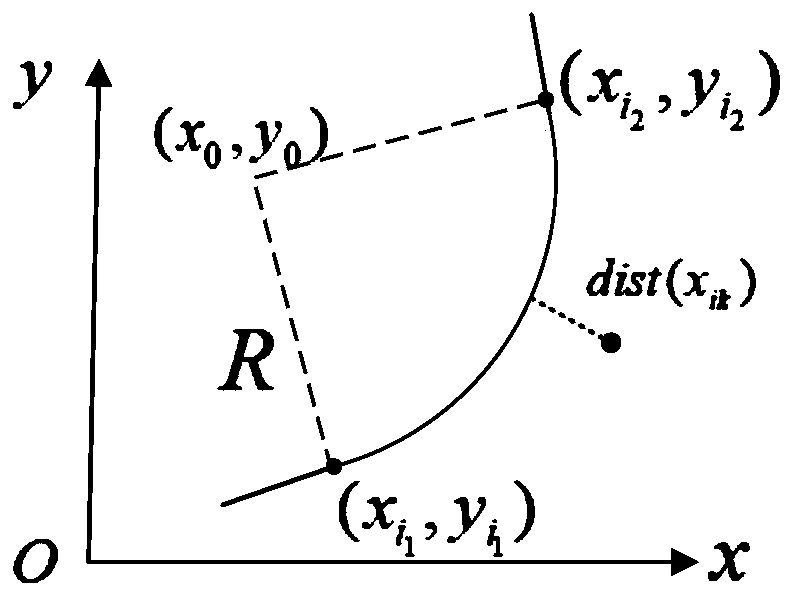
[0023] A method for generating an orbital electronic map, comprising:

[0024] Step 1: Obtain the discrete point position data of the track line and the attitude data of the carrier;

[0025] The attitude data of the carrier includes heading angle data of the carrier. When measuring line data, a multi-sensor combination system of position sensor and motion sensor is used to measure the position and motion attitude data ...


PUM


Abstract

The embodiment of the invention discloses a track electronic map generation method. The method comprises the steps: acquiring discrete point position data of a track line and attitude data of a carrier; determining a geometric line type of a track line based on the attitude data of the carrier; fitting the geometric line type; and generating an orbit electronic map based on the fitted geometric line type. Compared with the prior art, the requirement for a high-precision position sensor in measurement is lowered, a large number of repeated manual measurement links are reduced, possible mismeasurement and missed measurement in an area with poor signals are made up, meanwhile, the calculation process of the direction angle and curvature is reduced, the fitting precision is improved, and fitting errors caused by inaccurate linear recognition are avoided.

Description

technical field [0001] The invention relates to the technical field of orbit electronic map construction, in particular to a method for generating an orbit electronic map. Background technique [0002] Track electronic map construction is the process of generating track electronic maps through data collection, data processing, electronic map model design, track line fitting and other methods. It is important to update the map of the modified track. [0003] The measurement data commonly used in the construction of orbital electronic maps is to collect the position data of the centerline of the track line through high-precision GPS position sensors or real-time dynamic differential RTK (Real Time Kinematic) technology to obtain a series of discrete points of the track line. Data measurement methods include direct measurement method, indirect measurement method and composite measurement method. The direct measurement method is to directly collect the discrete point data of t...

Claims


Application Information

Patent Timeline
Patent Type & Authority Applications(China)
IPC IPC(8): G06T11/20G06F16/29G06N3/00
CPCG06F16/29G06T11/203G06N3/006Y02T10/40
Inventor 陈光武刘尚兰杨菊花程鉴皓邢东峰石建强李朋朋李鹏司涌波
Owner LANZHOU JIAOTONG UNIV
Why Eureka
Try Eureka