
Road Extraction Method Using Multi-temporal SAR Image and Optical Auxiliary Information

A technology for auxiliary information and road extraction, which is applied in character and pattern recognition, instruments, calculations, etc., to achieve good road extraction results

Active Publication Date: 2021-09-03
SOUTHEAST UNIV
View PDF7 Cites 0 Cited by
  • Summary
  • Abstract
  • Description
  • Claims
  • Application Information

AI Technical Summary

Problems solved by technology

[0005] Technical problem: The purpose of this invention is to propose a road extraction method using multi-temporal SAR images and optical auxiliary information for the existing remote sensing image road extraction problem

Method used


Image

  • Road Extraction Method Using Multi-temporal SAR Image and Optical Auxiliary Information
  • Road Extraction Method Using Multi-temporal SAR Image and Optical Auxiliary Information
  • Road Extraction Method Using Multi-temporal SAR Image and Optical Auxiliary Information

Examples


Embodiment Construction

[0026] The technical solutions of the present invention will be further elaborated below according to the drawings and in conjunction with the embodiments.

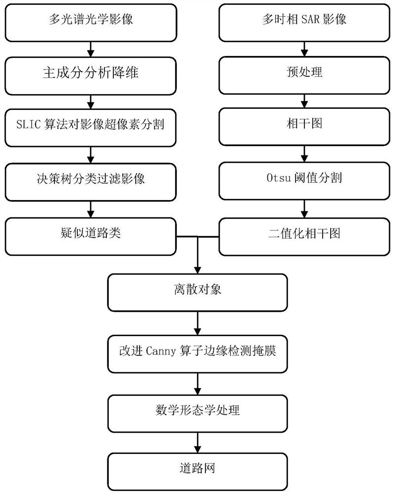
[0027] figure 1 It is a flow chart of the present invention, using the road extraction method of multi-temporal SAR images and optical auxiliary information, the specific steps are as follows:

[0028] 1) Preprocessing the SAR image to obtain the coherence map;

[0029] The preprocessing steps of SAR image data include: baseline estimation of the acquired data in single-view complex format; taking two scenes of single-view complex format data to generate an interferogram; performing adaptive filtering and coherence calculation on the interferogram to generate a filtered interference graph and coherence coefficient graph.

[0030] The coherence coefficient map is the target image selected in this experiment for road extraction combined with optical images. In this experiment, the acquired data of 7 scenes is processed s...


PUM


Abstract

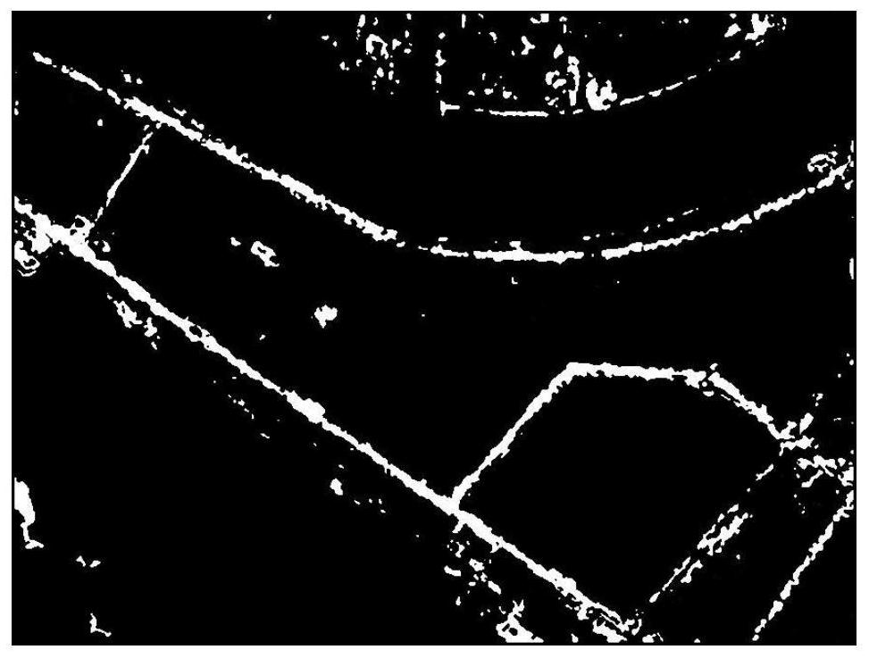
The invention discloses a road extraction method using multi-temporal SAR images and optical auxiliary information. Firstly, the multi-temporal SAR images are sequentially processed, and the coherent image formed in the interference image processing process is subjected to Otsu threshold segmentation; and then the corresponding optical images are Perform principal component analysis dimensionality reduction, SLIC superpixel segmentation, and decision tree classification in sequence to obtain suspected road classes; then use the suspected road classes obtained by optical image processing to mask the coherence map Otsu threshold segmentation results, and perform masking results on the masked results. Secondary masking of the edge contour, the edge contour is obtained by the edge detection of the suspected road class improved Canny operator; finally, the mathematical morphology processing is performed on the secondary masking result to obtain the road network. At the same time, the results obtained in each step are analyzed and compared, and it can be seen from the analysis results that the road extraction method proposed by the present invention using multi-temporal SAR images and optical auxiliary information is effective.

Description

technical field [0001] The invention relates to a road extraction method using multi-temporal SAR images and optical auxiliary information, and belongs to the technical field of remote sensing data processing. Background technique [0002] Remote Sensing (RS) has developed rapidly in recent years and has become an important means of obtaining geospatial information. With the wide application of remote sensing technology in economic, social, military and other fields, the information processing technology of remote sensing image information acquisition means With higher requirements, Synthetic Aperture Radar (SAR) came into being under this background. SAR is an active microwave sensor. Because it has a certain ability to pass through the surface of the stratum and vegetation, it can get rid of the influence of rain, snow, clouds and fog, etc., and can realize all-weather and all-weather observation of any terrain area. Observations in regions that are difficult for sensors ...

Claims


Application Information

Patent Timeline
Patent Type & Authority Patents(China)
IPC IPC(8): G06K9/00G06K9/34G06K9/62
CPCG06V20/182G06V10/267G06F18/2135G06F18/23G06F18/24
Inventor 田馨来尚婧
Owner SOUTHEAST UNIV
Learn More