Grid system and method based on longitude and latitude address geographic positions
A technology of geographic location and grid system, applied in the field of geographic information, can solve the problems of low security, traceability and authenticity
- Summary
- Abstract
- Description
- Claims
- Application Information
AI Technical Summary
Problems solved by technology
Method used
Image
Examples
Embodiment 1
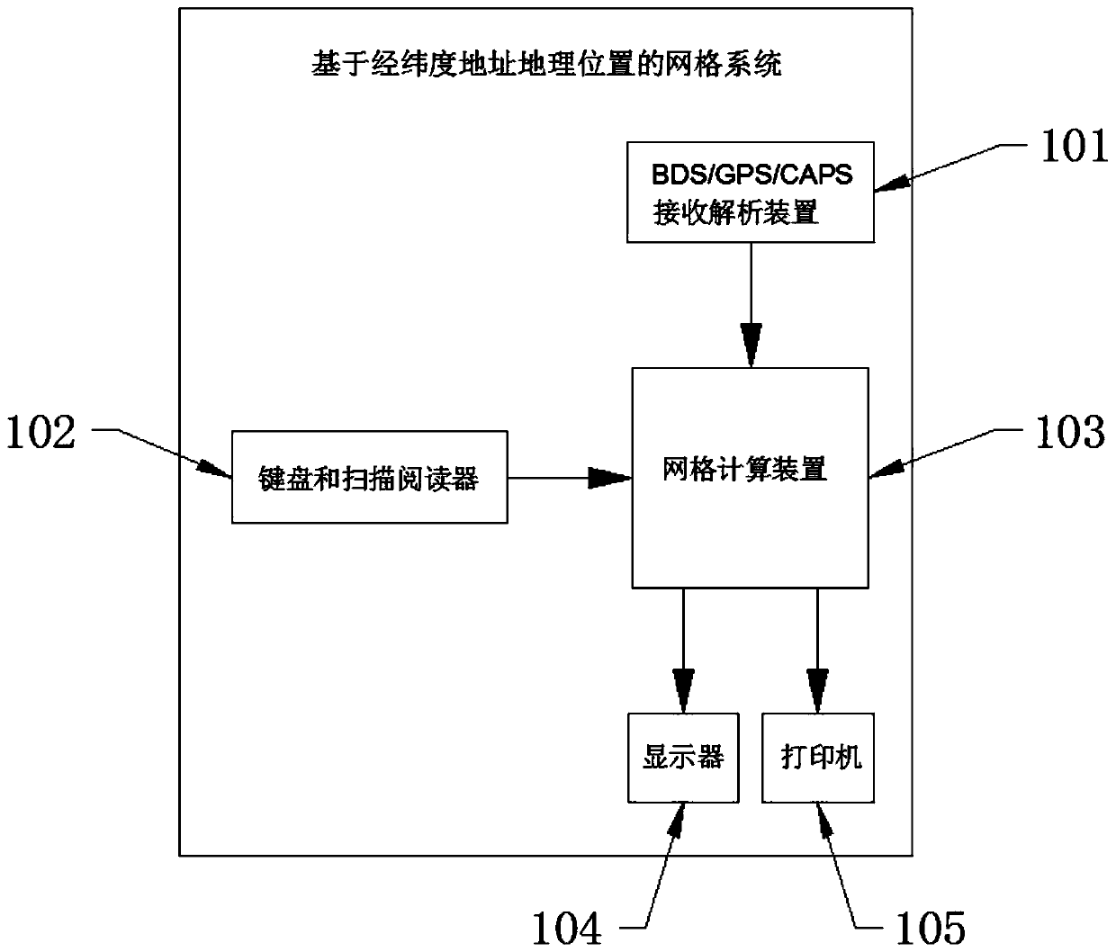
[0033] This embodiment 1 provides a grid system and method based on latitude and longitude address geographic location, the structural diagram of the system can be found in figure 1 , figure 1 Among them, the system includes a BDS / GPS / CAPS (BeiDou / GPS / CAPS Cape) receiving analysis device 101, a keyboard and a scanning reader 102, a grid computing device 103, a display screen 104 and a printer 105, wherein:
[0034] The BDS / GPS / CAPS receiving and analyzing device 101 is arranged in an open space outside the grid computing device 103; the keyboard and scanning reader 102, the display screen 104 and the printer 105 are all arranged in the grid The grid computing device 103 is external.
[0035] The BDS / GPS / CAPS receiving and analyzing device 101 , the keyboard and scanning reader 102 , the display screen 104 and the printer 105 are connected to the grid computing device 103 .
[0036] The BDS / GPS / CAPS receiving and analyzing device 101 is used to receive the satellite navigatio...
PUM
 Abstract
Description
Claims
Application Information
 - R&D Engineer
- R&D Manager
- IP Professional
- Industry Leading Data Capabilities
- Powerful AI technology
- Patent DNA Extraction
Browse by: Latest US Patents, China's latest patents, Technical Efficacy Thesaurus, Application Domain, Technology Topic, Popular Technical Reports.
© 2024 PatSnap. All rights reserved.Legal|Privacy policy|Modern Slavery Act Transparency Statement|Sitemap|About US| Contact US: help@patsnap.com


