A low-altitude near-real-time building earthquake damage assessment method

A near-real-time, architectural technology, applied in neural learning methods, instruments, biological neural network models, etc., can solve the problems of inability to reliably grasp the damage of building facades, time-consuming manpower and material resources, low efficiency, etc., and achieve improved prediction. The effect of precision and reliability

Active Publication Date: 2022-03-08
SHENZHEN UNIV +1
View PDF6 Cites 0 Cited by
  • Summary
  • Abstract
  • Description
  • Claims
  • Application Information

AI Technical Summary

Problems solved by technology

The current manual assessment method usually takes a lot of time, manpower and material resources, and cannot assess the earthquake damage of a large-scale building in a short period of time, and the efficiency is low
However, the method based on high-altitude remote sensing can only observe the damage of ground buildings from a higher perspective, and cannot reliably grasp the damage on building facades, and its accuracy is low.

Method used


Image

  • A low-altitude near-real-time building earthquake damage assessment method
  • A low-altitude near-real-time building earthquake damage assessment method
  • A low-altitude near-real-time building earthquake damage assessment method

Examples


Embodiment 1

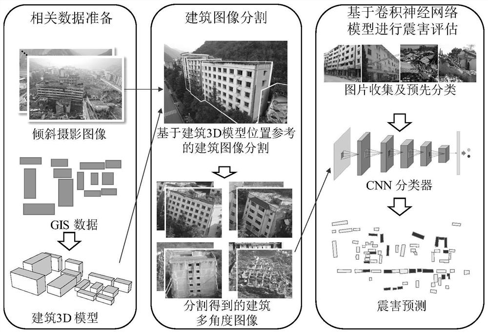
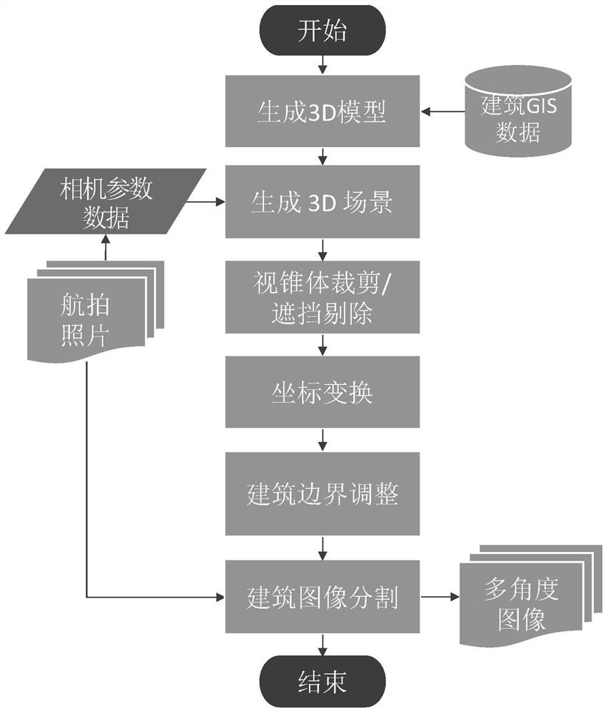
[0036] In this embodiment, combined with the means of deep learning, building earthquake damage assessment is performed based on a large number of oblique photographic images of buildings acquired by low-altitude drones. This embodiment discloses a low-altitude near-real-time building earthquake damage assessment method, including the following steps:

[0037] 1) Obtain building-related data in the area to be evaluated. Wherein, the building-related data includes pre-earthquake 3D models of buildings in the area to be evaluated, pre-earthquake 2D-GIS (Geographic Information System, geographic information system) data, post-earthquake original aerial photos, and camera parameter data of post-earthquake original aerial photos. The camera parameter data includes the shooting position of the aerial photo, the camera orientation and the camera viewing angle data.

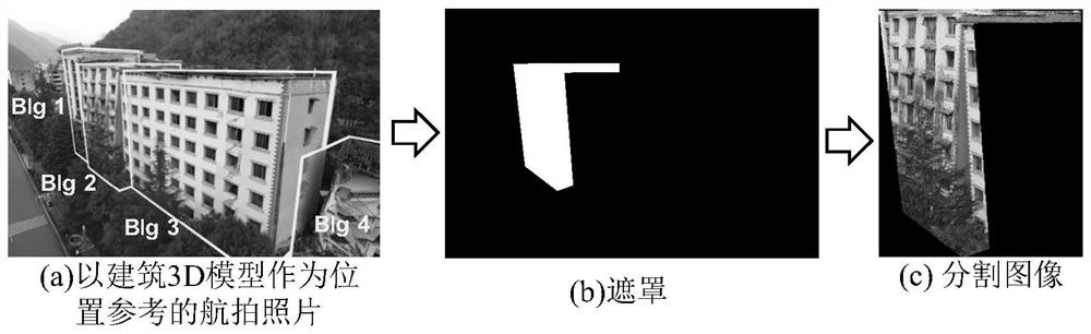
[0038] 2) Use the building 3D model as a location reference to segment the regional building image, and obtain aerial...


PUM


Abstract

The invention provides a low-altitude near-real-time building earthquake damage assessment method. The evaluation method includes relevant data preparation, building image segmentation, and earthquake damage assessment based on CNN model. This assessment method is expected to provide a reference for rapid assessment and emergency rescue of regional building earthquake damage. With the continuous application of this image segmentation method in actual earthquakes, more and more building damage images will be obtained, thereby significantly expanding the image library used to train the CNN classifier, and ultimately improving the prediction accuracy and reliability of the CNN classifier.

Description

technical field [0001] The invention relates to the technical field of civil engineering and earthquake engineering, in particular to a building earthquake damage assessment method. Background technique [0002] After the earthquake, in order to assist decision-making and emergency rescue, it is necessary to conduct a rapid assessment of the earthquake damage of the entire region. The current manual assessment method usually requires a lot of time, manpower and material resources, and cannot assess the earthquake damage of a large-scale building in a relatively short period of time, so the efficiency is low. However, the method based on high-altitude remote sensing can only observe the damage of ground buildings from a higher perspective, and cannot reliably grasp the damage on building facades, and its accuracy is low. Therefore, it is urgent to develop a low-altitude rapid building earthquake damage assessment method. Contents of the invention [0003] The purpose of t...

Claims


Application Information

Patent Timeline
Patent Type & Authority Patents(China)
IPC IPC(8): G06V20/10G06V10/26G06V10/82G06N3/04G06N3/08
CPCG06V20/39G06V10/26
Inventor 熊琛李强胜陆新征
Owner SHENZHEN UNIV
Why Eureka
Try Eureka