A virtual surface hydrological monitoring station
A virtual ground and monitoring station technology, applied in the direction of measuring devices, liquid level indicators, fluid velocity measurement, etc., can solve the problem of large monitoring scale, achieve intuitive display and reduce costs
- Summary
- Abstract
- Description
- Claims
- Application Information
AI Technical Summary
Problems solved by technology
Method used
Image
Examples
Embodiment Construction
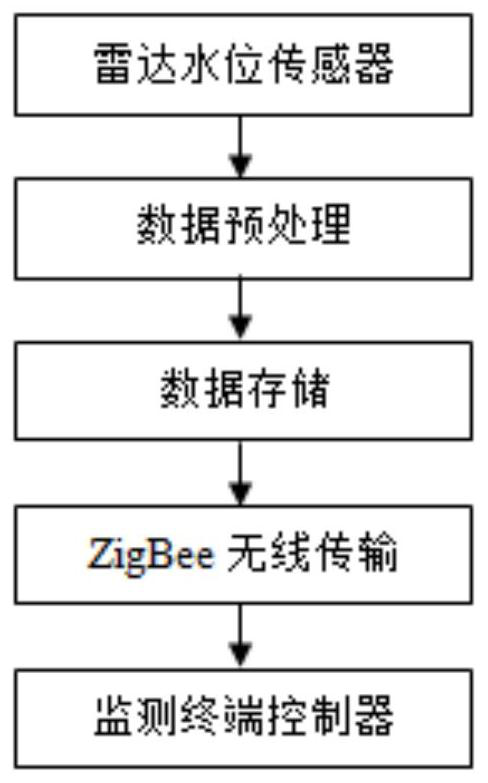
[0012] The purpose of the present invention is to provide a virtual surface hydrological monitoring station, in order to solve the difficulty of monitoring hydrological information in some river areas where hydrological monitoring stations cannot be built. Virtually establish a hydrological monitoring station in the monitored river area, and use satellite radar, aerial remote sensing and meteorological satellite cloud image technology to measure hydrological information. It is characterized in that it includes a radar water level monitoring module, a flow velocity generating module and a satellite flow monitoring module.
[0013] Please refer to figure 1 and figure 2 , figure 1 It is a flow chart of a virtual surface hydrological monitoring station module in an embodiment of the present invention; figure 2 It is a schematic diagram of a virtual surface hydrological monitoring station module in an embodiment of the present invention.
[0014] A virtual surface hydrologica...
PUM
 Abstract
Description
Claims
Application Information
 - Generate Ideas
- Intellectual Property
- Life Sciences
- Materials
- Tech Scout
- Unparalleled Data Quality
- Higher Quality Content
- 60% Fewer Hallucinations
Browse by: Latest US Patents, China's latest patents, Technical Efficacy Thesaurus, Application Domain, Technology Topic, Popular Technical Reports.
© 2025 PatSnap. All rights reserved.Legal|Privacy policy|Modern Slavery Act Transparency Statement|Sitemap|About US| Contact US: help@patsnap.com


