Water level gauge for engineering surveying and mapping

A level and engineering technology, applied in surveying and mapping, navigation, instruments, measuring devices, etc., can solve the problems of easy damage to objective lenses and eyepieces, inconvenient horizontal movement adjustment, etc. Effect

Inactive Publication Date: 2019-03-22
甘肃四维测绘工程有限公司
View PDF0 Cites 2 Cited by
  • Summary
  • Abstract
  • Description
  • Claims
  • Application Information

AI Technical Summary

Problems solved by technology

[0004] The object of the present invention is to provide a level for engineering surveying and mapping, to solve the problems of the prior art that the objective lens and eyepiece of the level for engineering surveying and mapping are prone to damage, and the horizontal movement is inconvenient to adjust.

Method used


Image

  • Water level gauge for engineering surveying and mapping
  • Water level gauge for engineering surveying and mapping
  • Water level gauge for engineering surveying and mapping

Examples


Embodiment Construction

[0017] The following will clearly and completely describe the technical solutions in the embodiments of the present invention with reference to the accompanying drawings in the embodiments of the present invention. Obviously, the described embodiments are only some, not all, embodiments of the present invention. Based on the embodiments of the present invention, all other embodiments obtained by persons of ordinary skill in the art without making creative efforts belong to the protection scope of the present invention.

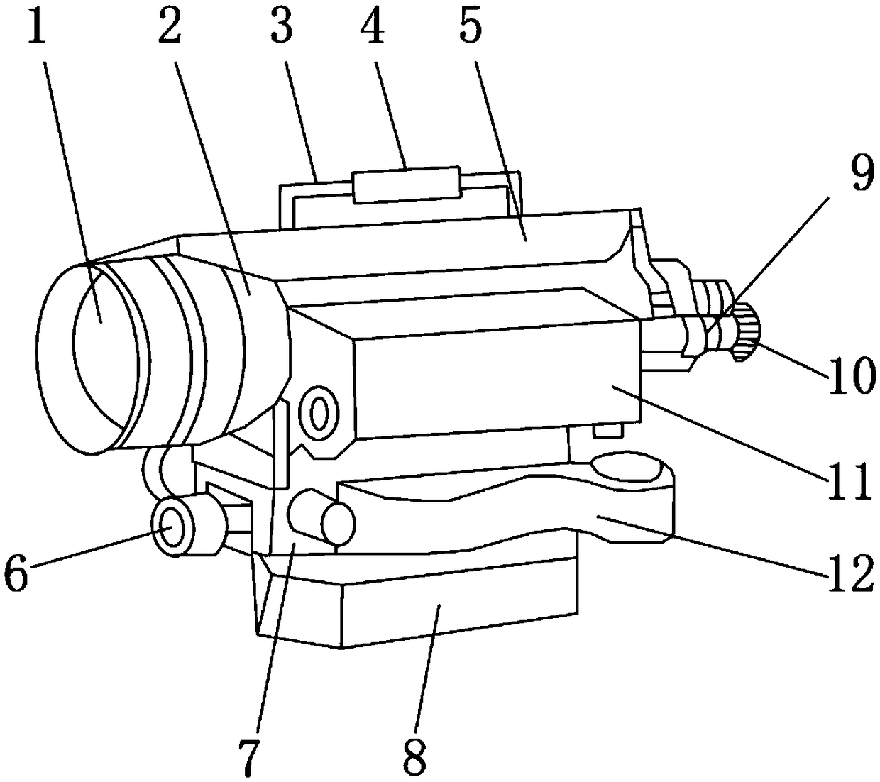
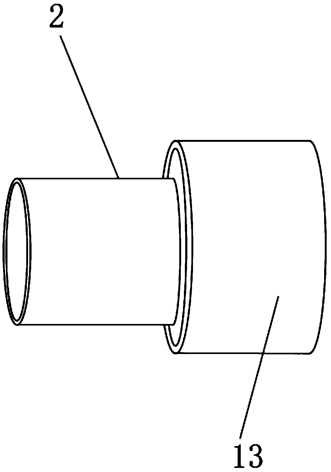
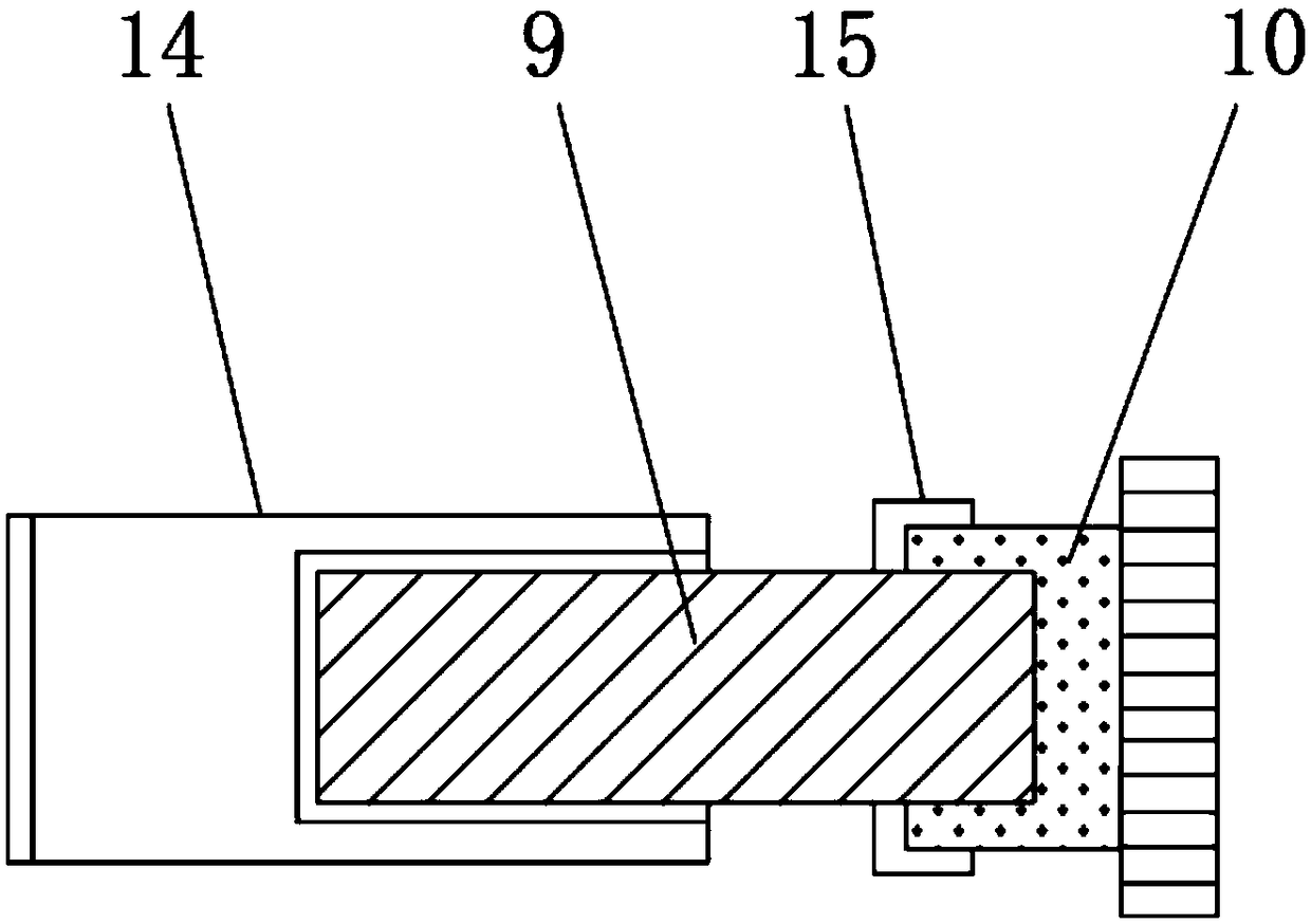
[0018] see Figure 1~4 , in an embodiment of the present invention, a level for engineering surveying and mapping includes a level main body 5, a handle 3 is fixed to the upper end of the level main body 5, and an anti-slip sleeve 4 is wrapped on the outer surface of the handle 3, and an objective lens is installed at the front end of the level main body 5 tube 2, and the objective lens tube 2 is inlaid with an objective lens 1, and one end of the level main b...


PUM


Abstract

The invention discloses a water level gauge for engineering surveying and mapping. The water level gauge comprises a water level gauge body; a handle is fixed at the upper end of the water level gaugebody; the outer surface of the handle is wrapped with an anti-skid sleeve; an objective lens tube is mounted at the front end of the water level gauge body; an objective lens is embedded in the lensobjective tube; a water level tube is mounted at one end of the water level gauge body; a level is mounted below the water level tube; an adjustment seat is arranged below the water level gauge body;a braking screw is arranged at the front end of the adjustment seat; a sliding base is mounted under the adjustment seat; a sliding slot is formed in the upper surface of the sliding base; an eyepiecetube is mounted at the rear end of the water level gauge body; a protective cover is mounted at one end of the eyepiece tube; and a long hollow tube is mounted in the water level gauge body. The water level gauge is capable of solving the problems that the present objective lenses and eyepieces for engineering surveying and mapping have high probability of being damaged and the horizontal movement and adjustment are inconvenient.

Description

technical field [0001] The invention relates to the field of level equipment, in particular to a level for engineering surveying and mapping. Background technique [0002] A level is an instrument for establishing a horizontal line of sight to measure the height difference between two points on the ground. The principle is to measure the height difference between ground points according to the leveling principle. The main components are the telescope, Tube level , vertical shaft, base, foot screw. According to the structure, it can be divided into micro-tilt level, automatic leveling level, laser level and digital level. According to the accuracy, it can be divided into precision level and ordinary level. Levels appeared after the invention of telescopes and levels in the 17th and 18th centuries. At the beginning of the 20th century, the micro-tilt level was produced on the basis of the inner focusing telescope and the coincidence level. Appeared in the early 1950s ...

Claims


Application Information

Patent Timeline
Patent Type & Authority Applications(China)
IPC IPC(8): G01C5/00
CPCG01C5/00
Inventor 安彦
Owner 甘肃四维测绘工程有限公司
Why Eureka
Try Eureka