Multi-robot positioning and mapping system and method
A multi-robot and robot technology, applied in the field of safety rescue, can solve the problems of slow rescue efficiency, poor traffic, and failure of mobile robots, and achieve the effects of reliable map quality, improved efficiency, and comprehensive data.
- Summary
- Abstract
- Description
- Claims
- Application Information
AI Technical Summary
Problems solved by technology
Method used
Image
Examples
Embodiment Construction
[0038] The present invention will be described in detail below in conjunction with specific embodiments. The following examples will help those skilled in the art to further understand the present invention, but do not limit the present invention in any form. It should be noted that those skilled in the art can make several changes and improvements without departing from the concept of the present invention. These all belong to the protection scope of the present invention.
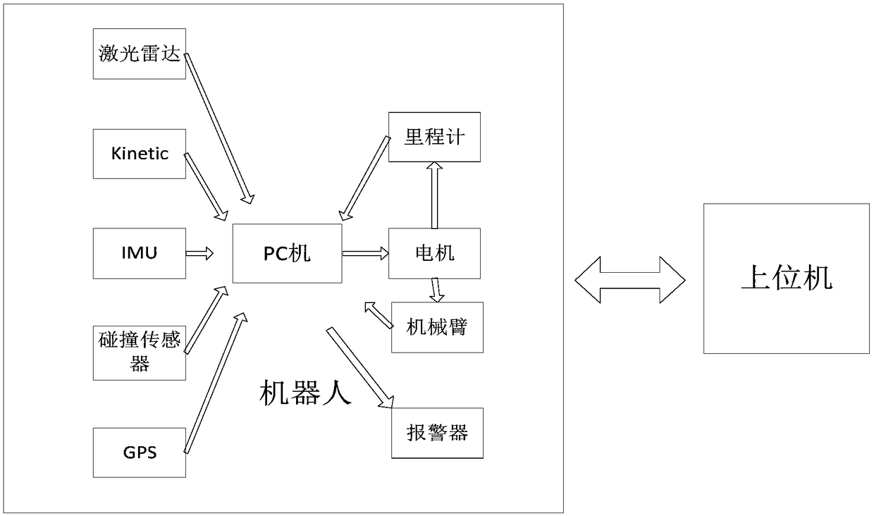
[0039] figure 1 The functional block diagram of the multi-robot positioning and mapping system provided for the implementation of the present invention, such as figure 1 As shown, the data information is collected by sensors such as laser radar, kinetic vision sensor, inertial navigation module IMU, collision detector and GPS, and the robot is controlled after being processed by the PC. Use the odometer to detect the position and posture information of the robot, realize closed-loop control, and have a...
PUM
 Abstract
Description
Claims
Application Information
 - R&D Engineer
- R&D Manager
- IP Professional
- Industry Leading Data Capabilities
- Powerful AI technology
- Patent DNA Extraction
Browse by: Latest US Patents, China's latest patents, Technical Efficacy Thesaurus, Application Domain, Technology Topic, Popular Technical Reports.
© 2024 PatSnap. All rights reserved.Legal|Privacy policy|Modern Slavery Act Transparency Statement|Sitemap|About US| Contact US: help@patsnap.com


