
Binocular vision target surface 3D detection method and system based on unmanned aerial vehicle

A binocular vision system and binocular vision technology, applied in the field of binocular vision target surface 3D detection, can solve the problems of increasing system cost, heavy weight, and high requirements on the load of unmanned aerial vehicles, and achieves flexible and convenient operation, simple use, and low cost. cost effect

Inactive Publication Date: 2018-07-24
NORTHEAST DIANLI UNIVERSITY
View PDF9 Cites 30 Cited by
  • Summary
  • Abstract
  • Description
  • Claims
  • Application Information

AI Technical Summary

Problems solved by technology

After retrieval, the publication number is CN106443705A, and the patent name is "airborne laser radar measurement system and method". This method is used for three-dimensional surveying and mapping, but 3D laser radar is expensive, heavy, and has high load requirements for drones, so it cannot be widely used. Increased system cost on small UAVs

Method used


Image

  • Binocular vision target surface 3D detection method and system based on unmanned aerial vehicle
  • Binocular vision target surface 3D detection method and system based on unmanned aerial vehicle
  • Binocular vision target surface 3D detection method and system based on unmanned aerial vehicle

Examples


Embodiment Construction

[0068] In order to make the objects and advantages of the present invention clearer, the present invention will be further described in detail below in conjunction with the examples. It should be understood that the specific embodiments described here are only used to explain the present invention, not to limit the present invention.

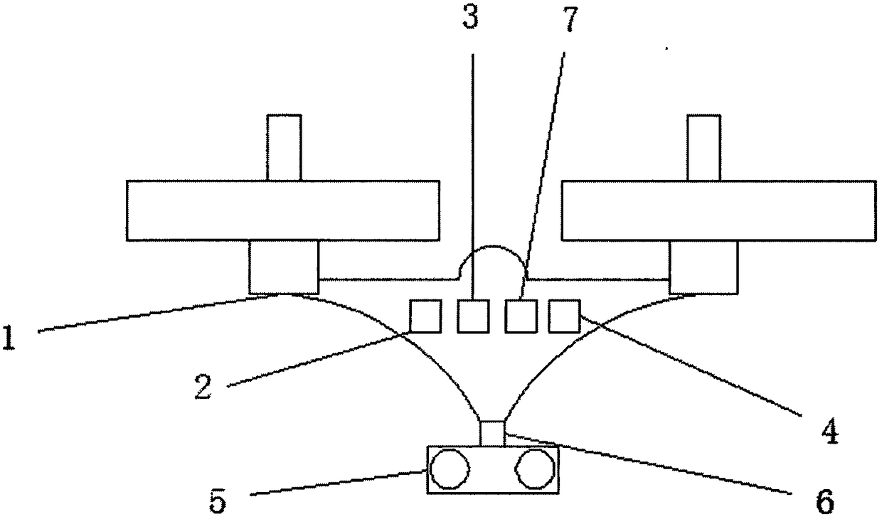
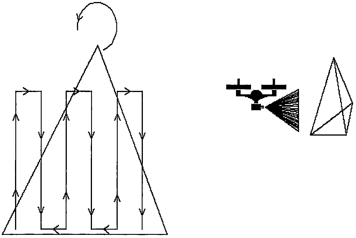
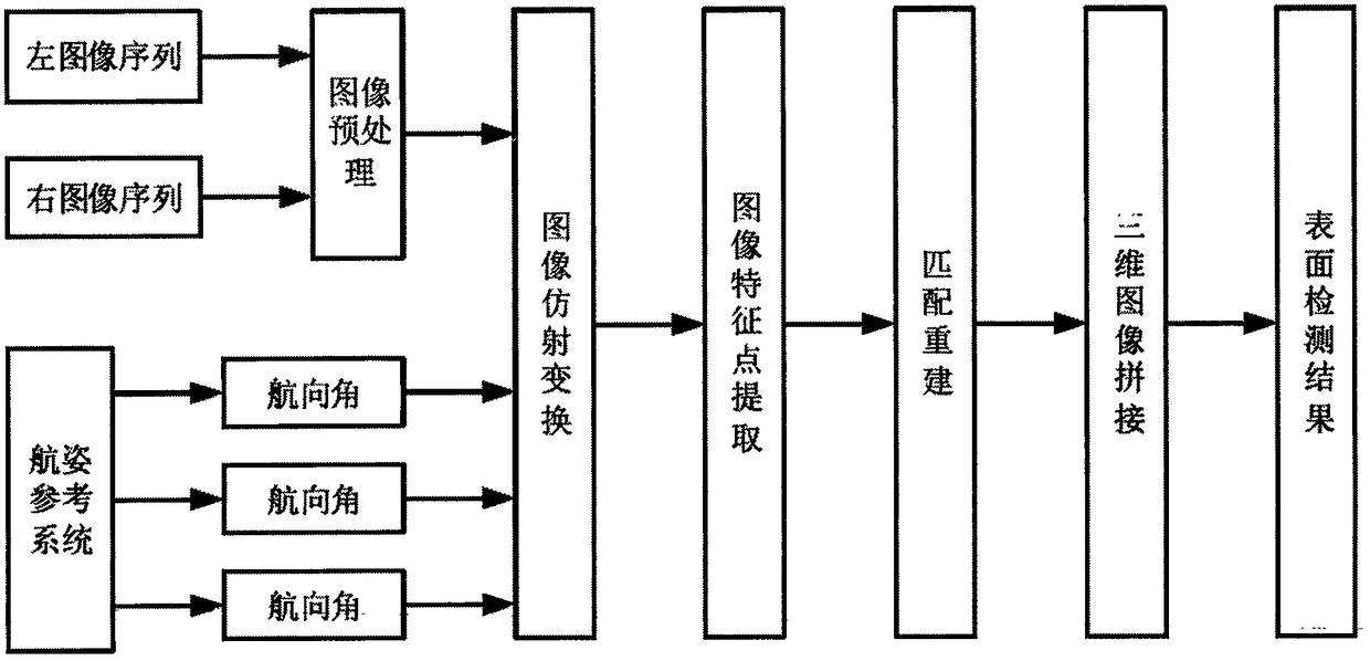
[0069] Such as figure 1 As shown, the embodiment of the present invention provides a 3D detection system for binocular vision target surfaces based on drones. The 3D surface detection method is based on binocular stereo vision 3D reconstruction and estimates the pose of the drone. The pose correction is combined with the 3D reconstruction through the software algorithm to obtain the depth information of the target, and then obtain the surface detection result. The system consists of drone, battery pack, on-board control unit, WiFi or wireless telex module, binocular camera with memory card, fixed attachment mechanism to attach the camera to the...


PUM


Abstract

The invention discloses a binocular vision target surface 3D detection system based on a unmanned aerial vehicle. The system comprises the unmanned aerial vehicle, a binocular vision system, a computer system and remote control equipment. A detection method comprises the following steps of using a binocular vision system carried by the unmanned aerial vehicle to traverse and collect the image dataof a target surface; using images collected by the binocular vision system to match and acquire the parallax information of the left and right images through characteristic extraction; combining parameters inside and outside a camera to acquire the three-dimensional coordinates of the midpoints of the images so as to obtain target local three-dimensional point cloud; and through carrying out characteristic extraction and matching on the three-dimensional point cloud of the adjacent images of the left camera, acquiring a transformation relation between two three-dimensional point cloud coordinate systems, then realizing the registration in pairs of the three-dimensional point cloud, finally acquiring the three-dimensional point cloud data of a whole target surface, and comparing the original three-dimensional data of the target surface so as to realize the detection of a target. The system is applied to the surface detection of a large-scale target, such as large-scale industrial equipment and the like, the operation is simple and efficiency is high.

Description

technical field [0001] The invention relates to the technical field of visual measurement, in particular to a 3D detection method and system for a binocular vision target surface based on an unmanned aerial vehicle. Background technique [0002] For the 3D reconstruction of the surface of a large target, under the requirement of high precision, the fixed detector cannot perceive its entire 3D surface. Only the method of moving the detector to scan can be used to detect the three-dimensional data of the target surface block by block under the dynamic coordinate system, and then splicing to obtain the final target. Therefore, image 3D reconstruction and reconstructed 3D image mosaic technology play a very important role in this application field. At present, there are few studies on the methods of 3D visual reconstruction of large target surfaces, and even less people have been involved in the surface detection of relatively complex large equipment. Therefore, the research r...

Claims


Application Information

Patent Timeline
IPC IPC(8): G01B11/00B64C39/02
CPCG01B11/00B64C39/02G01B11/002
Inventor 侯一民薛明镇刘峻杭伦向敏
Owner NORTHEAST DIANLI UNIVERSITY
Learn More