
Method for achieving self-localization and map building of mobile robot

A mobile robot and autonomous positioning technology, applied in the field of robot navigation, can solve problems such as the influence of map accuracy and the inaccurate position of map features

Active Publication Date: 2018-02-27
ZHEJIANG UNIV
View PDF10 Cites 26 Cited by
  • Summary
  • Abstract
  • Description
  • Claims
  • Application Information

AI Technical Summary

Problems solved by technology

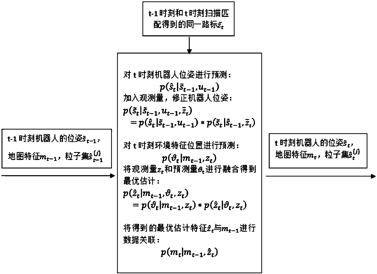
This method of joint robot positioning and map construction is basically feasible, but it is neglected in many methods that there is a large deviation in the pose estimation of the robot in different scenarios, and when there is a large error in the pose estimation of the robot, it will The location of map features is not accurate enough, which has a great impact on the accuracy of the entire map

Method used


Image

  • Method for achieving self-localization and map building of mobile robot
  • Method for achieving self-localization and map building of mobile robot
  • Method for achieving self-localization and map building of mobile robot

Examples


Embodiment Construction

[0072] The method of the present invention is illustrated below with a robot with three sensors of odometer, compass and laser radar in an unknown environment.

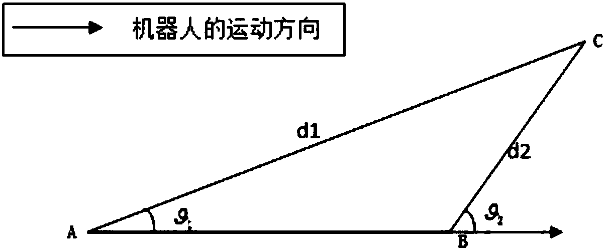
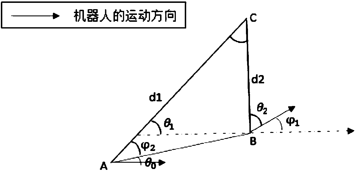
[0073] The robot uses the information of the odometer to predict the pose of the robot; obtains the initial target heading with the compass and at the corner, obtains the deflection angle of the robot by means of the difference of the compass data; utilizes the laser radar to obtain the distance and angle information of the surrounding environment features; the present invention utilizes The above three sensors obtain the surrounding environment map while locating the position of the robot. The above formulas (1.1)---(1.4), (2.1)---(2.3) give the general calculation form, and the specific calculation form is related to the probability distribution of its design and the robot motion. The specific meanings of variables, functions and probability density functions in formulas (1.1)---(1.4), (2.1)---(2.3) are illustrated ...


PUM


Abstract

The invention relates to the technical field of robot navigation, and aims to provide a method for achieving self-localization and map building of a mobile robot. An algorithm of simultaneous localization and map building of the robot is provided, the motion trail of the robot is divided into a pose and position estimation mode fusing straight lines with arcs in a complex environment, and on the basis that the pose and position of the robot are obtained, an environment characteristic processing method is invented to update map features, so that a more precise pose and position of the robot anda more precise environmental map are obtained. The method has high adaptability and reliability in the complex environment. It can be ensured that the pose and position error of the robot is kept within a very small and stable range during long-time motion; on the basis that the precise pose and position of the robot are determined, the surrounding environment characteristics are obtained, the environmental map is obtained, and then self-localization and navigation are achieved based on the environmental map. By means of the method, the possibility that the whole map has deviations due to therobot errors is avoided, and the method has high adaptability in various complex environments.

Description

technical field [0001] The invention belongs to the technical field of robot navigation, and relates to a method for realizing autonomous positioning and map construction of a mobile robot. Background technique [0002] Autonomous positioning and map construction of mobile robots is a key technology to realize autonomous navigation of robots in unknown environments. It has broad application prospects and is also one of the hot issues in robotics research. In an unknown environment, the robot relies on the information provided by its own sensors to describe the environment, and then builds a map feature model to obtain the precise location of the map feature, but the establishment of the environmental map depends on the observation position of the robot at each moment. Therefore, the robot faces a dilemma during its movement: 1) In order to construct the environment map, the robot needs to know the actual position of the robot at each moment; 2) If the robot wants to know the...

Claims


Application Information

Patent Timeline
IPC IPC(8): G05D1/08G01C21/20
Inventor 冀大雄邓志朱世强宋伟
Owner ZHEJIANG UNIV
Learn More