Real-time forecasting system of ocean floating body motion based on ocean wave image remote sensing and artificial intelligence
A technology of artificial intelligence and floating body motion, applied in character and pattern recognition, measuring devices, instruments, etc., to achieve good economic value and strong application prospects.
- Summary
- Abstract
- Description
- Claims
- Application Information
AI Technical Summary
Problems solved by technology
Method used
Image
Examples
Embodiment 1
[0029] Such as Figures 1 to 4As shown, the present invention mainly relates to a real-time prediction system for marine floating body movement based on ocean wave image remote sensing and artificial intelligence, including a marine environment sensor module 8, a floating body dynamic response sensor module 10, marine environment big data 9, and floating body dynamic response big data 11 , data storage 12, artificial intelligence learning module 14, floating body dynamic response real-time forecasting module 16, auxiliary decision-making module 17. The present invention is based on the ocean wave environment big data 9 obtained by the ocean environment sensor module 8, through the floating body dynamic response sensor module 10, the floating body dynamic response big data 11, and then through the deep learning of artificial intelligence, extracts the characteristics of the ocean storm environment image, and improves the ocean wave environment The image and the intelligent pred...
Embodiment 2
[0041] The present invention relates to a real-time prediction system for marine floating body movement based on ocean wave image remote sensing and artificial intelligence. The system includes a marine environment sensor module 8, a floating body dynamic response sensor module 10, marine environment big data 9, floating body dynamic response big data 11, and data storage 12. Artificial intelligence learning module 14, floating body dynamic response real-time forecasting module 16, auxiliary decision-making module 17.
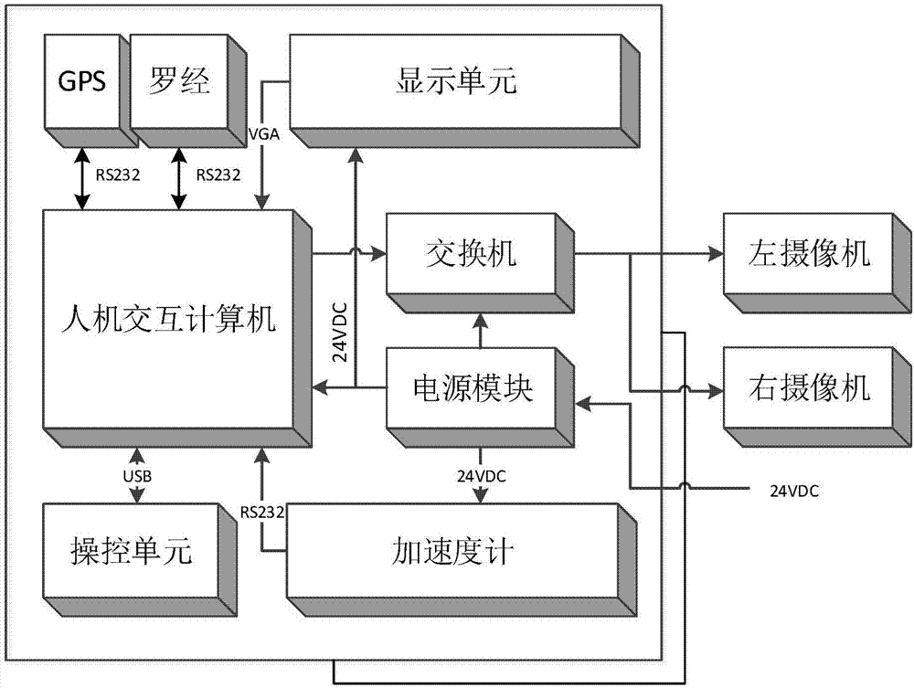
[0042] The marine environment sensor module 8 is composed of an X-band navigation radar system 1, a binocular vision system 4, an onboard wave height meter 5, an integrated data collection 6, and a sensor collection terminal 7. Among them, the X-band navigation radar system 1 is used to measure the ocean wind and wave information in the range of several kilometers around the floating body, the binocular vision system 4 is used to measure the ocean wind and wave ...
PUM
 Abstract
Description
Claims
Application Information
 - Generate Ideas
- Intellectual Property
- Life Sciences
- Materials
- Tech Scout
- Unparalleled Data Quality
- Higher Quality Content
- 60% Fewer Hallucinations
Browse by: Latest US Patents, China's latest patents, Technical Efficacy Thesaurus, Application Domain, Technology Topic, Popular Technical Reports.
© 2025 PatSnap. All rights reserved.Legal|Privacy policy|Modern Slavery Act Transparency Statement|Sitemap|About US| Contact US: help@patsnap.com


