
Urban road traffic condition prediction method based on spatial-temporal data

A technology of road traffic and traffic status, applied in the field of intelligent transportation system research, can solve problems that rarely consider the relationship between different spatial domains

Inactive Publication Date: 2017-05-10
HANGZHOU NORMAL UNIVERSITY +1
View PDF2 Cites 32 Cited by
  • Summary
  • Abstract
  • Description
  • Claims
  • Application Information

AI Technical Summary

Problems solved by technology

[0004] The above methods often only consider the relationship between traffic states in the time domain (different periods of the same road segment), and rarely consider the relationship in different spatial domains (different road segments at the same time period)

Method used


Image

  • Urban road traffic condition prediction method based on spatial-temporal data
  • Urban road traffic condition prediction method based on spatial-temporal data
  • Urban road traffic condition prediction method based on spatial-temporal data

Examples


Embodiment Construction

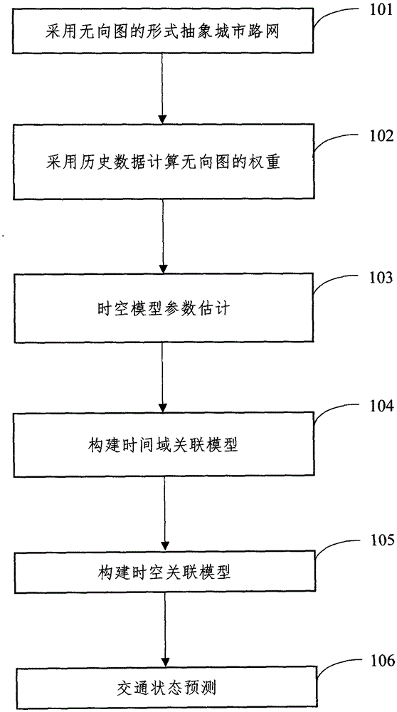
[0027] In order to make the object, technical solution and advantages of the present invention clearer, the present invention will be further described in detail below in conjunction with the accompanying drawings and embodiments.

[0028] Take the traffic congestion index of the section of Beishan Road-Baochu Road-Shuguang Road in Hangzhou and its surrounding roads on 2015.05.01 as an example.

[0029] In step 101, the urban road network is abstracted in the form of an undirected graph. According to the adjacency relationship between road segments, all road segments in the road network can be expressed as an undirected graph form G=(V, E, W), where V is a set of vertices, and the i-th road segment in the road network is abstracted into a vertex v i (v i ∈V); E is the set of edges, edge e i,j means v i and v j The two road sections are directly connected, and there is an adjacency relationship; W is the weight set, and the weight w i,j means v i to v j degree of influen...


PUM


Abstract

The invention discloses an urban road traffic condition prediction method based on spatial-temporal data. The method comprises the following steps: calculating the parameters of a spatial-temporal correlation model using historical traffic data; abstracting an urban road network in the form of undirected graph; calculating the weight of the undirected graph using historical data; building a time domain correlation model; building a spatial-temporal correlation model; and predicting the traffic condition of a road section through use of real-time traffic data and based on a time-space domain model. A more accurate urban road traffic condition prediction method is provided.

Description

technical field [0001] The invention relates to a method for predicting urban road traffic status based on spatio-temporal data, which belongs to the research field of intelligent traffic systems. Background technique [0002] Intelligent transportation systems have been successfully applied in many fields such as traffic management, travel guidance, signal control, and safe driving. Real-time estimation of traffic state and real-time prediction of traffic state are two important technologies in intelligent transportation system. Real-time traffic state estimation usually uses real-time data sent by sensors deployed on the road to estimate the traffic state of the road. Traffic state prediction refers to the technology of predicting the traffic state in the future period by using real-time estimated traffic data and the rules obtained by analyzing historical data. [0003] Research work related to traffic state prediction includes: the historical average method is the most...

Claims


Application Information

Patent Timeline
IPC IPC(8): G08G1/01
Inventor 单振宇陈宇鹏候培培吴佳雯
Owner HANGZHOU NORMAL UNIVERSITY
Learn More